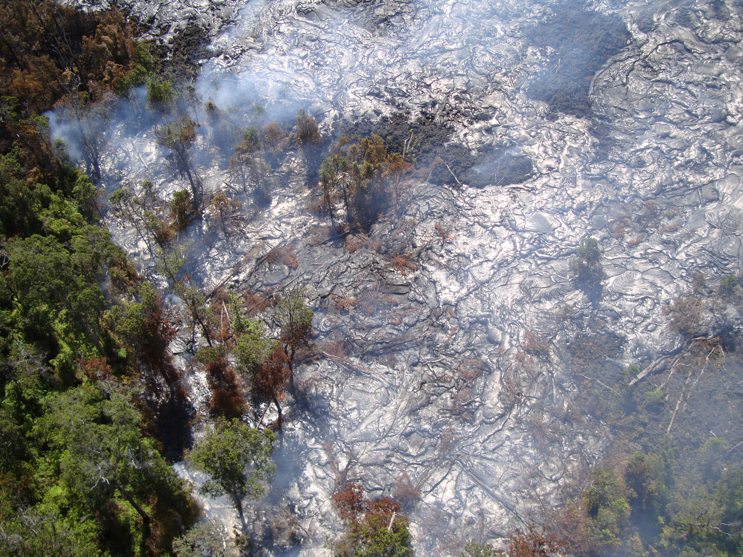
USGS photo: The flow, which consists of slowly moving pahoehoe, has widened but advanced little over the past two weeks.
VOLCANO, Hawaii – Lava spewing from the middle east rift zone of Kilauea volcano is burning through forests to the north of the active Pu`u `O`o crater.
Images posted by the USGS Hawaiian Volcano Observatory show the Kahauale’a 2 flow still expanding north, moving “a very minor amount into the forest, burning trees” scientists write.
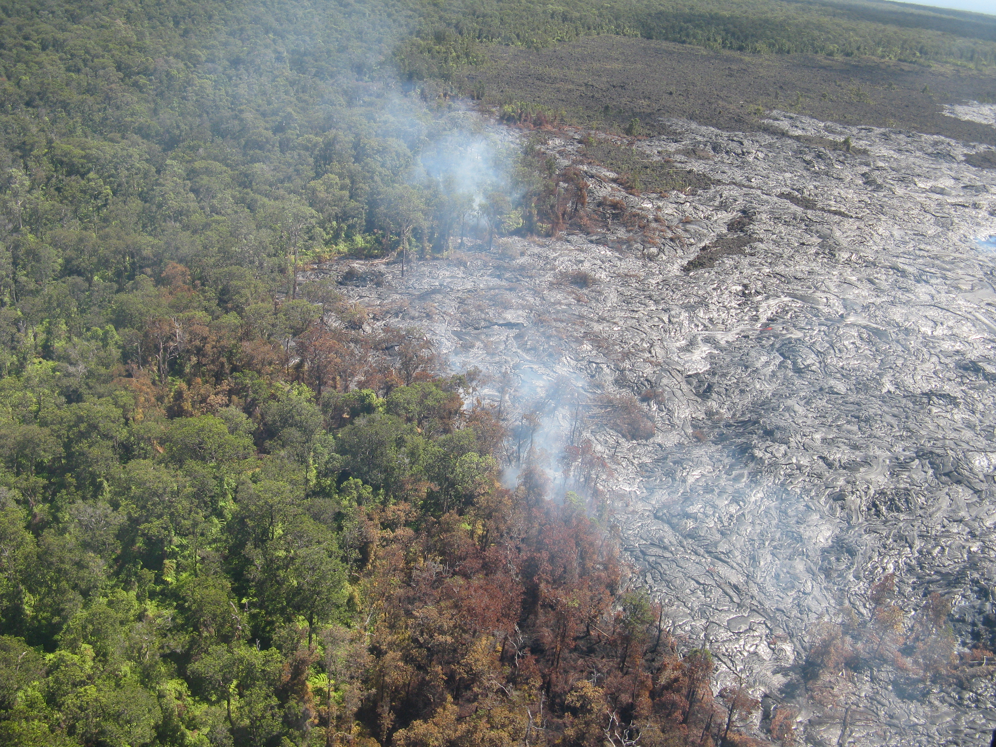
USGS photo: A wider view of a portion of the Kahaualeʻa 2 flow margin at the forest boundary.
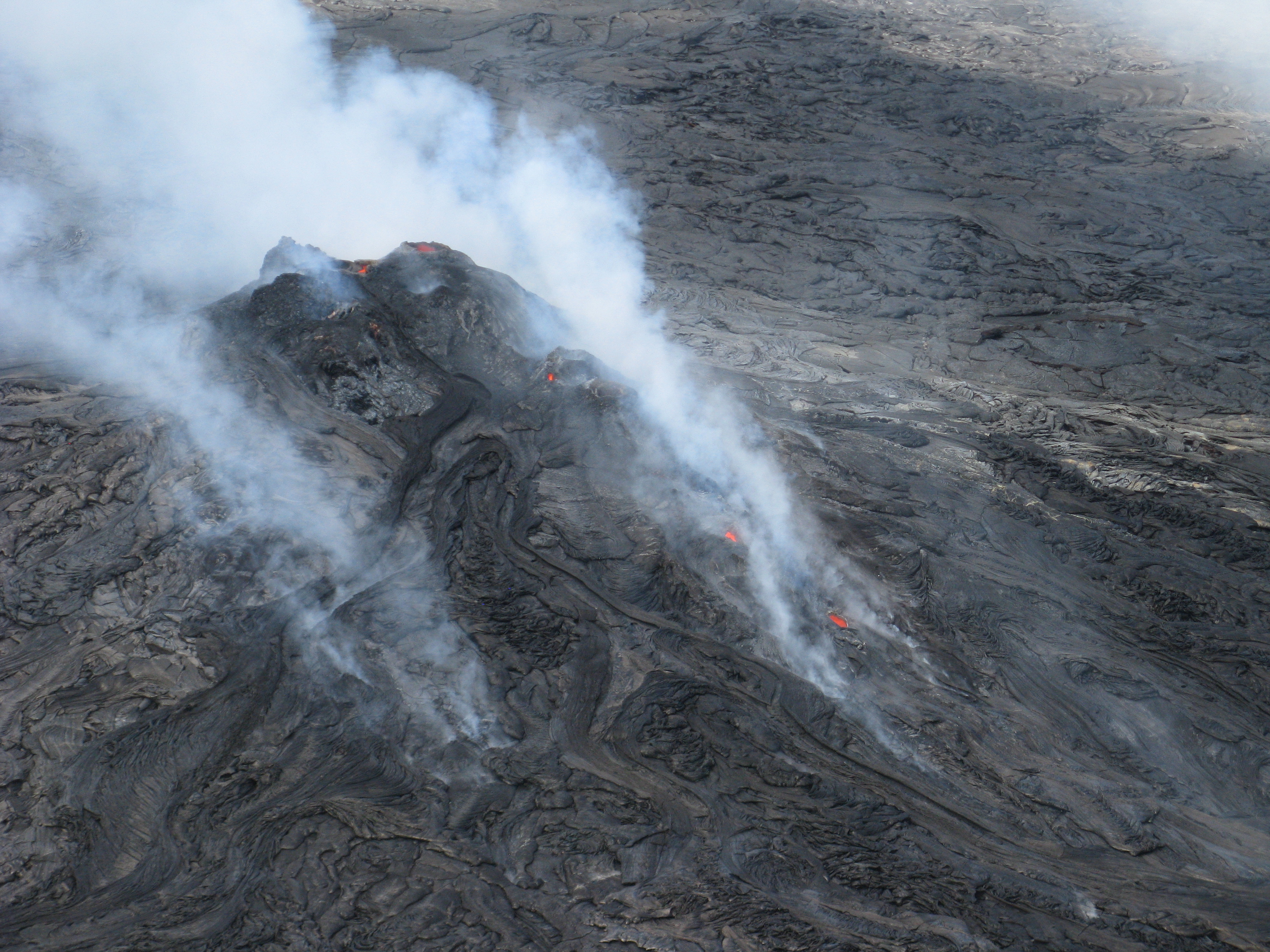
USGS photo: The Kahaualeʻa 2 flow, which is active north of Puʻu ʻŌʻō, is fed from a vent at this cone on the northeast rim of Puʻu ʻŌʻō crater. Small openings at the top of the cone contain sloshing lava, and two skylights at the very start of the Kahaualeʻa 2 lava tube provided views of a swiftly moving lava stream rushing downslope.
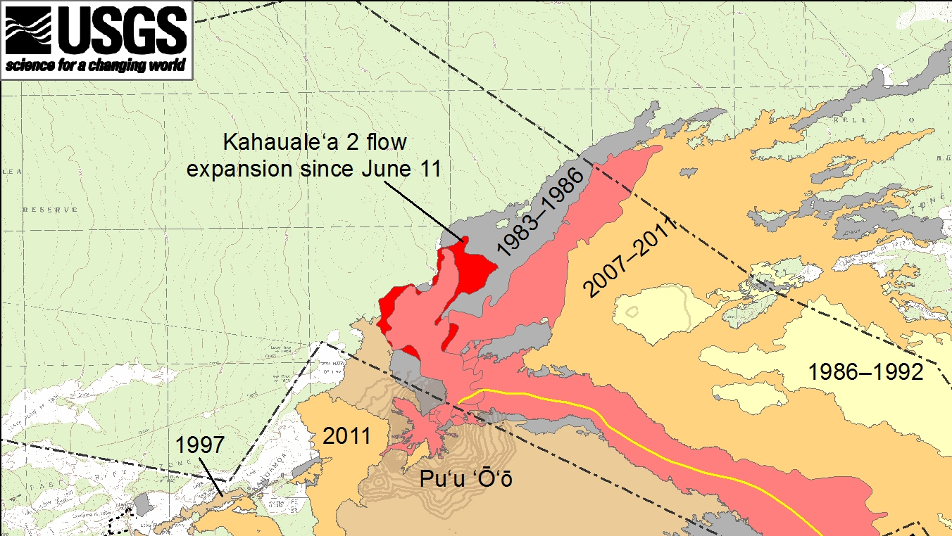
USGS map: This isolated close-up shows active Kahaualeʻa 2 flow north of Puʻu ʻŌʻō, as of June 27, 2013. The Kahaualeʻa 2 flow started on May 6 and continues to spread slowly on the lower flank and at the northern base of the Puʻu ʻŌʻō cone.

by Big Island Video News
on at
STORY SUMMARY
VOLCANO, Hawaii – Lava spewing from the middle east rift zone of Kilauea volcano is burning through forests to the north of the active Pu`u `O`o crater. Images posted by the USGS Hawaiian Volcano Observatory show the Kahauale’a 2 flow still expanding north, moving “a very minor amount into the forest, burning trees” scientists write.