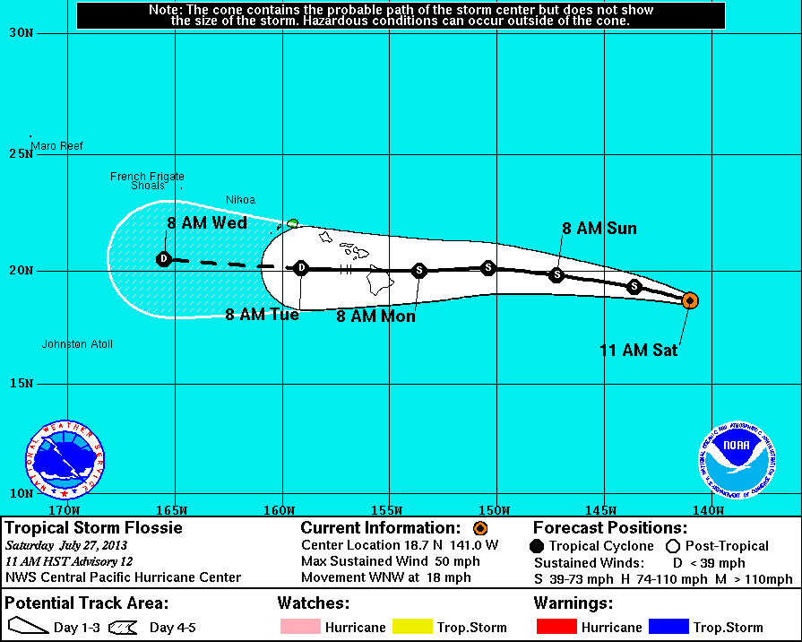
 HILO, Hawaii – Tropical Storm Flossie continues to weaken as it heads towards Hawaii. The storm is 920 miles east of Hilo and moving west-northwest at 18 miles per hour. Maximum sustained winds have fallen. They are now being measured at 50 miles per hour.
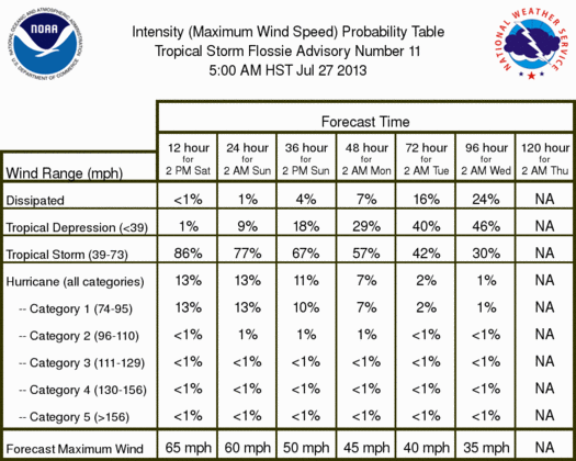
According to the most recent discussion posted at 11 a.m. by the National Weather Service:
 National Weather Service National Weather Service |
|
There are no coastal watches or warnings in effect. The next advisory from the NWS is expected around 5 p.m. HST.

by Big Island Video News
on at
STORY SUMMARY
HILO, Hawaii – Tropical Storm Flossie continues to weaken as it heads towards Hawaii. The storm is 920 miles east of Hilo and moving west-northwest at 18 miles per hour. Maximum sustained winds have fallen. They are now being measured at 50 miles per hour. According to the most recent discussion posted at 11 a.m. […]