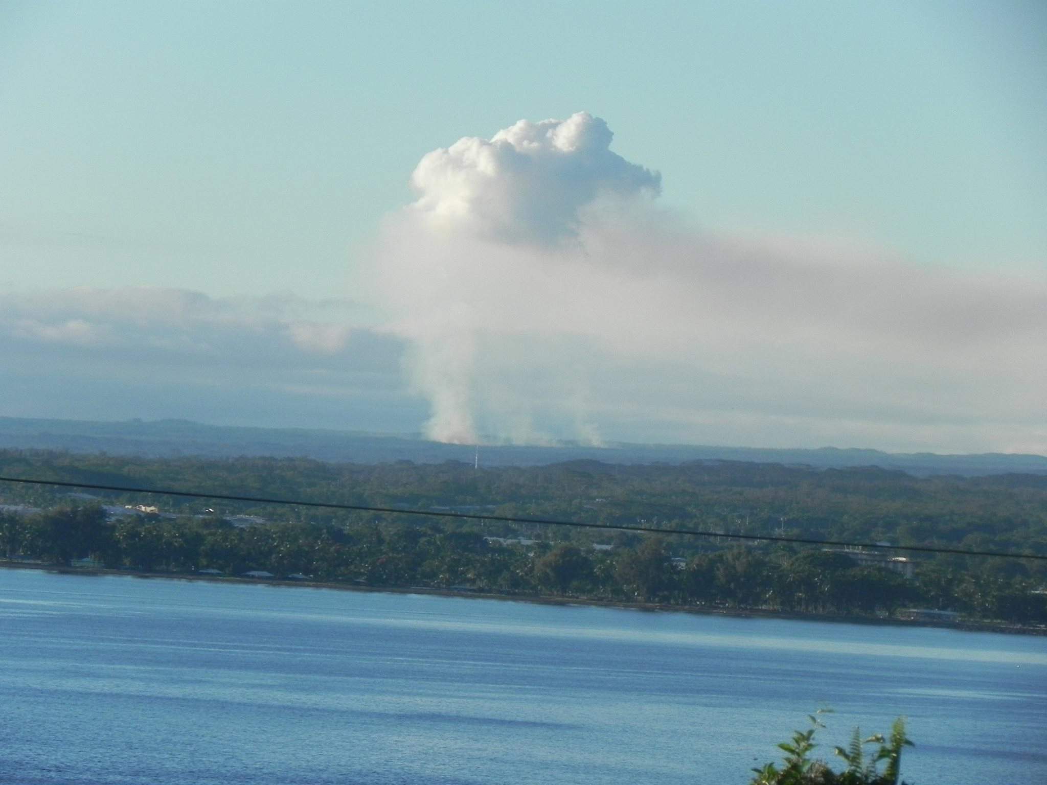
(ABOVE PHOTO) View of the lava flow and the plume above as seen from the vantage point of Honolii Pali, just north of Hilo town, taken by Marianna Scheffer.
PUNA, Hawaii – The June 27 lava flow that threatens populated areas in Puna has increased in speed a little after this weekend’s slowdown, and is again moving in a northeast direction.
On Sunday, residents and merchants in Pahoa town took some solace in the news that the lava had traveled about 300 yards since Friday, suggesting that the flow advance rate had slowed. Civil Defense also reported on Sunday that the flow seemed to be going in a northward direction, kindling hopes that the lava might bypass the center of town. On Monday however, civil defense reported the lava advanced another 250 yards in just one day, and is back on a northeast path.

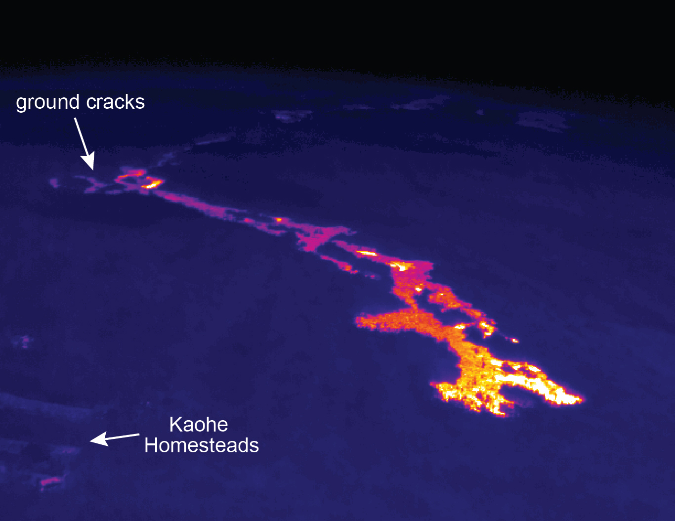
This morning’s assessment shows the surface lava flow continues towards the northeast and has advanced approximately 250 yards since yesterday. Presently the active edge of the surface flow is located approximately 0.1miles from the northwest or upper corner of the Wao Kele Forest Reserve and Kaohe homesteads boundary. Currently the flow does not pose an immediate threat to area communities however residents of the Kaohe Subdivision are advised to continue to monitor the local radio broadcasts for further updates and for possible evacuation instructions if conditions change. Residents will be given adequate notice to safely evacuate should that be necessary
There is no brushfire threat at this time and all burning is limited to the vegetation that is in direct contact with the flow. Smoke conditions may vary depending on wind conditions. During periods of heavy smoke conditions the Department of Health and American Lung Association have provided the following recommendations:
1. Remain indoors and limit or avoid outdoor activities.
2. If possible close all windows and if available use air conditioners on a recirculation setting.
3. If driving through areas of heavy smoke keep windows closed and if available use the air conditioner on the recirculation setting.
4. If symptoms or discomforts increase to seek medical attention and leave the area.
Construction activities on the Railroad Avenue and Government Beach Road are continuing. These activities are to establish alternate road access in the event Highway 130 is affected by the lava flow.
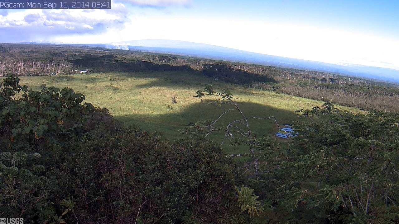
The public is reminded that the flow cannot be accessed and is not visible from any public areas. Access to the Kaohe Homesteads subdivision will be restricted and limited to subdivision residents only.Hawaii County Civil Defense on Sept. 15
The USGS Hawaiian Volcano Observatory followed up with this Monday update:

The June 27th lava flow remains active. A Civil Defense overflight this morning observed that the flow front was moving in a northeast direction once again, which is a slight shift from the north direction observed yesterday. They estimated that the flow had traveled 230 m (250 yards) over the past day. The flow front remains close to the boundary of the Wao Kele o Puna forest reserve and Kaohe Homesteads. The flow front is still in thick forest, creating smoke plumes as it engulfs trees and other vegetation, but fires are not spreading away from the flow. USGS Hawaiian Volcano Observatory on Sept. 15