(ABOVE VIDEO) Today’s Civil Defense message with video, photos and maps produced by USGS Hawaiian Volcano Observatory on Monday.
PUNA, Hawaii – Lava continues to burn through vacant lands in the Kaohe Subdivision, heading northeast. It has gone 270 yards since yesterday, according to a morning message from Hawaii County Civil Defense.

Presently the active edge of the surface flow is moving through the upper northwest corner of the Kaohe Homesteads and across a vacant forested parcel. The leading edge or front of the flow is approximately 100 yards wide. Currently the flow does not pose an immediate threat to area communities however residents of the Kaohe Subdivision are advised to continue to monitor the local radio broadcasts for further updates and for possible evacuation instructions if conditions change. Residents will be given adequate notice to safely evacuate should that be necessary. Civil Defense agency personnel will continue door to door notification in the Kaohe area today.
There is no brushfire threat at this time and all burning is limited to the vegetation that is in direct contact with the flow. Smoke conditions were moderate to heavy this morning over the Kaohe area and may vary depending on wind conditions. Hawaii County Civil Defense, Sept. 16
Yesterday, the USGS Hawaiian Volcano Observatory projected that lava could flow “from its current location to Apa`a Rd in 15 days and to the Pāhoa Village Road (government road) in Pāhoa within 20 days.”
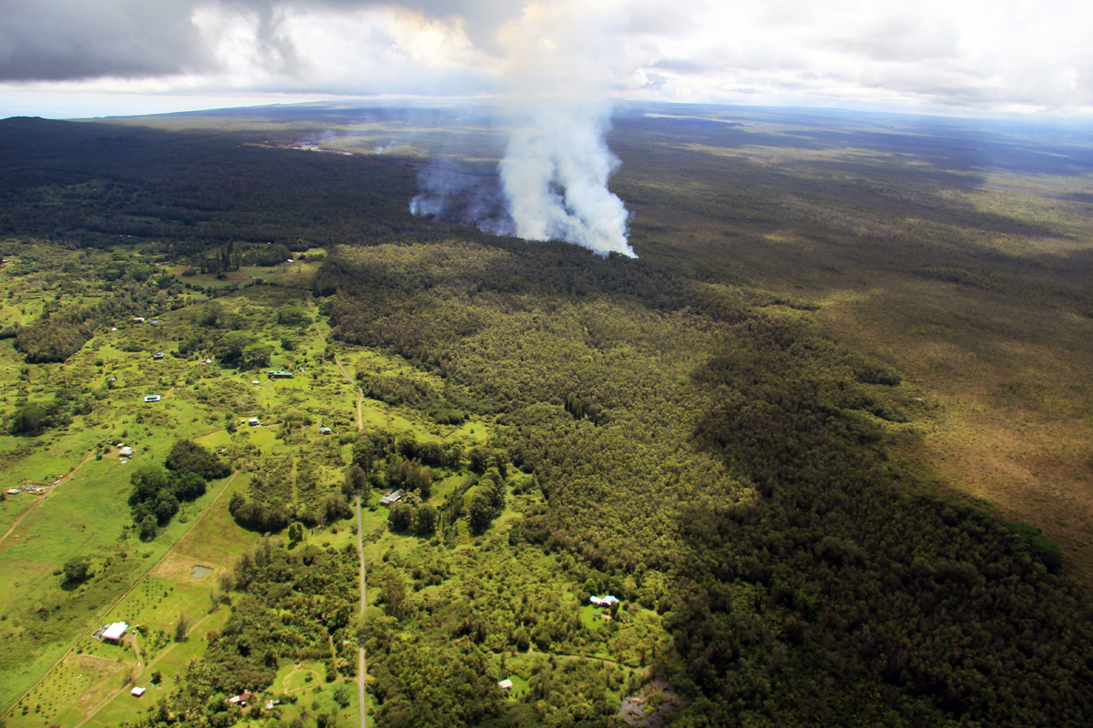
Wide shot of the flow front taken by USGS HVO, showing the lava moving through the forested northwest portion of the Kaohe subdivision. The flow front was 3.3 km (2.1 miles) upslope from Apaʻa Road and 4.3 km (2.7 miles) from Pāhoa Village Road.
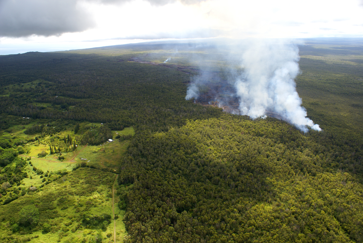
Another USGS HVO view of the flow front, in the northwest portion of Kaohe Homesteads subdivision.
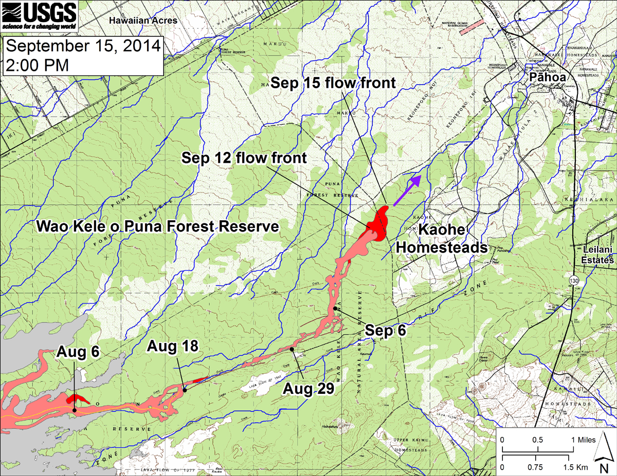
USGS: “This large-scale map shows the distal part of the June 27th flow in relation to nearby Puna communities. The black dots mark the flow front on specific dates. The latitude and longitude of the flow front on September 15 was 19.469506 /-154.981172 (Decimal degrees; WGS84). The blue lines show down-slope paths calculated from a 1983 digital elevation model (DEM; for calculation details, see http://pubs.usgs.gov/of/2007/1264/). Down-slope path analysis is based on the assumption that the digital elevation model (DEM) perfectly represents the earth’s surface. But, DEMs are not perfect, so the blue lines on this map indicate approximate flow path directions. The purple arrow shows a short term projection of flow direction based on the flow behavior over the past several days and the local topography.”

by Big Island Video News
on at
STORY SUMMARY
Lava continues to burn through vacant lands in the Kaohe Subdivision, heading northeast.