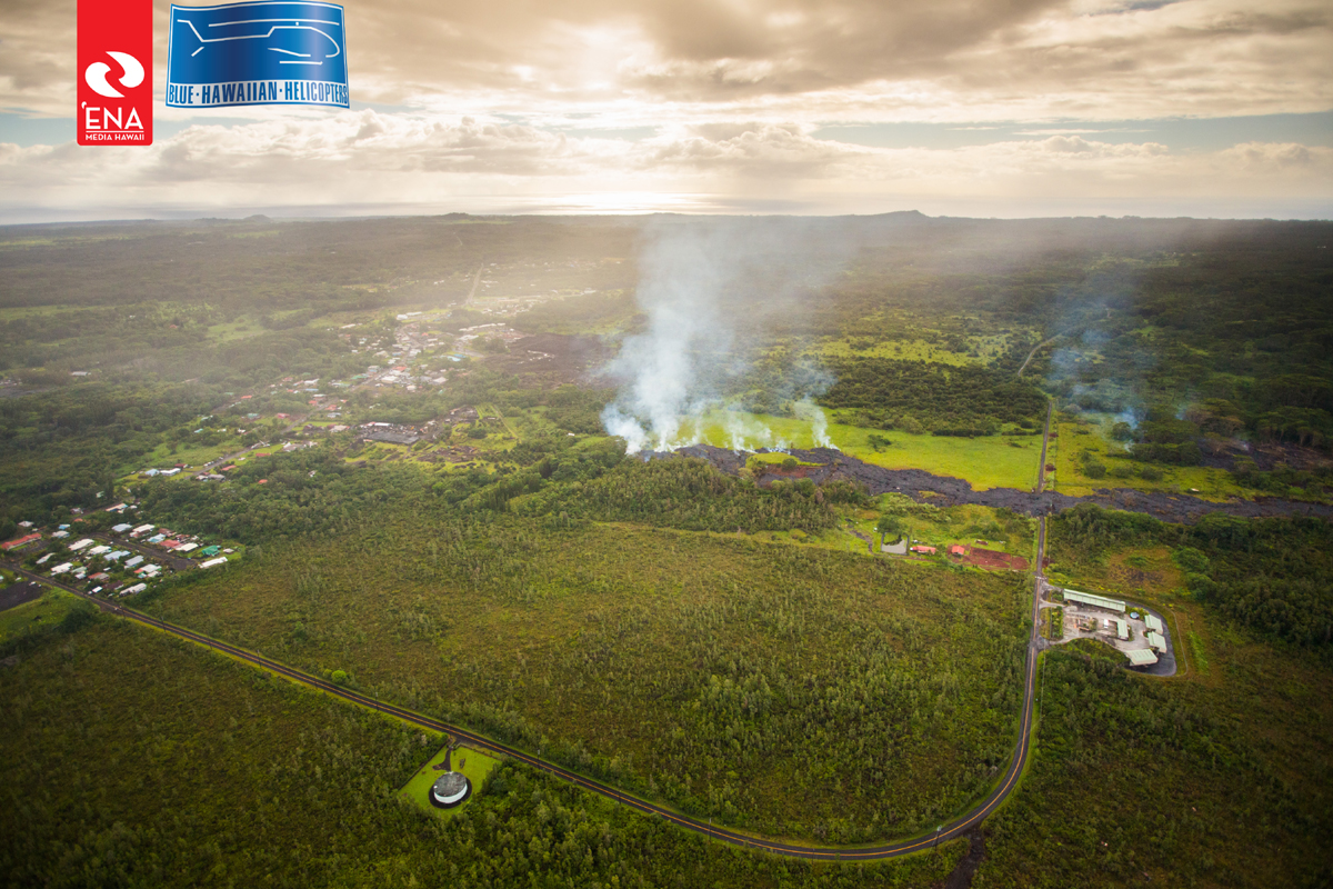
(ABOVE PHOTO) Aerial photo of the lava flow approaching a residential home in Pahoa on October 27. Courtesy ‘Ena Media Hawai’i/Blue Hawaiian Helicopters.
NEWS BRIEFS
- The lava flow has slowed somewhat since this morning, moving approximately 35 yards since 6:40 a.m. HST. The advance of the flow is averaging approximately 5 yards per hour. The lava is moving in a northeast direction and is about 70 yards from the nearest residential property.
- The Pahoa Village Road between Apa’a Street and the Post Office Road will remain closed and limited to area residents only.
- Pahoa Post Office Road is now a one-lane road for traffic heading out of Pahoa town, eastbound. Police say there will be no parking along road shoulders.
- Traffic entering Pahoa town is now limited to the intersection of Route 132/Route 130 near Pahoa High School.
- Residents in the immediate downslope area of the flow path were advised to prepare for possible evacuation last night. A Red Cross Shelter has opened at Sure Foundation Church in Puna (16-1592 Pohaku Circle in Orchidland Estates).
- Today the county announced that the next lava flow community update meeting will be held on Thursday, October 30 at 6:30 p.m. at the Pāhoa High School Cafeteria.
PRIMARY SOURCES

The flow continues to remain active and has advanced approximately 35 yards since this morning at 6:40AM. The flow front is currently moving in a northeast direction and is approximately 70 yards from the nearest residential property. The flow advancement has been inconsistent however averaging approximately 5 yards per hour.
Smoke conditions were light to moderate with moderate trade winds from the northeast pushing the smoke in a south southwest direction. Smoke conditions may increase in some areas and residents down wind that may be sensitive or have respiratory problems are advised to take necessary precautions and to remain indoors.
Based on the current flow location, direction and advancement, residents in the flow path were placed on an evacuation advisory and notified of possible need for evacuation beginning last night. The evacuation advisory for those residents down slope of the flow will continue and residents will be kept informed of the flow status and advancement.
The Pahoa Village Road between Apa’a Street and the Post Office Road will remain closed and limited to area residents only. In addition, Civil Defense and public safety personnel will be operating in the area round the clock to maintain close observations of flow activity.Hawaii County Civil Defense on Oct. 27 at 2:30 p.m. HST