(ABOVE VIDEO) First video of the house fire ignited by lava in Pahoa, filmed by Mick Kalber of Tropical Visions Video aboard Paradise Helicopters.
NEWS BRIEF
- The June 27 lava flow came in contact and ignited its first home in Pahoa just before noon on Monday. Hawaii County Civil Defense says the home – sitting on a 45-acre agricultural lot off Cemetery Road – had already been evacuated. A small storage shed on the property was also destroyed this morning. Civil Defense has stated on a number of occasions that the fire department will not put out house fires that ignite due to contact with lava.
- Although the front of the lava flow remains stalled, breakouts upslope – like the one that claimed this home – continue to be active.
PRIMARY SOURCES

The current assessment shows that the flow front remains stalled with very little activity and has not advanced. The front remains approximately 480 feet from the Pahoa Village Road. An upslope breakout in the area of Apa’a Street near the cemetery had entered a private property yesterday morning and at approximately 11:55 this morning, the residential structure or house was ignited by the advancing flow. Emergency personnel are on scene and there is not threat to any other properties at this time. Smoke from the burning structure is currently rising and dissipating.
Smoke conditions are currently moderate to heavy with light trade winds blowing the smoke in a south southwest direction towards the Leilani and lower Puna areas. Smoke conditions may increase in some areas and residents down wind that may be sensitive or have respiratory problems are advised to take necessary precautions and to remain indoors.The evacuation advisory for those residents down slope of the flow will continue and residents will be kept informed of the flow status and advancement.
The Pahoa Village Road between Apa’a Street and the Post Office Road will remain closed and limited to area residents only. In addition, Civil Defense and public safety personnel will be operating in the area round the clock to maintain close observations of flow activity. Additional updates will be broadcasted as conditions change. Hawaii County Civil Defense on Nov. 10 at 12:15 p.m. HST
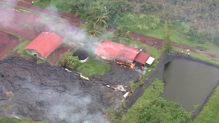
Still image taken from overflight video shot by Mick Kalber

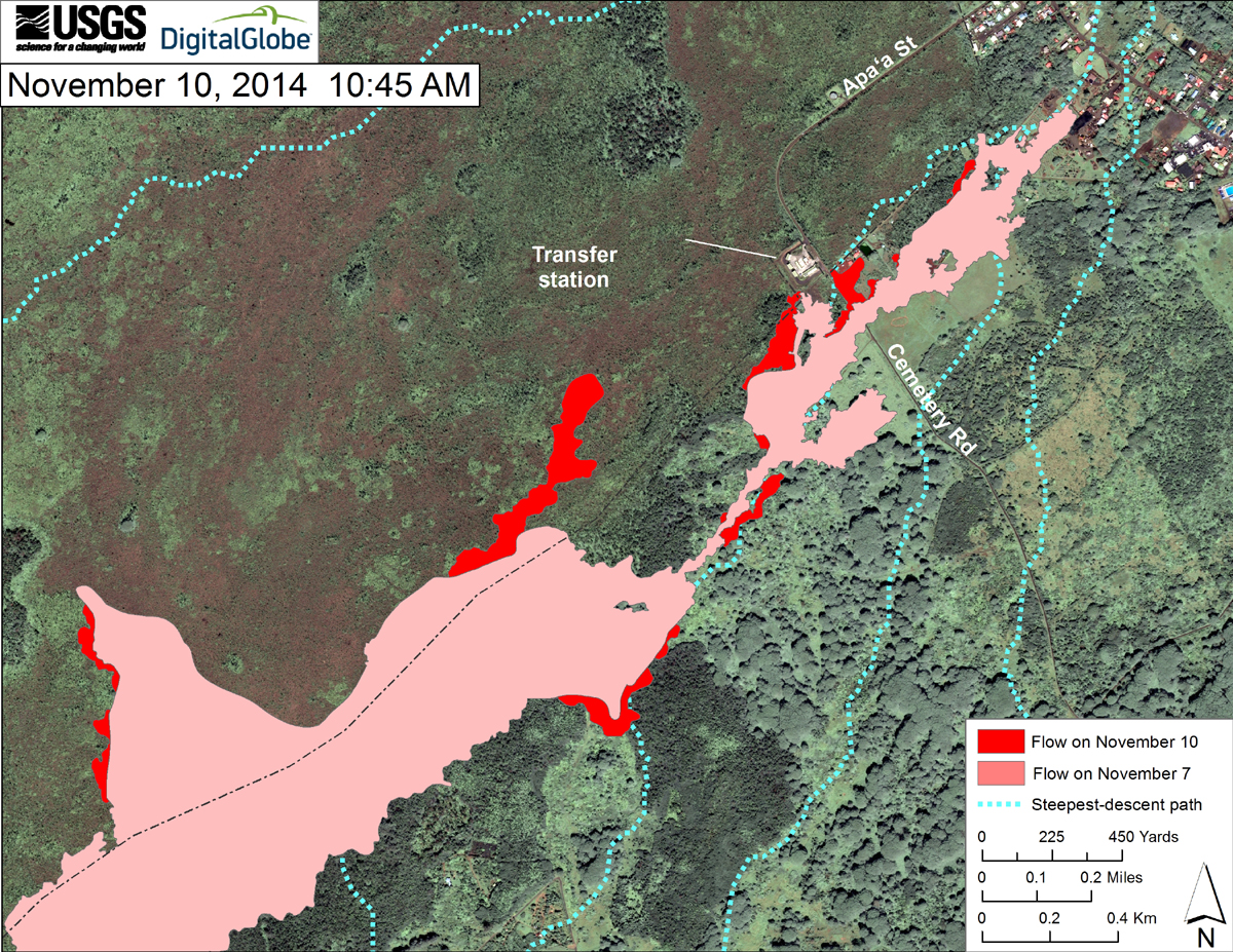
This USGS map uses a satellite image acquired in March 2014 (provided by Digital Globe) as a base at 1:13,000 scale to show the area around the front of the June 27th lava flow. The area of the flow on November 7, 2014, at 3:30 PM is shown in pink, while expansion of the flow as mapped on November 10 at 10:45 AM is shown in red. The latitude and longitude of the front of the narrow finger of lava advancing toward Pāhoa was 19.49590, -154.95256 (Decimal Degrees; WGS84). The dotted blue lines show steepest-descent paths in the area, calculated from a 1983 digital elevation model (DEM).
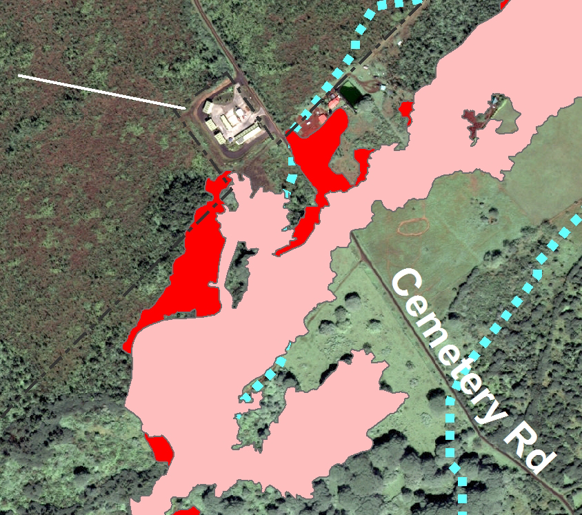
Inset of the Nov. 10 USGS map. The home that burned down can be seen on the north edge of the flow, on the makai side of Cemetery Road.

by Big Island Video News
on at
STORY SUMMARY
First video of the house fire ignited by lava before noon on Monday