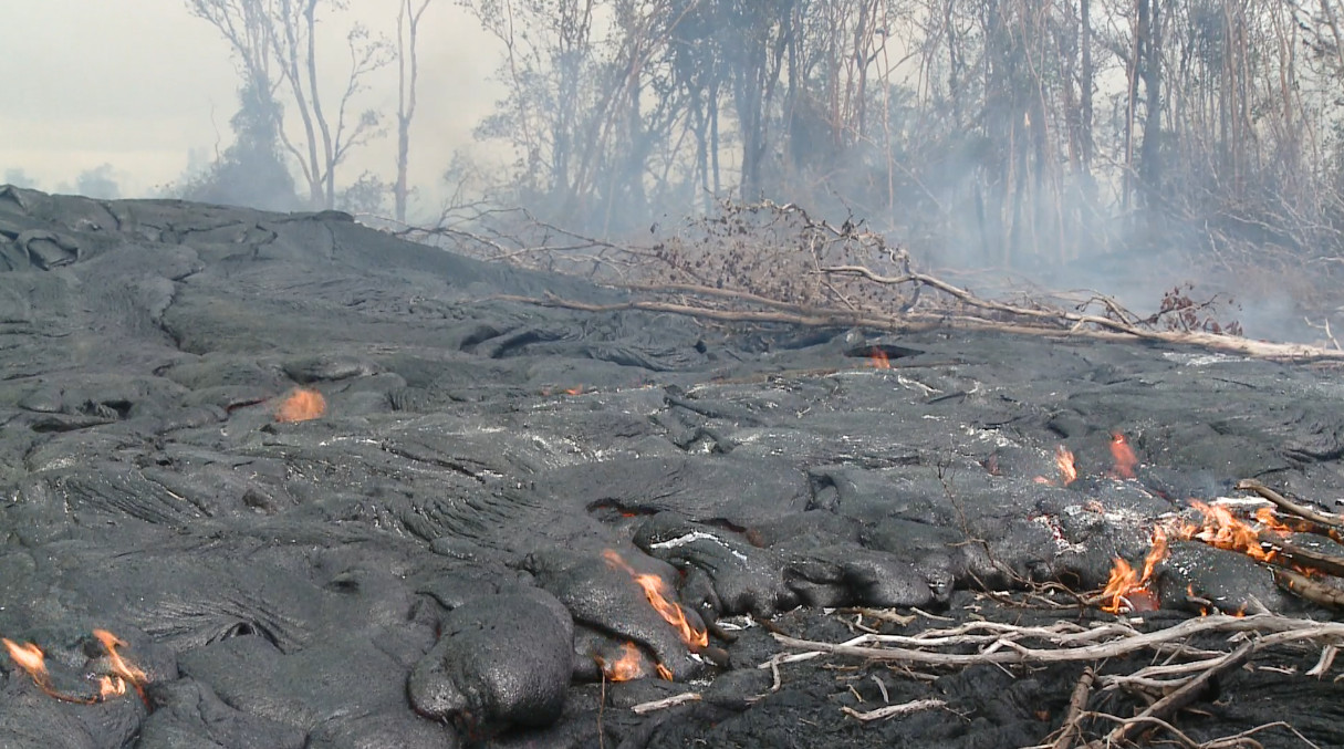
(ABOVE PHOTO) Lava burning 3 miles above Apa’a Street. Image taken on November 29 courtesy Hawaii County.
NEWS BRIEFS
- The most active, down slope breakout was within 2.5 miles of Apa’a Street according to the USGS Hawaiian Volcano Observatory. Webcam imagery of smoke from burning forest suggests that the flow is advancing by several hundred meters per day along the northwest margin of the existing flow.
PRIMARY SOURCES

This morning’s helicopter assessment was not possible due to an ongoing search and rescue mission. An assessment will be conducted as soon as possible. Yesterday’s over flight showed that the up slope breakouts remained active. The active and most down slope breakout was located along the north side or margin of the original flow and moving in a north direction. The nearest breakout activity was approximately 2.7 miles upslope of the Apa’a street area. Current activity does not pose an immediate threat to area communities and Civil Defense and Hawaiian Volcano Observatory personnel are maintaining close observations of flow activity. Residents down slope will be kept informed of any changes in flow activity, advancement, and status.
Smoke conditions were light this morning in the immediate area with all smoke from burning vegetation being blown in a southeast direction. Smoke conditions may increase in some areas and residents that may be sensitive or have respiratory problems are advised to take precautions and to remain indoors.
The Pahoa Village Road remains open to all traffic and motorists are advised to exercise caution as some utility pole protection material remains in place. Everyone is asked to please respect the residents of the area who were affected by the lava flow and to not trespass on private property.
Once again we would like to thank everyone for your patience and understanding and your cooperation and assistance is greatly appreciated.Hawaii County Civil Defense on Nov. 30 at 8 a.m. HST

Kīlauea Volcano continues to erupt at its summit and within its East Rift Zone. Active breakouts on the June 27th flow field are advancing at a rate of several hundred meters per day between the abandoned geothermal well site and Kaohe Homesteads. DI deflation is ongoing at the summit, and the lava lake has dropped slightly in response.
June 27th Lava Flow Observations: The lowermost breakouts on the flow field continue to advance downslope between the abandoned geothermal well site and Kaohe Homesteads. Webcam imagery of smoke from burning forest suggests that the flow is advancing by several hundred meters per day along the northwest margin of the existing flow, which is consistent with observations from recent Civil Defense overflights. Based on these data, the flow is now within about 4 km (2.5 miles) of Apaʻa Street. An HVO overflight is planned for Monday, weather permitting.
Puʻu ʻŌʻō Observations: A small amount of deflationary tilt has been recorded over the past 24 hours, which may be related to a DI event that is currently ongoing at the summit, but no other changes are apparent at Puʻu ʻŌʻō. Seismic tremor continues to be low and steady, and webcams revealed no strong variations in the pattern of glow from degassing vents or the configuration of the crater floor. GPS-measured deformation across the cone has shown neither extension nor contraction since July. The most recent measurement of sulfur dioxide emissions from the East Rift Zone was about 250 tonnes per day on November 26, 2014.
Summit Observations: DI deflation began at about 5 AM on Saturday and is currently ongoing. The level of the summit lava lake has dropped by several meters (yards) as a result, with fluctuations due to changes in spattering superimposed on that trend and correlated to changes in volcanic tremor amplitude. Small amounts of particulate material were carried aloft by the plume. The average emission rate of sulfur dioxide was 6,900 tonnes/day for the week ending on November 25.USGS Hawaiian Volcano Observatory on Nov. 30 at 8:11 a.m. HST