(ABOVE VIDEO) This morning’s Civil Defense message with video courtesy Mick Kalber aboard Paradise Helicopters.
NEWS BRIEFS
- The lava flow front is showing very little signs of advancement, having moved only 20 yards since downlsope since 6:30 a.m. this morning. The front remains 0.6 miles upslope of the Highway 130 and Pahoa Village Road intersection.
MEDIA
Here is this evening’s Hawaii County Civil Defense message:
PRIMARY SOURCES

This afternoon’s assessment shows that the flow front remains active however showing very little signs of advancement. The active flow had advanced approximately 20 yards since 6:30AM this morning and the front remains approximately .6 miles upslope of the Highway 130 and Pahoa Village Road intersection. Current activity does not pose an immediate threat to area communities and Civil Defense and Hawaiian Volcano Observatory personnel are maintaining close observations of the flow. Residents and businesses down slope will be kept informed of any changes in flow activity, advancement, and status.
The Railroad Avenue alternate access road has been opened for use from 12:00 noon this past Saturday December 20th. This is to allow for motorists to become familiar with the road and traffic flow. Highway 130 remains open and there is no anticipated road closure at this time.
On behalf of the Hawaii County Civil Defense Agency and our partners we would like to thank everyone for your assistance and cooperation. Hawaii County Civil Defense on Dec. 22 at 6:30 p.m. HST

USGS Hawaiian Volcano Observatory (HVO) scientists conducted a helicopter overflight of the June 27th lava flow this afternoon and mapped its leading edge. At the time of the flight, the tip of the flow was stalled about 0.7 km (0.4 miles) from the Pahoa Marketplace, measured in a straight line, but lava was active in several places immediately behind the front. One or more of these other active lobes could overtake the stalled front in the coming hours to days, or the stalled front could reactivate. Numerous breakouts were also active along the flow in an area extending from 1 to 3 km (0.6 to 2 miles) upslope from the front of the flow, in the ground crack area near the True/Mid-Pacific well pad, and about 3 km (2 miles) downslope from Puʻu ʻŌʻō.USGS Hawaiian Volcano Observatory on Dec. 22 at 7:38 p.m. HST
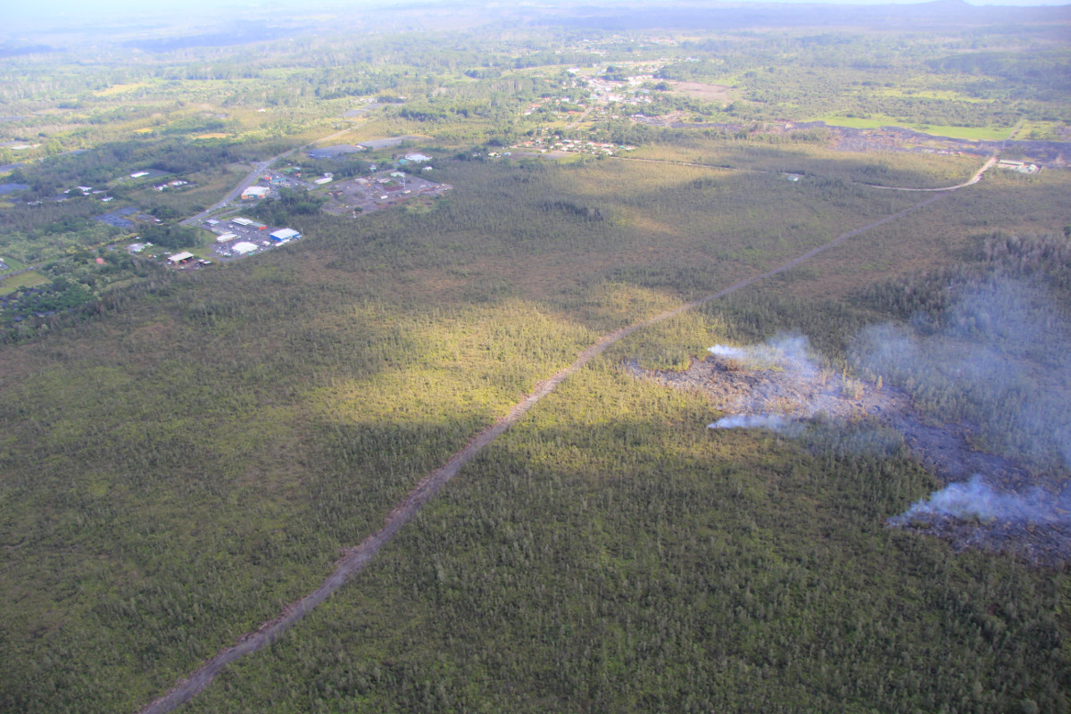
This USGS photo shows the flow was very close to a firebreak road cut several months ago. The Pahoa Transfer Station is at upper right. The view is to the southeast.

by Big Island Video News
on at
STORY SUMMARY
The flow front is showing very little signs of advancement, as new overflight video shows the lava is still active.