NEWS BRIEF
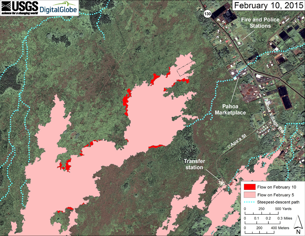
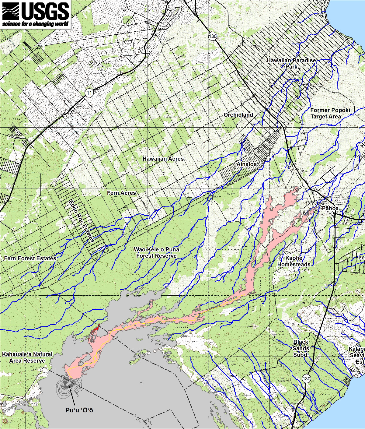
- USGS mapped the perimeter of the lava flow while conducting a helicopter overflight on Tuesday. Scientists with the Hawaiian Volcano Observatory posted a new status report, maps and photos to its website.
NEW MAP
PRIMARY SOURCES
After Tuesday’s overflight, the USGS Hawaiian Volcano Observatory posted this update:
At the time of the flight, the leading edges of the two active lobes to the north and east were inactive, but several small breakouts across the interior and edges of the lobes were active. The eastern lobe, formerly headed toward the Pahoa Fire station, remained stalled at its leading tip but continued to host small breakouts from about 0.3 to 2.8 km (0.2 to 1.7 mi) upslope of the inactive tip. The northern lobe remains inactive beyond where it branched off from the more easterly lobe. Additional breakouts were observed farther upslope at the junction of the flow’s two main branches, west of Kahoe Homesteads, and in the crack system. The breakout just northeast of Puʻu ʻŌʻō that started about 2 weeks ago continues to be active, and it advanced about 440 m (480 yds) since February 5. The cross-sectional area of the lava stream in the tube on the flank of Puʻu ʻŌʻō was the same as measured on February 5, suggesting that lava discharge from the vent has not changed in the past week. USGS Hawaiian Volcano Observatory on Feb. 10 at 8:52 p.m. HST