NEWS BRIEFS
- There continues to be no change with of any of the down slope flow areas, although breakouts continue upslope, civil defense reports.
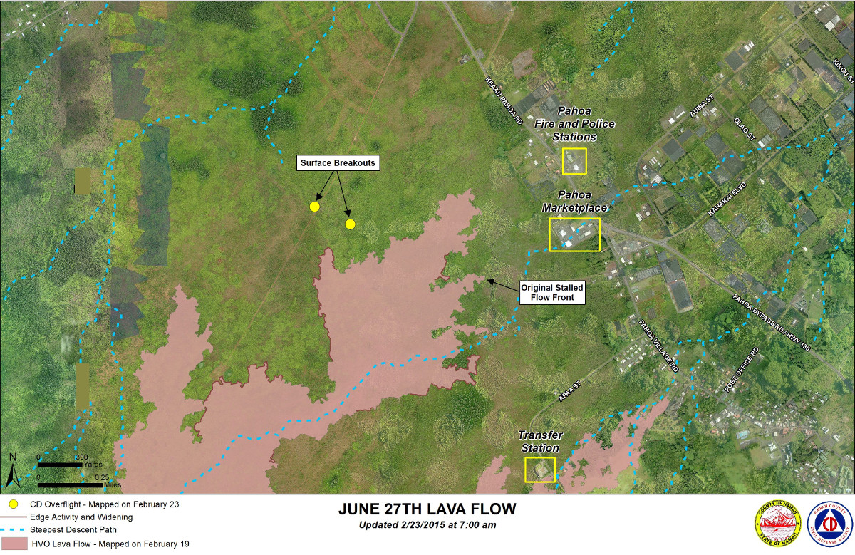
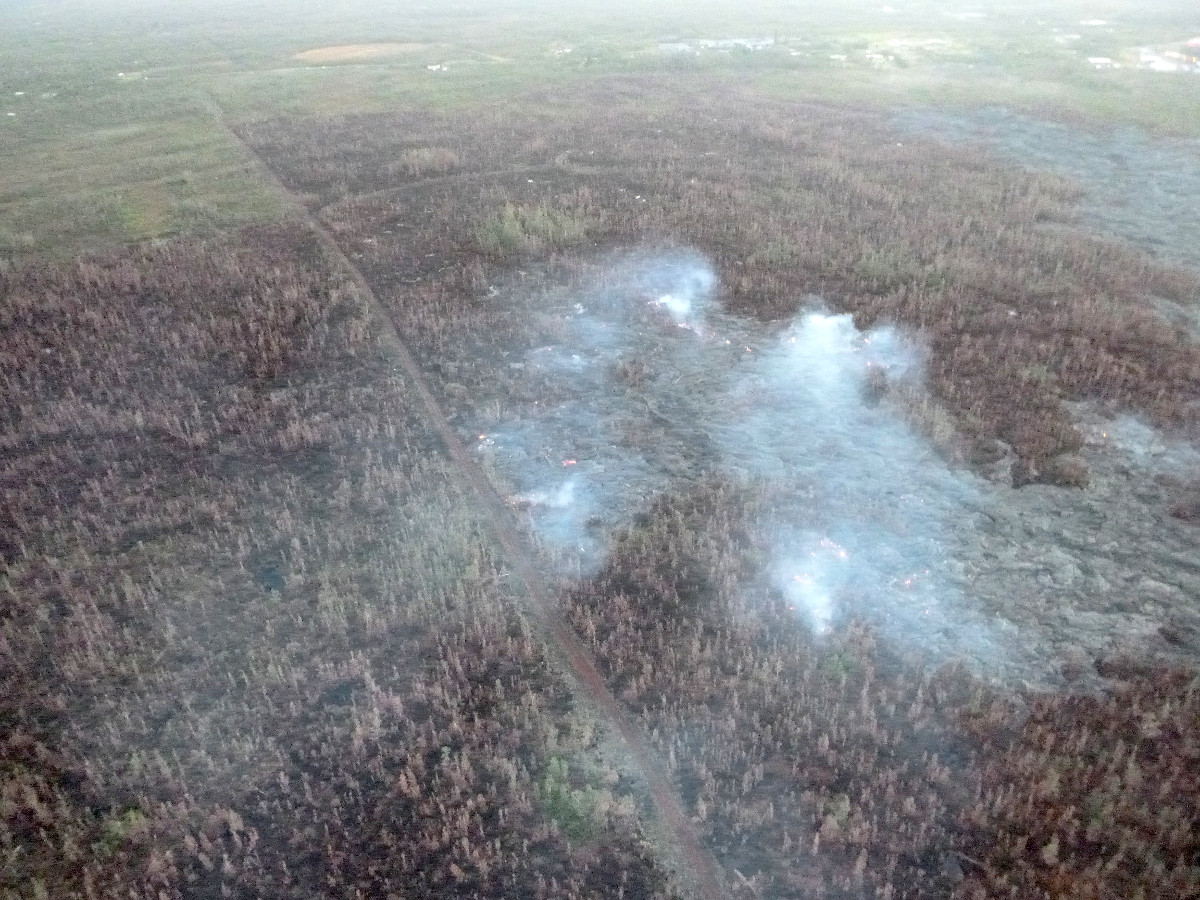
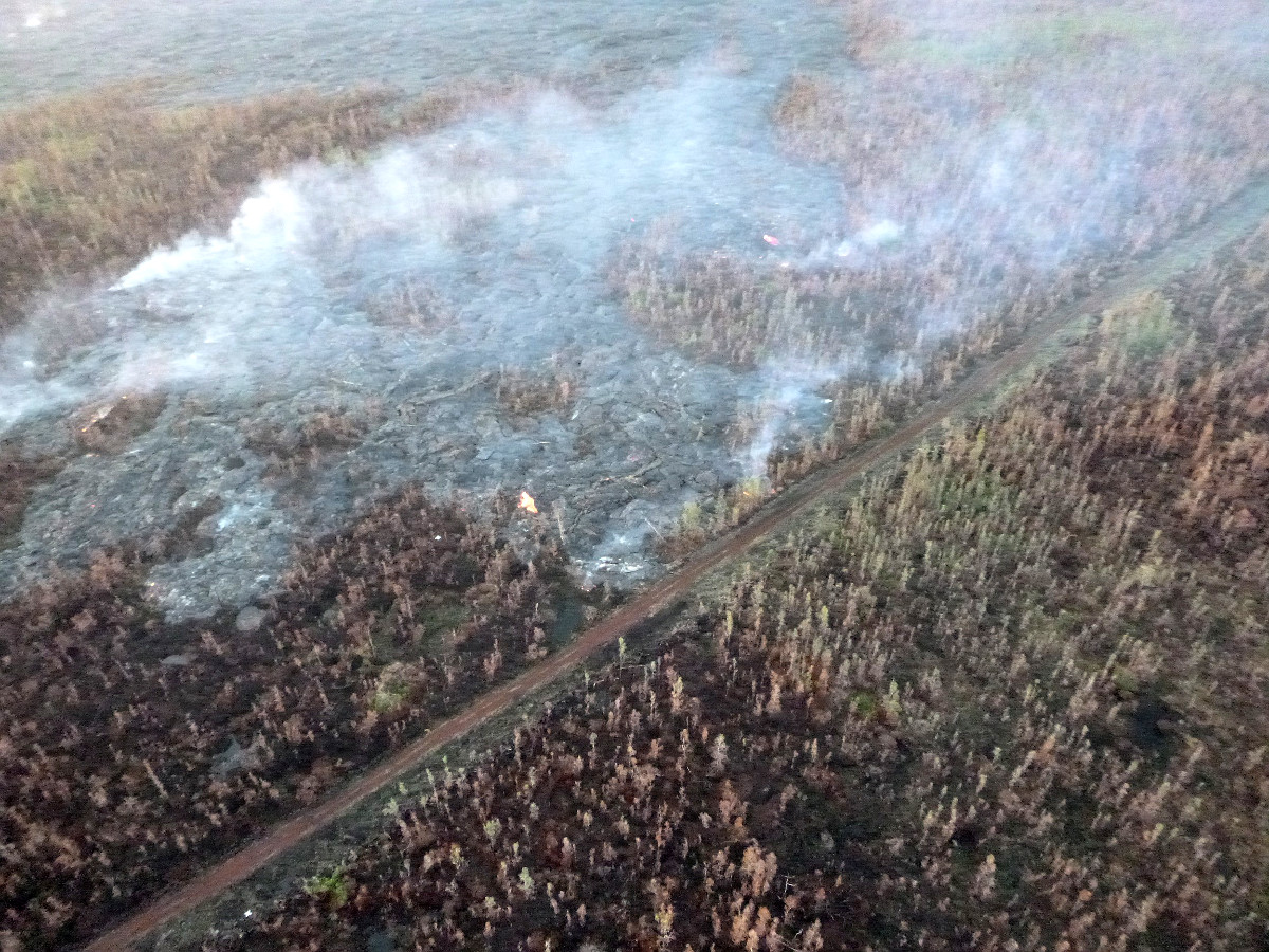
- The north margin breakout has not advanced toward the highway since yesterday morning. The breakout is active and is widening. Civil defense photos show the distal portion of the breakout reaching a fire break road. The leading edge of this breakout is approximately 1 mile to the west or mauka of Highway 130.
- Smoke conditions were light with a light north wind blowing the smoke in a southeast direction.
LATEST MAP
PRIMARY SOURCES

This morning’s assessment continues to show no change with any of the down slope flow areas. Surface breakouts and breakouts along both margins upslope of the flow front continue and provide indication that the tube system continues to be supplied and lava from the source is making its way to the down slope areas. The breakout along the north margin remains active however sluggish and widening. No advancement was noted since yesterday morning. The leading edge of this breakout is approximately 1 mile to the west or mauka of Highway 130. All current activity does not pose an immediate threat to area communities. The Hawaii County Civil Defense Agency and Hawaiian Volcano Observatory are maintaining close observations of the flow and residents and businesses down slope will be informed of any changes in flow activity and advancement.
Smoke conditions were light with a light north wind blowing the smoke in a southeast direction. Smoke conditions may increase in some areas and individuals who may be sensitive or have respiratory problems are advised to take necessary precautions and to remain indoors.
On behalf of the Hawaii County Civil Defense Agency and our partners we would like to thank everyone for your assistance and cooperation. Hawaii County Civil Defense on Feb. 23 at 7:45 a.m. HST

Activity Summary: Kīlauea Volcano continues to erupt at its summit and from its East Rift Zone. The inactive distal tip of the June 27th lava flow remains roughly 500 m (~550 yd) from Highway 130 in the area west of the Pāhoa Fire and Police Stations. Breakouts continue in both the down slope and upslope flow areas. The breakout along the north margin of the stalled flow tip is still active but sluggish, and has not advanced since yesterday morning. The leading edge of this flow is approximately 1.6 km (1 mile) upslope of Highway 130. Web cam images show a recent breakout on the north flank of Puʻu ʻŌʻō. Tiltmeters located at the summit have recorded no significant change in tilt over the past day.
June 27th Lava Flow Observations: Observers on a Civil Defense overflight this morning reported that the inactive flow tip remains stalled with scattered breakouts active upslope of the tip. The breakout along the north margin of the stalled flow tip is sluggish and is widening the flow, but has not advanced since yesterday morning. The leading edge is roughly 1.6 km (1 mile) upslope of Highway 130. Web cam views show a recent breakout on the north flank of Puʻu ʻŌʻō, as well as continued activity at the upslope and downslope breakouts.
Puʻu ʻŌʻō Observations: The tiltmeter on the north flank of Puʻu ʻŌʻō shows sharp deflationary tilt since yesterday morning. Webcam views show incandescence in the normal locations within the crater, however, there is a recent breakout on the north flank of Puʻu ʻŌʻō. Seismic tremor has remained low. The rate of sulfur dioxide emission from all East Rift Zone vents was about 200 tonnes per day, measured on January 7 (unfavorable wind and weather conditions have prevented more recent measurements).
Summit Observations: Tiltmeters operating around the summit have recorded no significant change in tilt over the past day. Minor fluctuations have occurred in the level of the lava surface within the summit eruptive vent over the past day. Emission rates of sulfur dioxide were measured at 3,300 tonnes/day on February 13. Seismic tremor at the summit remained low. Small earthquakes located near the south portion of Kīlauea Caldera continue, although at a reduced rate as compared to last week.USGS Hawaiian Volcano Observatory on Feb. 23 at 9 a.m. HST
Mahalo for making it clear that while the N. margin breakout has not advanced *toward the Hwy*, it is “active and widening” and has reached a dirt road/fire break. This is better information than I got from the HVO/USGS site, where they frame it as if no advance *toward the Hwy.* is the same as no advance at all. I live t the back of Ainaloa and the N. margin outbreak is heading toward my subdivision. Civil Defense needs to change the way it defines “advance” to include widening as well as heading toward the Hwy.