Big Island Video News

Serving Hawaii County

  • Hawaiʻi Island News Regions
    • Hamakua
      • Mauna Kea
    • Hilo
    • Kau
    • Kona
    • Kohala
    • Puna

“Fantastic” Lava Outbreak Filmed Over Flow Field
Avatar photo

by Big Island Video News
on Oct 8, 2015 at 6:14 pm

Subscribe to Big Island Video News (FREE)

* indicates required

STORY SUMMARY

PUNA: A large lava outbreak from the tube system about a mile and a half northeast of the Pu'u 'O'o vent was captured on video during a helicopter overflight this morning.

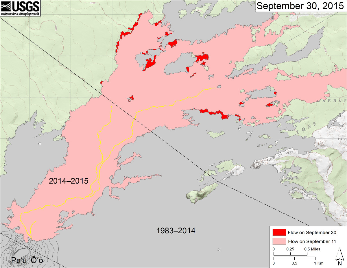
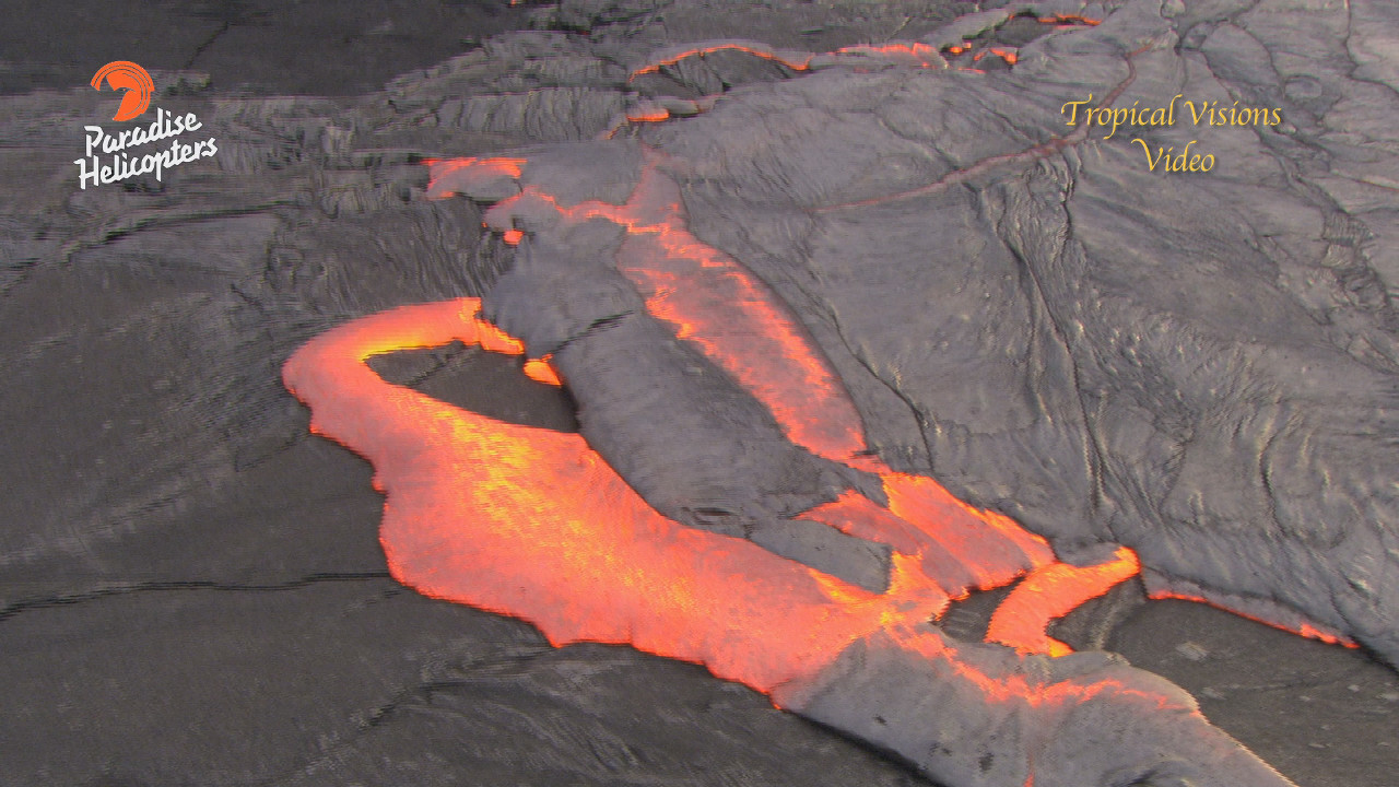
PUNA, Hawaii – A large lava outbreak from the tube system about a mile and a half northeast of the Pu’u ‘O’o vent was captured on video during a helicopter overflight this morning.

The lava, which is not currently threatening any communities, is “oozing a multitude of pahoehoe toes over a very broad shield,” according to videographer Mick Kalber, who filmed the event from above on a Paradise Helicopters flight. Kalber provided these observations:

Mick Kalber

“Lava apparently broke out of the tube system early this morning, and continued during our flight this morning. The outbreak is about a quarter-mile long, and 75-80 yards wide, the crust repeatedly cracking, oozing lava, and subducting the plates nearby in a remarkable display. In the thirty years of documenting Pele’s activities, this is the first time this reporter has seen this type of activity taking place in the middle of a flow field. The outbreak is headed slowly toward the crack that fed flows to the Pahoa area a year ago, but is still about 3.5 to 4 miles away from the start of the fissure. Nearly all surface activity throughout the flow field has ceased with this new activity. We saw no forested areas burning anywhere and only a few small outbreaks two to three miles below the vent.”Mick Kalber on Oct. 8, 2015

This USGS map shows recent changes to Kīlauea’s active East Rift Zone lava flow field. The area of the flow on September 11 is shown in pink, while widening and advancement of the flow as of September 30 (based on satellite imagery) is shown in red. The yellow lines show the active lava tube system. Puʻu ʻŌʻō lava flows erupted prior to June 27, 2014, are shown in gray. This map does not reflect today's activity.

This USGS map shows recent changes to Kīlauea’s active East Rift Zone lava flow field. The area of the flow on September 11 is shown in pink, while widening and advancement of the flow as of September 30 (based on satellite imagery) is shown in red. The yellow lines show the active lava tube system. Puʻu ʻŌʻō lava flows erupted prior to June 27, 2014, are shown in gray. This map does not reflect today’s activity.


Filed Under: Uncategorized Tagged With: June 27 lava flow, lava, Puu Oo

LATEST NEWS

Giant Banyan Tree Falls Over Kilauea Avenue

Captain Cook Man Arrested After Domestic Incident, Car Crash

“Village Street Eats” Debuts July 16th At Hilton Waikoloa Village

2025 Richardson Roughwater Swim Set For August 30

VOLCANO WATCH: Snowshoeing On Kīlauea? High Lava Fountains Pose New Challenges For USGS

Kīlauea Volcano Eruption Update for Thursday, June 10

About Big Island Video News

  • Privacy Policy

Copyright © 2025 · Dynamik-Gen on Genesis Framework · WordPress · Log in