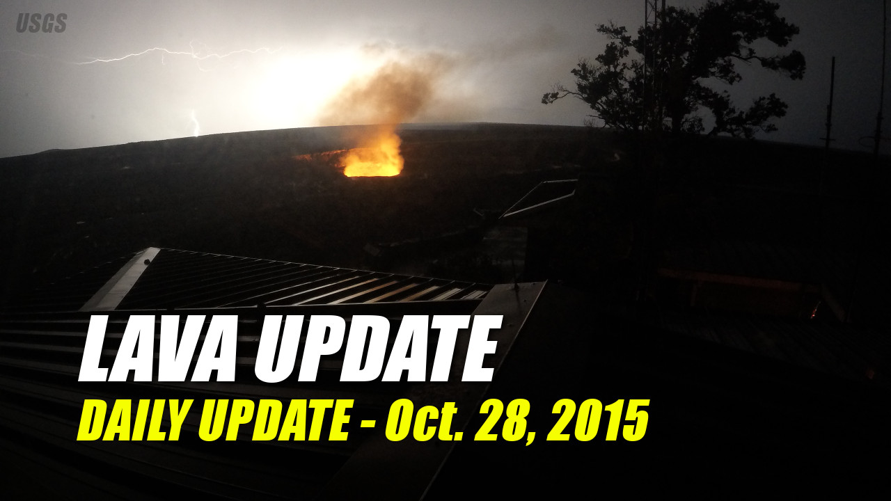
ABOVE: An intense lightning storm at Kīlauea’s summit on October 16 lights up the sky behind Halema’uma’u. (courtesy USGS)
NEWS BRIEFS
- There is no lava flow threat to nearby communities.
- The increase in earthquake activity on the southwest rift of Kīlauea near Pahala continued.
- Deflationary tilt continued both at the summit of Kilauea and at Pu’u O’o.
- Mauna Loa volcano is not erupting. The last weekly update was on October 22, 2015.
KILAUEA VOLCANO UPDATE
KILAUEA STATUS UPDATE
October 28, 2015Activity Summary: Eruptions continue at Kīlauea Volcano’s summit and in its east rift zone at Puʻu ʻŌʻō. Deflationary tilt at the summit has continued and the lava lake level is roughly 72 m (235 ft) below the Overlook crater rim. Earthquake activity on the Kīlauea Southwest Rift zone is still elevated, but not associated with any significant change in activity of the volcano. Scattered breakouts remain active northeast of Puʻu ʻŌʻō, within about 7 km (4 miles) of the vent. There is no lava flow threat to nearby communities.
Summit Observations: Deflationary tilt continues this morning. The lava lake level has dropped to roughly 72 m (235 ft) below the Overlook crater rim. During the past day steady spattering activity has been observed within the lake. The increase in earthquake activity on the southwest rift of Kīlauea continues. Earthquake swarms in this area are not unusual, and have not historically correlated with any significant change in activity directly at the volcano. These deep earthquakes (20-40 km or 12-25 miles) are associated with the conduit supplying magma from the mantle hotspot to the volcano’s summit. Summit sulfur dioxide emission rates ranged from 2,500 to 6,500 metric tons per day during the past week.
Puʻu ʻŌʻō Observations: Web cam images this morning show no significant change in eruptive activity. Tilt at Pu’u ‘Ō’ō has roughly mirrored the summit tilt over the past days, with continued minor deflationary tilt. No significant changes in seismicity have occurred. The sulfur dioxide emission rate from all East Rift Zone vents was about 150 metric tons per day when last measured on October 21, 2015.
June 27th Lava Flow Observations: This morning, webcam images show that scattered breakouts remain active between about 2.2 and 6.4 km (1.4 and 4 mi) northeast of Puʻu ʻŌʻō. There is no lava flow threat to nearby communities.
RECENT MAPS
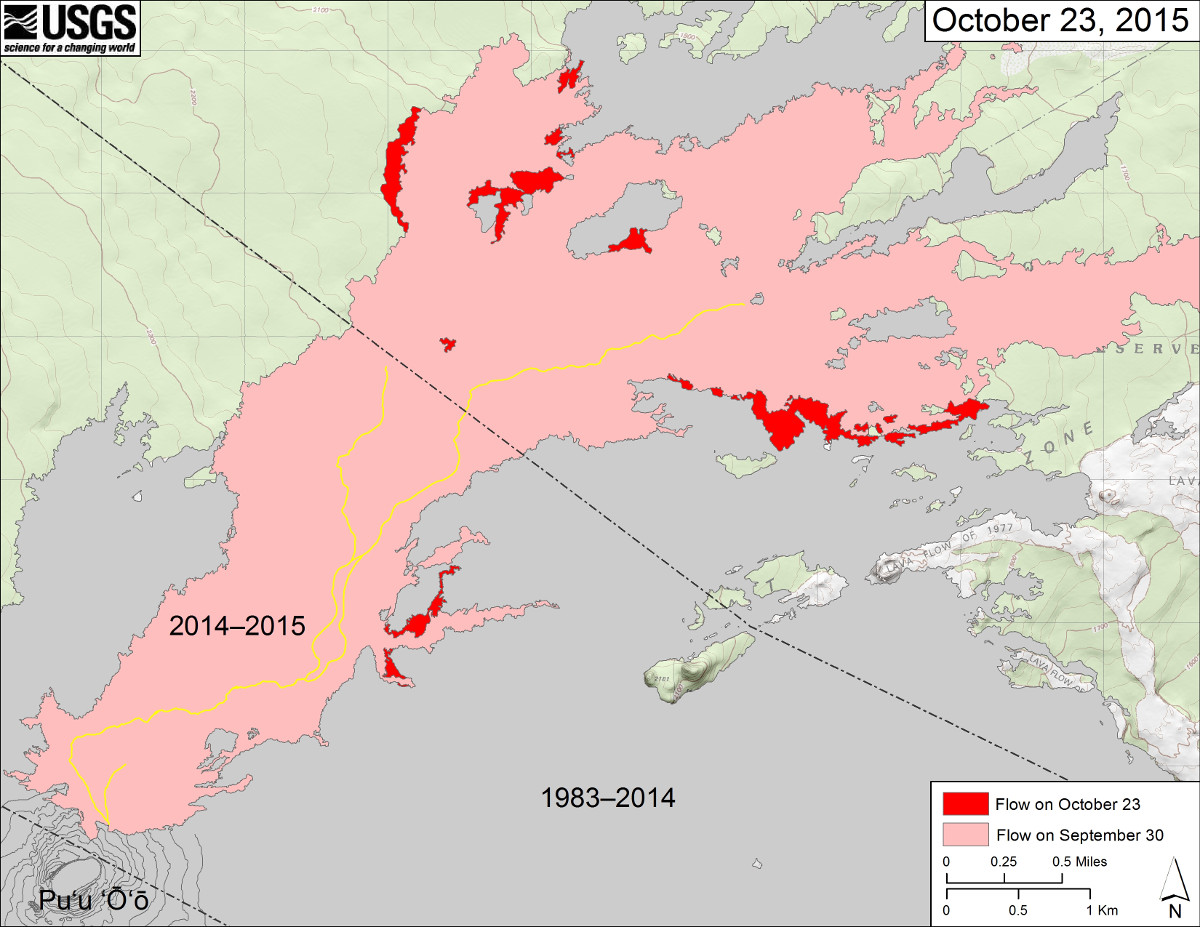
This USGS map shows recent changes to Kīlauea’s active East Rift Zone lava flow field. The area of the flow on September 30 is shown in pink, while widening and advancement of the flow as of October 23 (based on satellite imagery and ground mapping) is shown in red. The yellow lines show the active lava tube system. Puʻu ʻŌʻō lava flows erupted prior to June 27, 2014, are shown in gray.
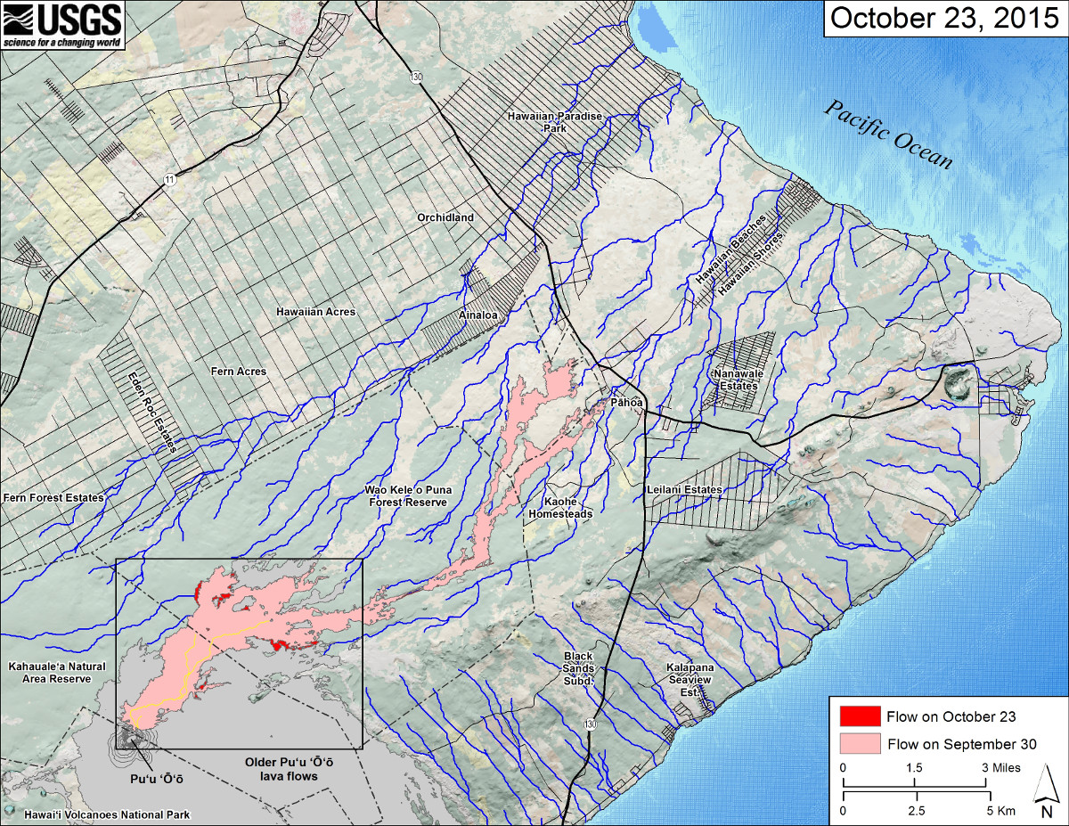
This small-scale USGS map shows Kīlauea’s active East Rift Zone lava flow in relation to the eastern part of the Island of Hawaiʻi. The area of the flow on September 30 is shown in pink, while widening and advancement of the flow as of October 23 is shown in red. The yellow lines show the active lava tube system. Puʻu ʻŌʻō lava flows erupted prior to June 27, 2014, are shown in gray. The black box shows the extent of the accompanying large scale map. The blue lines show steepest-descent paths calculated from a 1983 digital elevation model. Because the flow field is changing very little at the moment, mapping of the lava flow is being conducted relatively infrequently.
MAUNA LOA VOLCANO UPDATE
WEEKLY MAUNA LOA STATUS UPDATE
October 22, 2015On Thursday, September 17, the Volcano Alert Level and Aviation Color Code for Mauna Loa was elevated to Advisory/Yellow based on long-term trends in both earthquake and deformation monitoring data.
Activity Summary: Mauna Loa is not erupting. The seismicity rate is elevated above background, though at a lower weekly rate than reported in mid- to late-summer. Earthquakes occurred beneath Mauna Loa’s upper Southwest Rift Zone at depths less than 13 km (8 miles). Deformation data are still consistent with inflation of magma reservoirs beneath Mauna Loa’s summit and upper Southwest Rift Zone.

by Big Island Video News
on at
STORY SUMMARY
Today's Kilauea and Mauna Loa volcano activity report, includes recent maps and imagery.