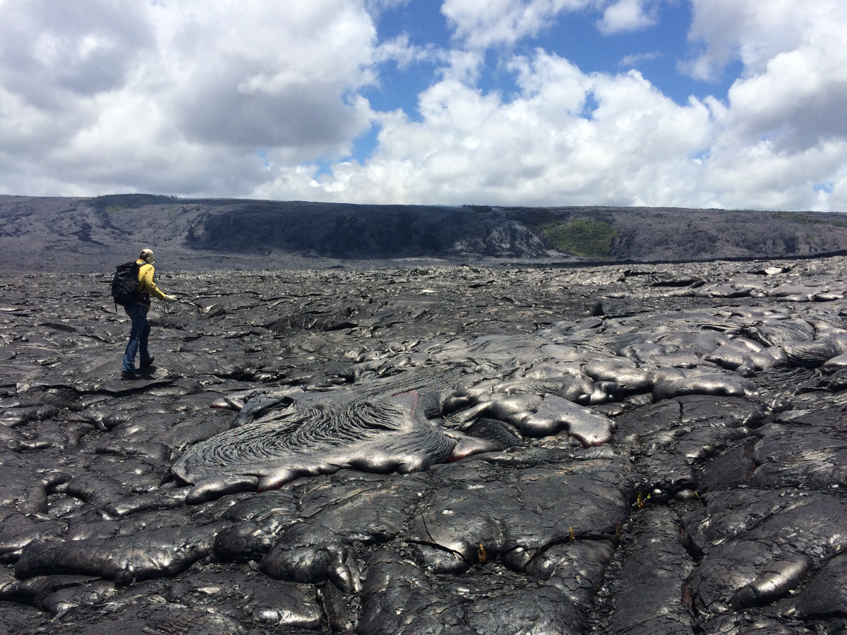
(USGS photo) An HVO geologist maps the flow margin using a handheld GPS unit.
KALAPANA, Hawaii – The 61g lava flow southeast of Puʻu ʻŌʻō is still active and continued to move across the coastal plain on Kīlauea’s south flank this weekend.
Scientists say although progress has been slow during the past two days, the flow is still advancing. “When mapped on Saturday afternoon,” wrote the USGS Hawaiian Volcano Observatory in a morning update, “the flow front had advanced 130 m (142 yards) since Friday’s measurements.”
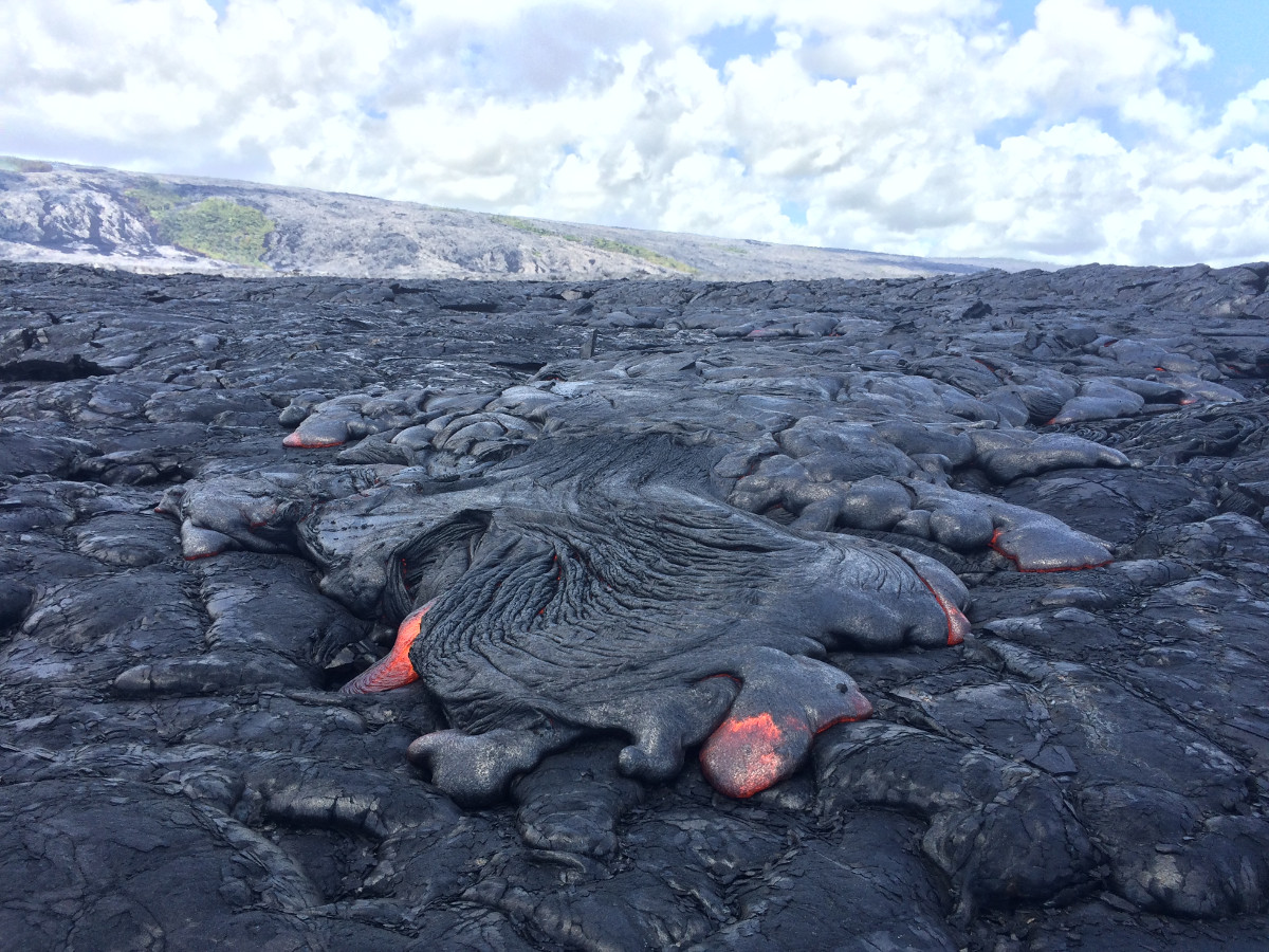
(USGS) One of the many breakouts upslope of the flow front.
The lava flow front is now 0.6 miles from the ocean.
In a video sent to us courtesy Epic Lava Tours via Facebook, John Tarson gave an overview from out on the flow field Sunday morning.
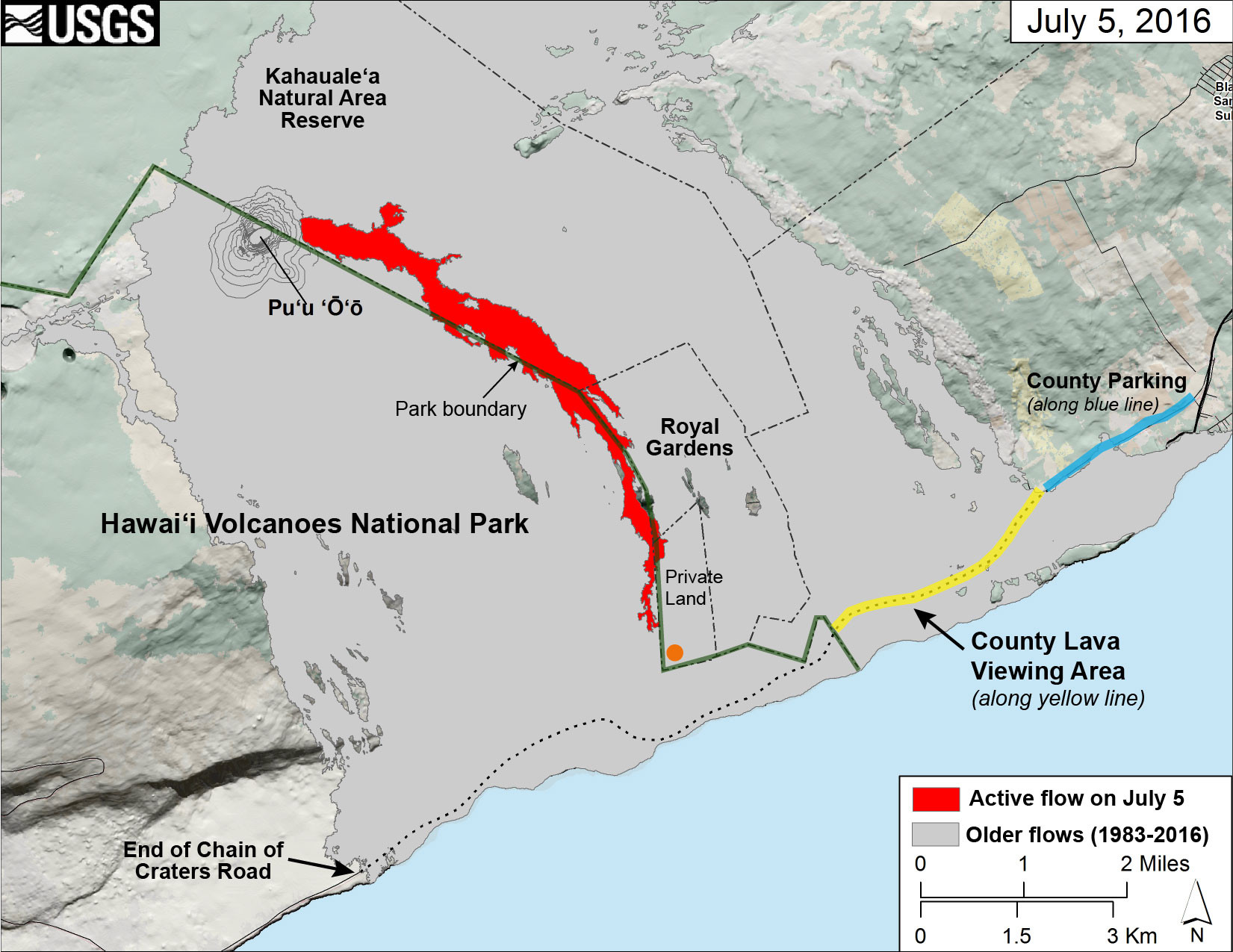
This map of Kīlauea Volcano’s lava flow shows the locations of Hawaiʻi County’s designated lava-viewing and parking areas, as well as the lava flow’s location relative to the Hawaiʻi Volcanoes National Park boundary (green line). The full extent of the active lava flow on July 5 is shown in red; an orange dot shows the location of the flow front as of mid-day on July 7. For recent maps and photos of the lava flow, please visit the USGS Hawaiian Volcano Observatory website. USGS graphic.

by Big Island Video News
on at
STORY SUMMARY
KALAPANA (BIVN) - Scientists say although progress has been slow during the past two days, the flow is still advancing. The USGS Hawaiian Volcano Observatory posted new photos.