Big Island Video News

Serving Hawaii County

  • Hawaiʻi Island News Regions
    • Hamakua
      • Mauna Kea
    • Hilo
    • Kau
    • Kona
    • Kohala
    • Puna

Inset of new USGS map

New Hawaii Lava Flow Maps Rendered
Avatar photo

by Big Island Video News
on Jul 11, 2017 at 7:38 am

Subscribe to Big Island Video News (FREE)

* indicates required

STORY SUMMARY

HAWAII VOLCANOES NATIONAL PARK - As the June 26 breakout continues to advance across the coastal plain, USGS scientists map the activity.

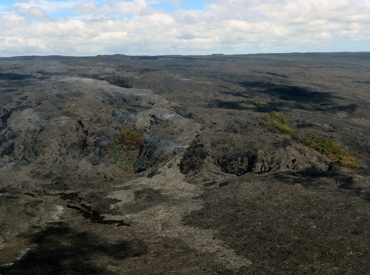
(BIVN) – Kīlauea Volcano continues to erupt at its summit and from the Puʻu ʻŌʻō vent on its East Rift Zone, sending lava to the sea miles downhill.

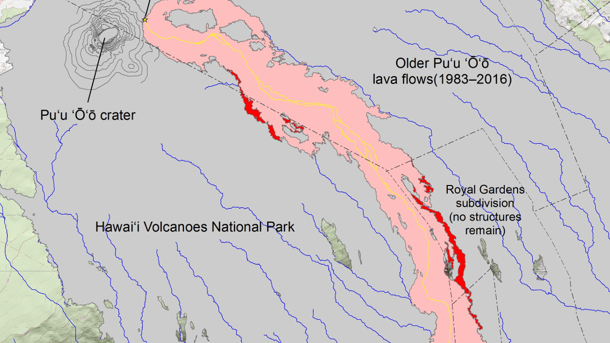
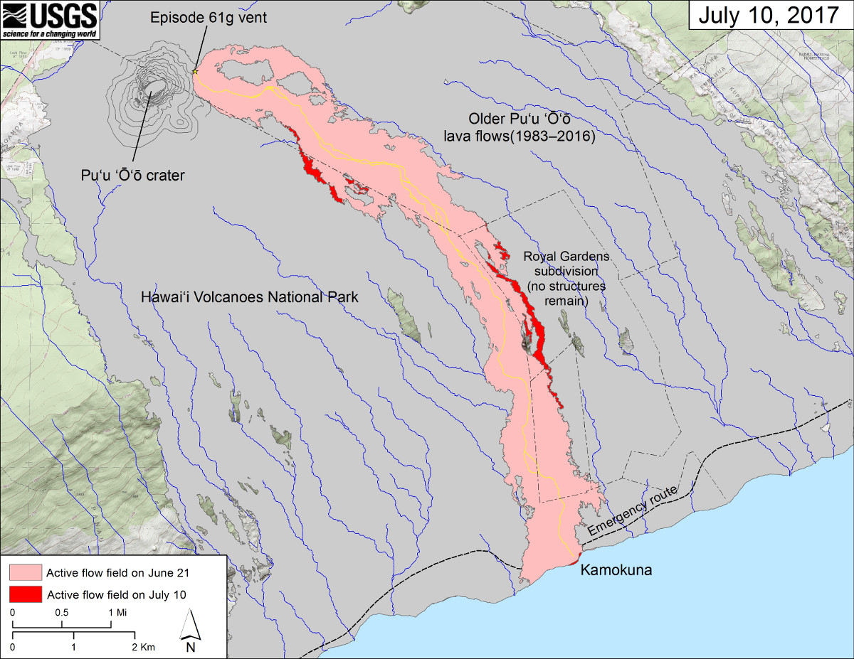
Geologists from the USGS Hawaiian Volcano Observatory reported that the June 26 breakout on the episode 61g flow remains active at the flow front. “The flow has been slowly advancing along the eastern margin of the main episode 61g flow field, and this afternoon was approximately 1 km (0.6 miles) from the base of the pali and 2.2 km (1.4 miles) from the emergency access road,” the scientists reported.

(USGS photo) The June 26 breakout has developed a lava tube on the pali based on the areas of concentrated degassing on the pali (center) and above.

This new map was published by the USGS and posted to the Hawaiian Volcano Observatory website on Monday.

(USGS map) This map shows recent changes to Kīlauea’s East Rift Zone lava flow field. The area of the active flow field as of June 21 is shown in pink, while widening and advancement of the active flow as of July 10 is shown in red. Older Pu‘u ‘Ō‘ō lava flows (1983–2016) are shown in gray. The yellow line is the trace of the active lava tube.

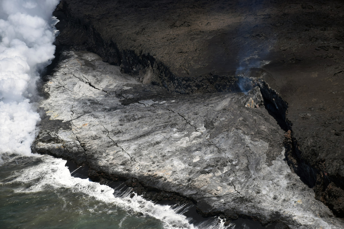
Ariel photos gathered at the the lava ocean entry show what appears to be growing instability of the lava delta.

(USGS photo) A zoomed in view of the Kamokuna lava delta reveals several crack systems parallel to the sea cliff which suggests instability of the delta. Over the past few weeks, flows on the delta have built up the surface near the base of the cliff creating a slope seaward.

These flows do not pose any threat to nearby communities at this time, scientists say.


Filed Under: Breaking Tagged With: 61g flow, Kamokuna ocean entry, Kilauea, lava, Volcano

LATEST NEWS

Woman Indicted After Officer Involved Shooting Incident In Kona

Critical Habitat Proposed For 12 Species Found Only On Hawaiʻi Island

Delays Reported In Kilauea Recovery Road, Waterline Projects

Hawaiʻi COVID-19 Update for Wednesday, March 29

Mass Dolphin Harassment In Hōnaunau Under Investigation

East Hawaiʻi Police Officer, Firefighter Of The Year Named

About Big Island Video News

  • Privacy Policy

Copyright © 2023 · Dynamik-Gen on Genesis Framework · WordPress · Log in