(BIVN) – Two new maps have been produced and published by the USGS Hawaiian Volcano Observatory. The maps show recent changes to Kīlauea’s East Rift Zone Episode 61g lava flow field, which stretches from the Puʻu ʻŌʻō vent to the Kamokuna ocean entry.
In the first map, the area of the active flow field as of September 21 is shown in pink, while widening and advancement of the active flow as of October 12 is shown in red. Older Pu‘u ‘Ō‘ō lava flows (1983–2016) are shown in gray. The yellow line is the trace of the active lava tube.
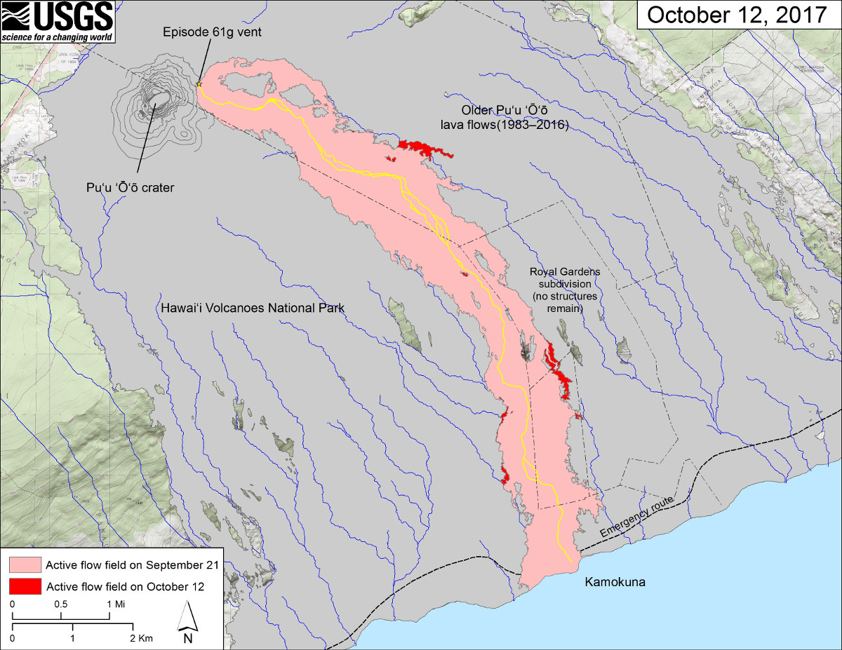
October 12, 2017 map of flow field (USGS)
The second map is similar to the map above, scientists say, but shows a thermal map over the Episode 61g lava flow. “Cooler colors (blue and green) show cooled, inactive portions of the flow surface. Hot colors (red and orange) show areas of active surface breakouts,” the USGS caption states. “Areas of the Episode 61g flow not covered by the thermal map – because of clouds, rain, or incomplete image coverage – are shown as dark gray.”
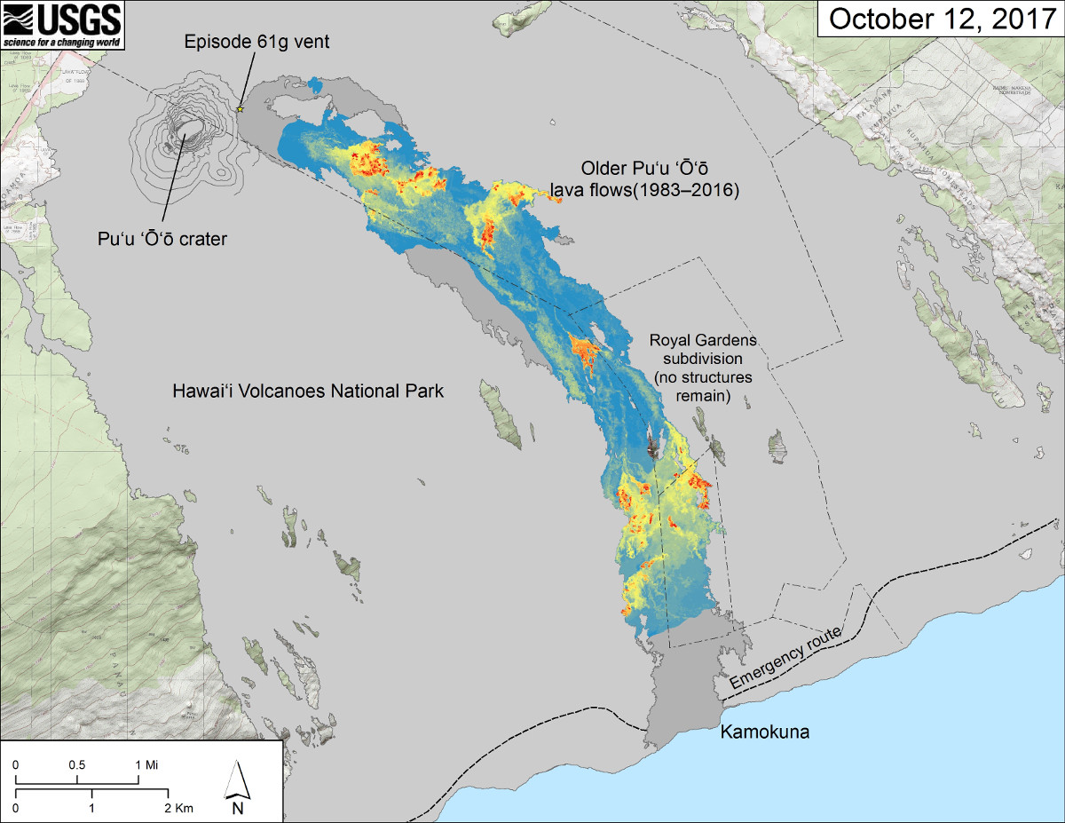
October 12, 2017 thermal; map of flow field (USGS)
The episode 61g lava flow is still entering the ocean at Kamokuna and producing scattered surface flow activity, scientists reported in Friday’s eruption update. According to USGS lava flow observations:
Lava from the episode 61g flow continues to enter the ocean at Kamokuna. Webcam views show continued surface flow activity on the upper portion of the flow field, southeast of Puʻu ʻŌʻō and on the coastal plain, as well as renewed surface flow activity on the pali. A plume was consistently present at the ocean entry yesterday, during daylight hours when it is detectable on webcam images, indicating continuing activity. Intermittent lava flows over the cliff and onto the lava delta (“lavafalls”) have been reported on the western side of the ocean entry. Recent activity has built up the height of the lava delta and covered over several large cracks, which previously had been visible on the surface. The episode 61g flows do not pose a threat to nearby communities at this time.
These lava flows pose no threat to nearby communities at this time.

by Big Island Video News
on at
STORY SUMMARY
HAWAII VOLCANOES NATIONAL PARK - USGS scientists just posted to new maps plotting the latest activity on the 61g lava flow from Pu'u O'o to the Kamokuna ocean entry.