UPDATE (1:45 p.m.) – A sunny Tuesday morning is giving way to another evening of severe weather. Already, at 1:17 p.m., a strong thunderstorm was located over Ninole, or 15 miles north of Hilo, moving east at 10 mph.
Winds in excess of 40 mph and dime size hail are possible with this storm, the National Weather Service said. Locations impacted include Ninole, Pepeekeo, Laupahoehoe, Honomu, Hakalau and Papaikou.
“Frequent cloud to ground lightning is occurring with this storm,” forecasters warned. “Lightning can strike 10 miles away from a thunderstorm. Seek a safe shelter inside a building or vehicle.”
Earlier today, the National Weather Service said thunderstorms developing this afternoon could produce strong, gusty winds and hail. This message was issued at 10 a.m.:
The atmosphere over the state is very unstable, and mostly sunny morning conditions will give way to scattered afternoon heavy showers and thunderstorms. Some of these thunderstorms will be capable of producing strong and gusty winds, frequent lightning, intense downpours, and hail.
When thunderstorms approach, you should move indoors. Stay away from windows and electrical appliances until the the storm is over. Be aware that lightning can strike several miles away from a thunderstorm. It does not have to be raining where you are to be struck by lightning.
Remain alert for changing weather conditions, and stay tuned to NOAA Weather Radio or local media sources for more information.
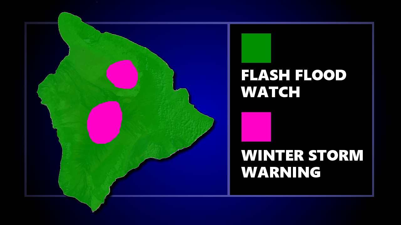
(BIVN) – The Flash Flood Watch continues for all Hawaiian Islands through Wednesday afternoon.
The National Weather Service reports a strong trough in the upper atmosphere will continue to bring a chance of very heavy rain and thunderstorms. Extreme rainfall rates with these storms will bring a high potential for flash flooding.
“Conditions are conducive for the development of terrain-anchored and slow-moving heavy showers and thunderstorms,” forecasters stated. “Rain will also affect urban areas and lower elevations, which are more susceptible to flooding problems.”
Also, a Winter Storm Warning for the summits of Mauna Kea and Mauna Loa. Heavy snow is occurring.
“Plan on difficult travel conditions,” the National Weather Service said. “Additional snow accumulations of 5 to 8 inches are expected.” The road to the summit of Mauna Kea is closed.
Overnight, a line of strong thunderstorms rolled over parts of Kohala and Kona, triggering a handful of Severe Thunderstorm Warnings. A Severe Thunderstorm Watch was in effect for the entire island until 3 a.m. this morning.