(BIVN) – On Thursday, Hawai‘i County distributed a new message for the residents of the earthquake-rattled Puna, as well as a new map to help them understand their risk in the event of an eruption.
“Hawai’i County Civil Defense is on high alert on a 24-hour basis for the possibility of a volcanic eruption in the lower Puna area,” a county media release stated. “All areas bordering the East Rift Zone are at high risk for eruption activities. Hawaiian Volcano Observatory has identified magma movement in the lower East Rift Zone. We urge all residents to keep themselves informed and on the alert.”
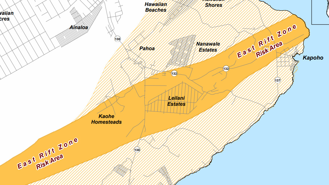
According to emergency officials, all areas from Pu`u O`o crater down to Kapoho along the East Rift Zone are at risk.
Here is the full map distributed by the county:
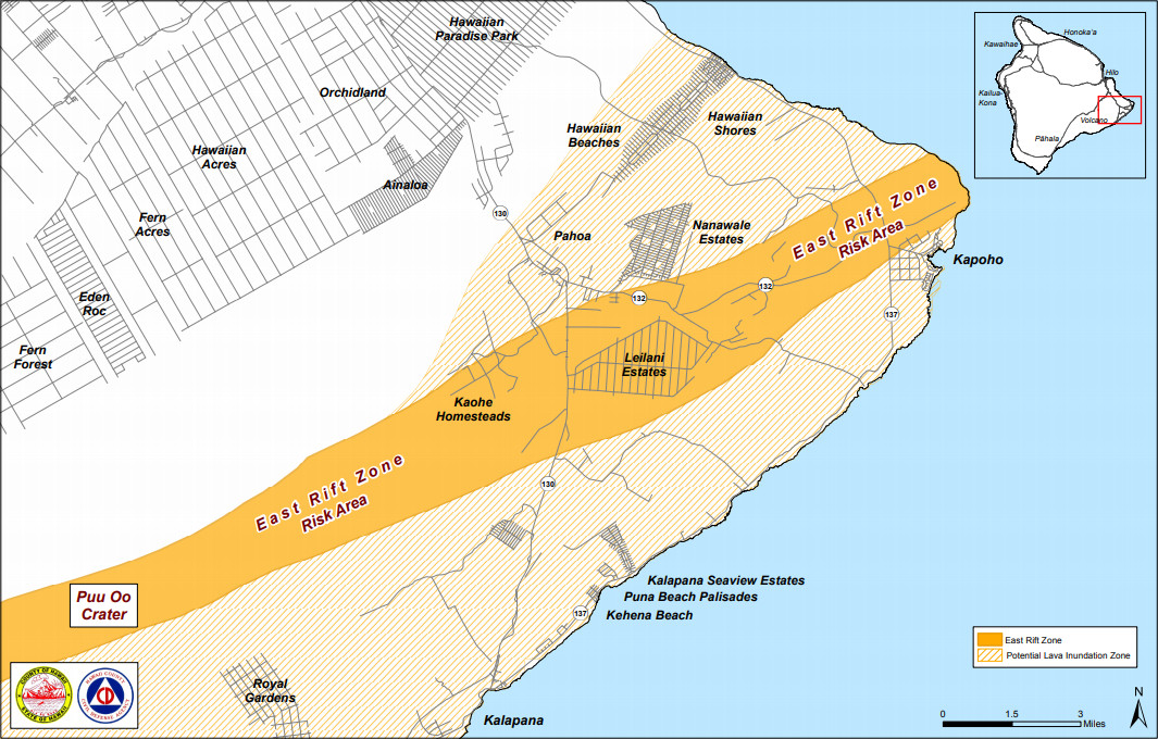
Eruption Risk Map
“Please be aware that volcanic activities can take place with little or no warning,” county officials wrote.
The county says residents should be on the alert for the following volcanic hazards:
- Lava inundation
- Fire
- Smoke
- Methane gas explosion
- Earthquakes
- Poor air quality
The county says residents of high-risk areas are urged to take the following actions:
- Do prepare your emergency plan. Plans should be discussed with your family now.
- Stay informed on the situation by listening to your radio.
- You are asked to report any unusual events to Civil Defense at 935-0031.
- If you need special assistance, please call 935-0031.
The county says evacuation shelters “will be open as needed, and you will be informed about shelter locations.”
Hawai`i County Civil Defense is working in close coordination with the USGS Hawaiian Volcano Observatory, officials say.
“The entire County emergency response team has been activated,” the county says. “You are asked to keep yourself informed, and be prepared for immediate evacuation if necessary.”

by Big Island Video News
on at
STORY SUMMARY
PUNA, Hawaii - Civil Defense has put out a new map of Puna, saying all areas bordering the East Rift Zone are at high risk for eruption activities.