(BIVN) – At 10:41 p.m. HST on Tuesday, June 26, a collapse explosion event occurred at Kīlauea’s summit. The USGS Hawaiian Volcano Observatory says an ash-poor plume less than 1,000 ft above the ground drifted southwest. The energy released by the event was equivalent to a Magnitude 5.4 earthquake, scientists say.
Before the collapse explosion, the summit of Kīlauea was a topic of discussion at the weekly public eruption meeting in Pahoa. USGS scientists Steve Brantley explained the dramatic changes.
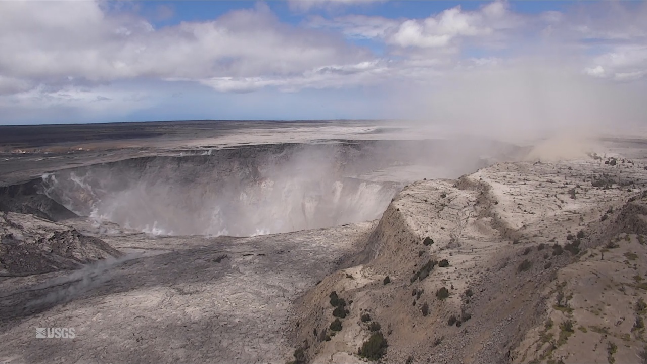
Earlier Tuesday, the USGS Hawaiian Volcano Observatory shared this information on a recent UAV mission to the summit area:
A UAS (Unoccupied Aircraft Systems) mission on June 24, 2018, filmed details of the dramatic changes occurring within Halema‘uma‘u crater at Kīlauea’s summit since explosive eruptions of ash and gas and ongoing wall collapse began in mid-May. Clearly visible are the steep crater walls that continue to slump inward and downward with ongoing subsidence at Kīlauea’s summit. The deepest part of Halema‘uma‘u is now over 400 m (1300 ft) below the caldera floor. There are two obvious flat surfaces within the crater that have slumped downward as nearly intact blocks – the shallower one is the former caldera floor and the deeper one is the former Halema‘uma‘u crater floor. Limited UAS flights into this hazardous area are conducted with permission and coordination with Hawai‘i Volcanoes National Park. The overflights collect visual information on what is happening at this rapidly changing eruption site. Scientists examine the footage in detail to understand how the expanding collapse area is evolving, the extent of tephra fall, and other surface changes. This information is used to assess hazards at Kīlauea’s summit , which are shared with the National Park Service and emergency managers. Video by the U.S. Geological Survey and Office of Aviation Services, Department of the Interior, with support from the Hawaiian Volcano Observatory and Hawai‘i Volcanoes National Park.
Watch the entire public meeting on the eruption held in Pahoa Tuesday night on demand on Nā Leo TV.