Big Island Video News

Serving Hawaii County

  • Hawaiʻi Island News Regions
    • Hamakua
      • Mauna Kea
    • Hilo
    • Kau
    • Kona
    • Kohala
    • Puna

inset of USGS thermal map

Multiple Overflows Of Fissure 8 Lava Channel
Avatar photo

by Big Island Video News
on Jul 9, 2018 at 9:41 pm

Subscribe to Big Island Video News (FREE)

* indicates required

STORY SUMMARY

PUNA, Hawaii - This afternoon multiple overflows occurred along the Fissure 8 lava channel. Most have stopped, USGS reports, but one flow lobe was still moving northeast towards Cinder Road.

(USGS) This thermal map shows the fissure system and lava flows as of 2 pm on Monday, July 9. The upper part of the Fissure 8 flow is not shown here as weather conditions did not allow data collection in that area – only the lower part of the flow is shown here. The fountain at Fissure 8 remains active. Numerous overflows today appear to have disrupted the supply of lava to the ocean. The open channel terminates just west of Four Corners, with several overflows on the north and south margins of the flow. The black and white area is the extent of the thermal map. Temperature in the thermal image is displayed as gray-scale values, with the brightest pixels indicating the hottest areas. The thermal map was constructed by stitching many overlapping oblique thermal images collected by a handheld thermal camera during a helicopter overflight of the flow field. The base is a copyrighted color satellite image (used with permission) provided by Digital Globe.

(BIVN) – The lower parts of the main lava channel generated by Fissure 8 in Leilani Estates has “undergone significant reorganization” today, resulting in numerous overflows.

The activity prompted this second status report from the USGS Hawaiian Volcano Observatory on Monday evening at 5:05 p.m. HST:

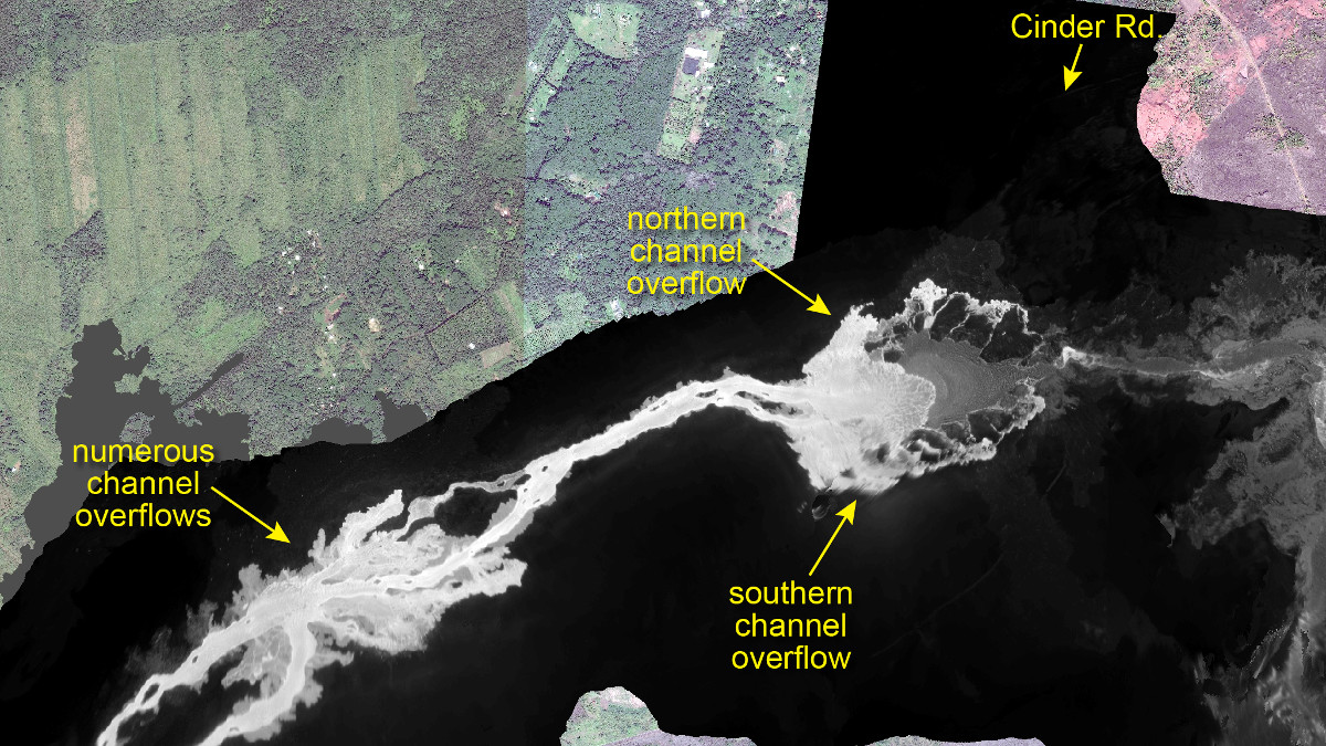
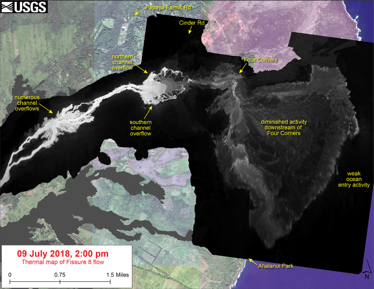
Early this afternoon observers reported multiple overflows occurring along both sides of the main lava channel, in an area extending from near the “Y” intersection at Pohoiki Road eastwards to an area just west of Kapoho Crater. Overflows on the upper part of the channel did not extend beyond areas previously covered in lava. Overflows further down the channel have reached beyond the flow field, including one flow lobe that is moving northeast from the main channel towards Cinder Rd.

USGS said residents are urged to heed warnings and notices from Hawaii County Civil Defense.

At 4 p.m. civil defense said there was “no immediate threat at this time,” but added that “residents in the Cinder Road area are advised to be prepared for voluntary evacuation if necessary.”

In its evening update, the USGS Hawaiian Volcano Observatory added:

Based on information from ground observers and morning and afternoon overflights, the lower part of the main lava channel has undergone significant reorganization. In particular, the channel that had been open near Four Corners is now mostly crusted over, and plumes from ocean entry are significantly reduced. It is likely this is due to a blockage that formed in the early morning in the main channel upstream of Kapoho Crater. Flow volumes coming out of Fissure 8 remain significant, and it is possible that changes in flow channels will continue to occur in the coming days.


Filed Under: Breaking Tagged With: Cinder Road, Kilauea, lava

LATEST NEWS

Largest DLNR Recruit Class In History Commissioned

Shark Bite At Anaehoʻomalu Bay Sends Man To Hospital

VOLCANO WATCH: GeoScientists Promoting Accessible Collaborative Experiences

Kona Man Charged In Kopiko Street Burglaries

Suspect In Ocean View Shooting Indicted By Hilo Grand Jury

VIDEO: Bill Removes Power To Suspend Electronic Media During Emergency

About Big Island Video News

  • Privacy Policy

Copyright © 2023 · Dynamik-Gen on Genesis Framework · WordPress · Log in