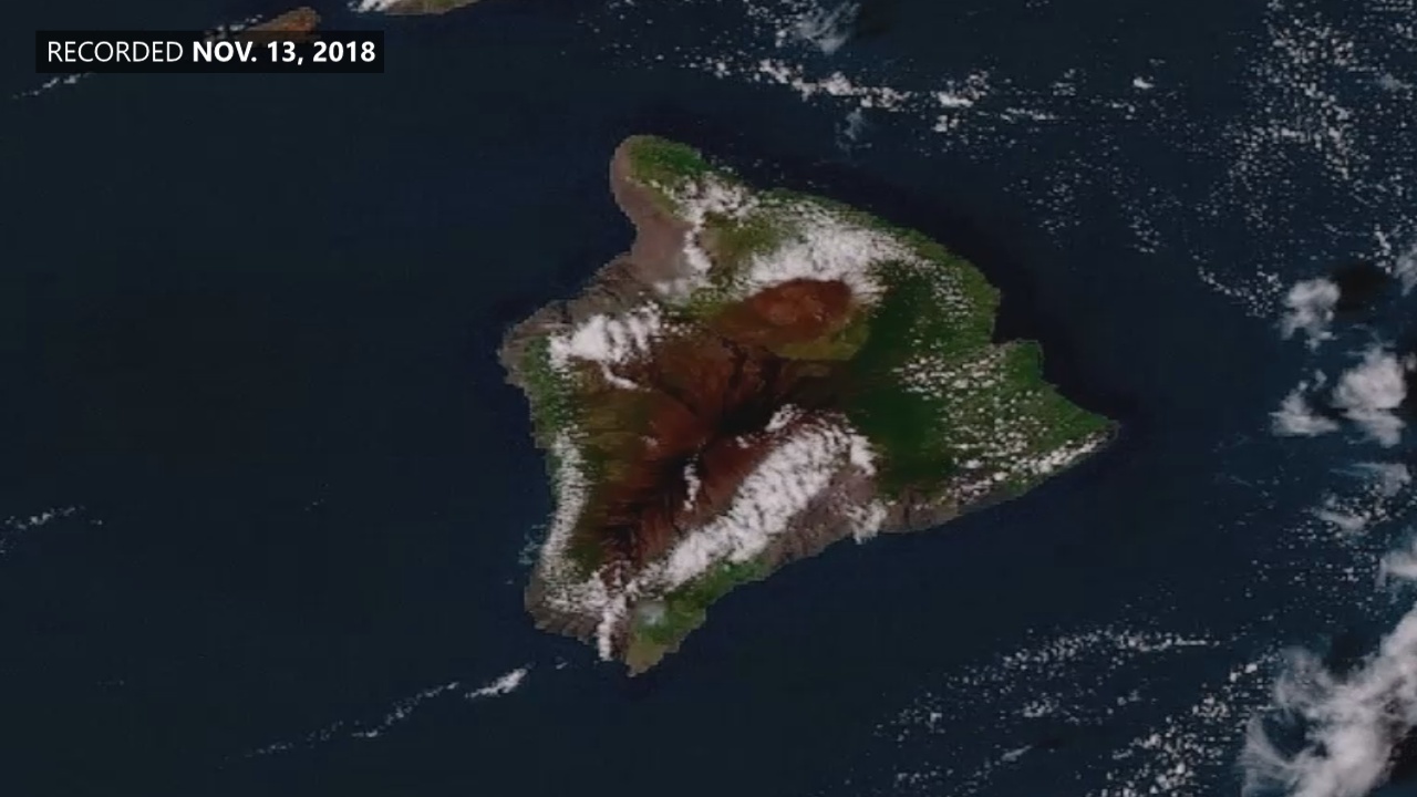
A NOAA GOES-17 view of high-level clouds moving over low clouds above the Hawaiian Islands on Nov. 13, 2018.
(BIVN) – NOAA’s GOES-17 satellite has reached “an exciting new milestone”, officials say. “On November 13, 2018, the satellite began transmitting its first high-definition images of Alaska, Hawaii, and the Pacific Ocean. The new imagery became available shortly after GOES-17 finished moving to its new orbital position at 137.2 degrees west longitude, where it will become NOAA’s operational GOES West satellite on December 10, 2018,” the National Oceanic and Atmospheric Administration reported.
The GOES-17 satellite was launched March 1, 2018 from NASA’s Kennedy Space Center, and follows GOES-16 as the second in a series of NOAA’s next-generation geostationary weather satellites.
Using its on-board Advanced Baseline Imager (ABI), GOES-17 will offer the same high-resolution visible and infrared imagery in GeoColor and 16 different channels, allowing NOAA to track and monitor cloud formation, atmospheric motion, convection, land surface temperatures, fire and smoke, volcanic ash, sea ice, and more.
“GOES-17 will significantly enhance our ability to forecast the weather in the western United States, especially in Alaska and Hawaii,” a NOAA media release stated. “With its expanded satellite coverage at high latitudes, GOES-17 will provide a significantly clearer view of the state of Alaska, where it will improve our ability to track environmental conditions, such as sea ice, volcanic ash, snow cover and wildfires. GOES-17 will also provide more and better data over the northeastern Pacific Ocean, where many weather systems that affect the continental U.S. begin.”
The satellite has already transmitted an impressive set of images back to Earth, capturing a GeoColor view of high-level clouds moving over low clouds above the Hawaiian Islands on Nov. 13, 2018. “Convective clouds can be seen forming on the windward side of the mountain slopes of the islands,” NOAA said.

by Big Island Video News
on at
STORY SUMMARY
HAWAI'I - The GOES-17 Advanced Baseline Imager (ABI) has sent its first images from the satellite's new vantage point over the Pacific Ocean, the National Oceanic and Atmospheric Administration says.