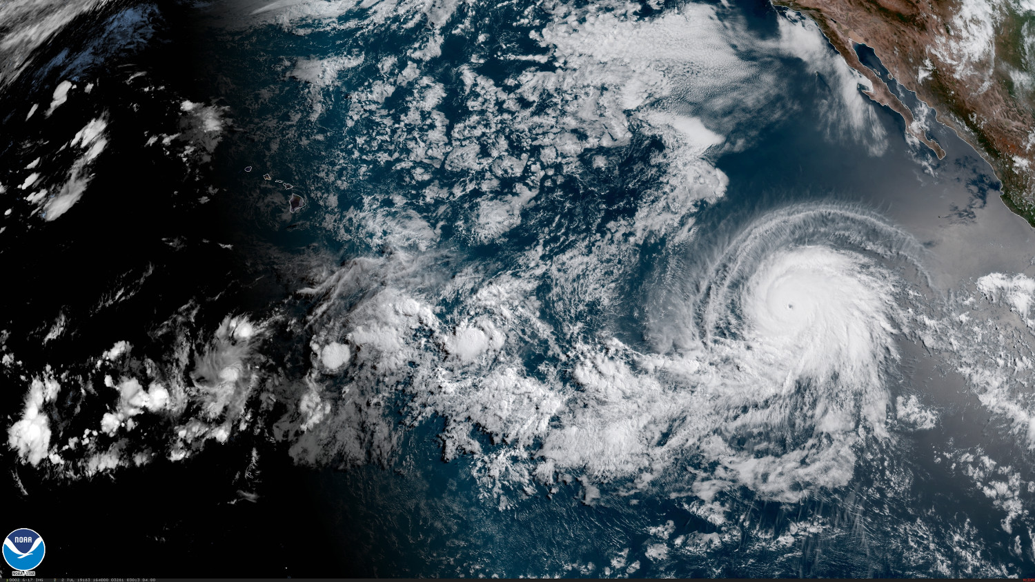
(BIVN) – The eye of powerful hurricane Barbara was 1,080 miles southwest of the southern tip of Baja California on Tuesday morning, moving toward the west-northwest near 14 mph.
The National Hurricane Center in Miami says satellite data indicate that Barbara’s maximum sustained winds have increased to near 130 mph with higher gusts, making it a category 4 hurricane on the Saffir-Simpson Hurricane Wind Scale.
Some additional strengthening is possible today, forecasters say, but weakening is likely to begin on Wednesday and continue into Thursday as the storm heads towards the Central Pacific.
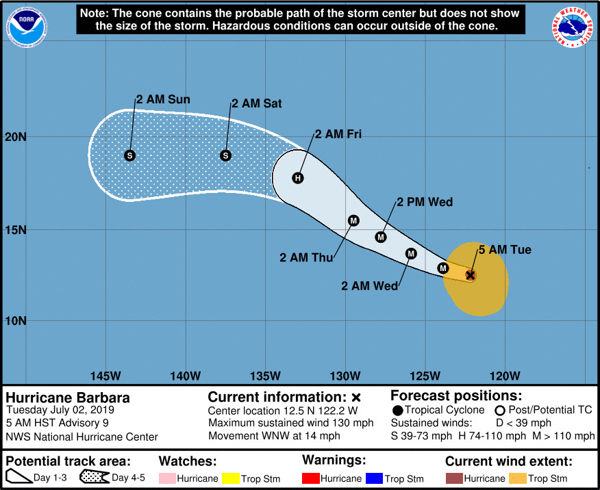
By the time Barbara reaches the Central Pacific, it is likely to be a tropical storm or even a remnant low, the NHC says.
Keeping an eye on Hawaiʻi surf, the National Weather Service in Honolulu says “forerunners from the swell produced by East Pacific Tropical Cyclone Barbara may arrive along east facing shores of the Big Island, and possibly Maui, starting Saturday morning,” although forecasters say it is too early to know the exact height of this swell at this time.
Here is the discussion posted by forecaster Avila at 5 a.m. HST:
Conventional satellite imagery and microwave data reveal that the structure of Barbara has improved significantly. The hurricane has developed an eye surrounded by a ring of very deep convection and both features have been present during the past several hours. This improvement in structure has been accompanied by a substantial intensification, and based on both objective and subjective numbers of 6.0 on the Dvorak scale, the initial intensity has been adjusted upward to 115 kt. This is a marked increase of 55 kt since yesterday at this time. A prevailing warm ocean and low shear could fuel additional intensification during the next 12 hours or so. However, the hurricane is forecast to encounter cooler waters and strong shear primarily beyond 3 days resulting in weakening which could be much faster by the end of the forecast period. By the time Barbara reaches the Central Pacific, it is likely to be a tropical storm or even a remnant low.
Barbara has been moving steadily toward the west and west-northwest or 290 degrees ar 12 kt. The hurricane is moving south of a deep-layer ridge of high pressure extending from the west coast of the United States westward across the Pacific. Barbara should move a little more to the northwest around the ridge in about 2 or 3 days, but as soon as the cyclone weakens and becomes shallow, it will likely move to the west steered by the low-level flow. The NHC track forecast is similar to the previous one, and it is basically on top of the multi-model consensus.
NOTE: Beginning this hurricane season, all National Hurricane Center eastern Pacific advisory products that utilize local time, and the corresponding graphical products, will use Hawaiian Standard Time (HST) instead of Pacific Daylight Time (PDT) or Standard Time (PST) if the final forecast point is west of 140W. Since Barbara’s day 5 official forecast point is now west of 140W, advisory products are now being issued in Hawaiian Standard Time.
FORECAST POSITIONS AND MAX WINDS
INIT 02/1500Z 12.5N 122.2W 115 KT 130 MPH
12H 03/0000Z 12.9N 123.9W 130 KT 150 MPH
24H 03/1200Z 13.7N 125.9W 125 KT 145 MPH
36H 04/0000Z 14.6N 127.8W 115 KT 130 MPH
48H 04/1200Z 15.5N 129.5W 100 KT 115 MPH
72H 05/1200Z 17.8N 133.0W 75 KT 85 MPH
96H 06/1200Z 19.0N 137.5W 50 KT 60 MPH
120H 07/1200Z 19.0N 143.5W 35 KT 40 MPH

by Big Island Video News
on at
STORY SUMMARY
PACIFIC OCEAN - Hurricane Barbara intensified rapidly Tuesday morning, and the storm could strengthen a little more as it heads towards the Central Pacific.