Big Island Video News

Serving Hawaii County

  • Hawaiʻi Island News Regions
    • Hamakua
      • Mauna Kea
    • Hilo
    • Kau
    • Kona
    • Kohala
    • Puna

USGS: "Portions of Crater Rim Drive, within Hawai‘i Volcanoes National Park, appear cracked, offset, and down-dropped in this photo, taken during an overflight of Kīlauea’s summit on September 23, 2020. To the north, Kīlauea’s summit water lake, within Halema‘uma‘u, is visible." (USGS photo by K. Mulliken.)

New Views Of Kilauea Volcano Summit Water Lake
Avatar photo

by Big Island Video News
on Sep 25, 2020 at 4:34 pm

Subscribe to Big Island Video News (FREE)

* indicates required

STORY SUMMARY

HAWAIʻI VOLCANOES NATIONAL PARK - New views of the Kīlauea's summit water lake were recently provided by scientists at the USGS Hawaiian Volcano Observatory.

USGS: “This view point is on the large downdropped block that subsided during the 2018 collapse events. From this spot, a view of the entire lake is possible, providing a new perspective on the growth of the lake. . The last visit to this spot was on December 18, 2019, when the lake had a surface area of 1.1 hectares (2.7 acres). The lake has risen approximately 25 m (82 feet) since that time, and now has a surface area of 3.3 hectares (8.2 acres). The yellow circle in the left photo shows the normal observation site used by HVO geologists on the west caldera rim. Steaming is more apparent in the September 23, 2020, image due to the humid and rainy conditions on that day.” (USGS photos by K. Mulliken and M. Patrick.)

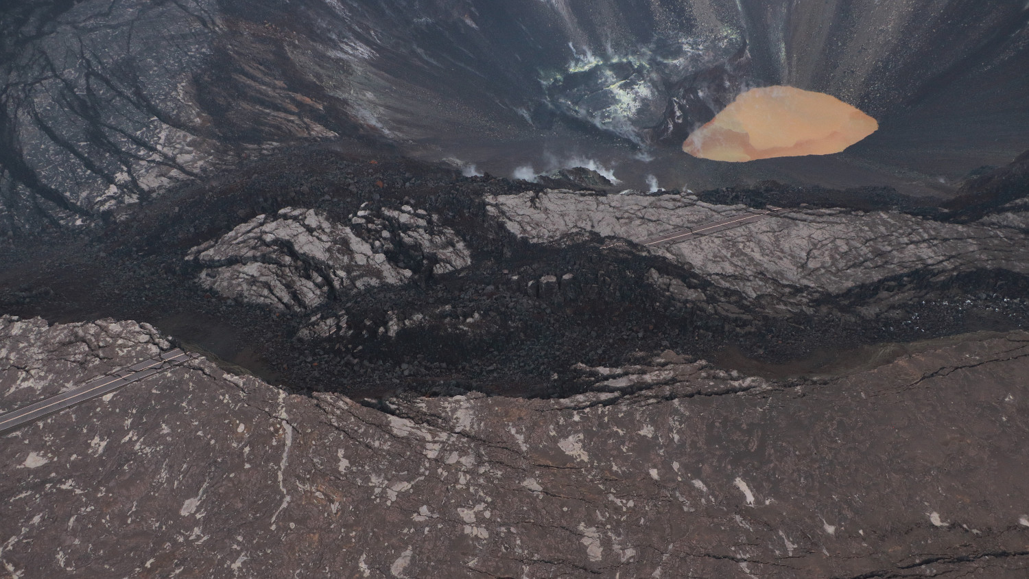
(BIVN) – Kīlauea volcano is not erupting, and scientists say that monitoring data for the past month “show variable but typical rates of seismicity and ground deformation, low rates of sulfur dioxide emissions, and only minor geologic changes since the end of eruptive activity in September 2018,” as has been the case for many months now. Meanwhile, the water lake at the bottom of Halema‘uma‘u at the summit of the volcano continues to slowly expand and deepen.

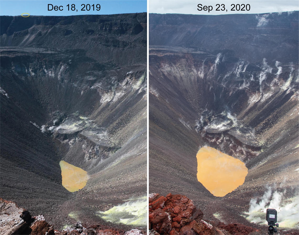
The USGS Hawaiian Volcano Observatory has published several new photos taken at the summit of Kīlauea volcano. Geologists made observations of Kīlauea’s summit water lake from the east rim of Halema‘uma‘u, for example, and posted a side-by-side comparison showing the dramatic changes that have taken place over the course of a year and a half.

Light-colored floating material was seen drifting in the Kīlauea summit water lake. (USGS photo by M. Patrick.)

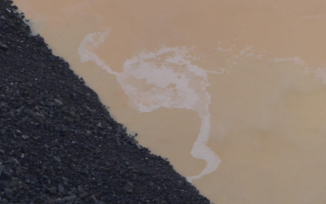
Scientists continue to note the lake is varied in color, with patches of greenish and brown water. The majority of the lake surface is a tan hue. “Small patches of light-colored floating material were seen drifting on the surface of Kīlauea’s summit water lake on September 23, 2020,” the USGS HVO wrote in one photo capton. “The composition of this material is unknown, but future water sampling missions may provide insight.”


Filed Under: Volcano Tagged With: Halemaumau, Kilauea

LATEST NEWS

VOLCANO WATCH: Lava Ooze-Outs At Kīlauea Examined By Scientists

Police Identify Pedestrian Killed In Kurtistown Crash

In Hawaiʻi, Drowning Leading Cause Of Death For Tourists, Children Under 15

New Webcam Captures Abrupt End Of Kīlauea Lava Fountaining

Bomb Squad Responds To Report Of Unexploded Grenade In Waimea

Kīlauea’s Episode 22 Lava Fountains Reach 1,000 Feet

About Big Island Video News

  • Privacy Policy

Copyright © 2025 · Dynamik-Gen on Genesis Framework · WordPress · Log in