Big Island Video News

Serving Hawaii County

  • Hawaiʻi Island News Regions
    • Hamakua
      • Mauna Kea
    • Hilo
    • Kau
    • Kona
    • Kohala
    • Puna

image from interactive map by USGS

Earthquake Under Maunakea Shakes North Hawaiʻi
Avatar photo

by Big Island Video News
on Nov 13, 2020 at 9:52 am

Subscribe to Big Island Video News (FREE)

* indicates required

STORY SUMMARY

WAIMEA, Hawaiʻi - Initially measured at a Magnitude 3.7, the earthquake was felt in districts of North and South Kohala and Hāmākua.

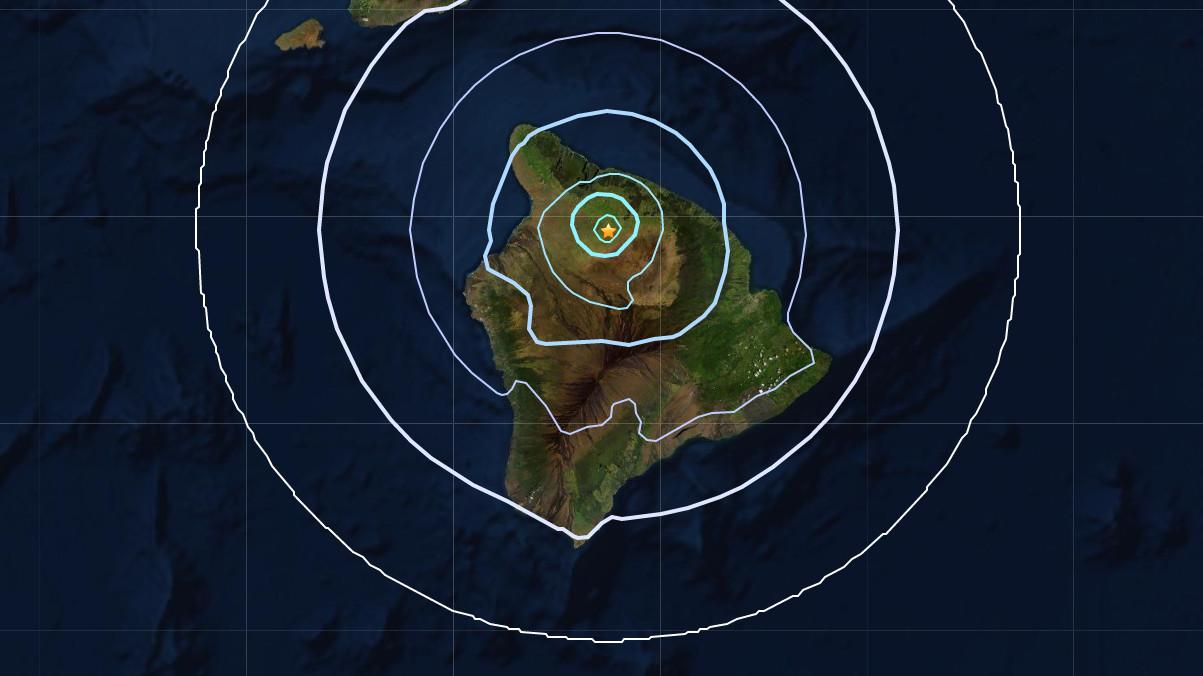
(BIVN) – An earthquake occurred on Hawaiʻi island just after 9:36 a.m. on Friday morning, almost 5 miles below the northwest slopes of Maunakea.

UPDATE – (1:30 p.m.) – Although the earthquake was initially measured at a Magnitude 3.7, the UGSG Hawaiian Volcano Observatory reviewed the data and revised the seismic event to a Magnitude 3.8.

The earthquake was located roughly ten miles southeast of Waimea, and was felt in the districts of North Kohala, South Kohala and Hāmākua. Some reported feeling the temblor as far south as Kona and Hilo.

This is a breaking news story, and it will be updated with new information.


Filed Under: Hawaii Tagged With: earthquake, Mauna Kea, Waimea

LATEST NEWS

Keāhole Ag Park Green Waste Fumigated For CRB

Puʻuhonua o Hōnaunau To Host “Chief Of War” Cultural Programs

Brother Noland To Kick Off Kahilu Theatre Season

Utility Work To Close Kona Highway, Aug. 28 and Sept. 4

Hāmākua-Area Water Restriction Downgraded

USGS Photos Show Aftermath Of Kīlauea Eruption Episode 31

About Big Island Video News

  • Privacy Policy

Copyright © 2025 · Dynamik-Gen on Genesis Framework · WordPress · Log in