The following is a transcript for the video article above.
Hours of new drone-video, recorded in 2018, but never before seen by the general public, has been released by the U.S. Geological Survey. The footage includes the heartbreaking final hours of Kapoho, the beloved seaside community along the Puna shore, on the day it was taken by lava.
The footage is part of an expansive release by the federal agency, which includes over 1,000 video files, recorded during the 4-month eruption of Kīlauea on the lower East Rift Zone, two and a half years ago.
This dataset contains material recorded by Unoccupied Aircraft Systems deployed to measure flow velocities and inform emergency responders. This is the second story in our series exploring the newly available archive. It begins on June 2nd, as the wide lava flow from the Fissure 8 vent in Leilani Estates was headed towards the ocean.
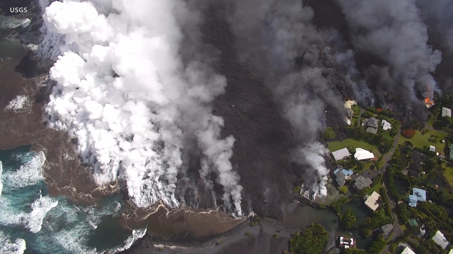
The flow crossed the Four Corners intersection of Highway 132 and Highway 137, and advanced into Kapoho Crater, where it quickly vaporized the famous Green Lake.
The lava crawled along, engulfing homes and farms along the way. All residents were evacuated from the Vacationland and Kapoho Beach Lots subdivisions. This is the civil defense message that was broadcast that evening.
(AUDIO)
The next day – June 3rd, 2018 – the last day for Kapoho. This drone footage is part of the new government archive release. Most of it was not available to the public at the time. During this June 3rd conference call, emergency officials provided an update on the situation.
(AUDIO)
The lava entered the bay at 10:30 p.m. that evening. Civil Defense gave this update on the morning of June 4th.
Over the next few days, most of the Vacationland and Kapoho Beach Lots would be covered by lava. Mayor Harry Kim was among the many who lost a home in the event. Mayor Kim’s words were a reminder of the beauty of the area, shaped by constant change.
A new lava delta was now building at Kapoho Bay. New land, extending out into the sea. Our examination of the new video archive will continue in the third part of our series, still to come.
The UAS data release by the USGS can be found here.