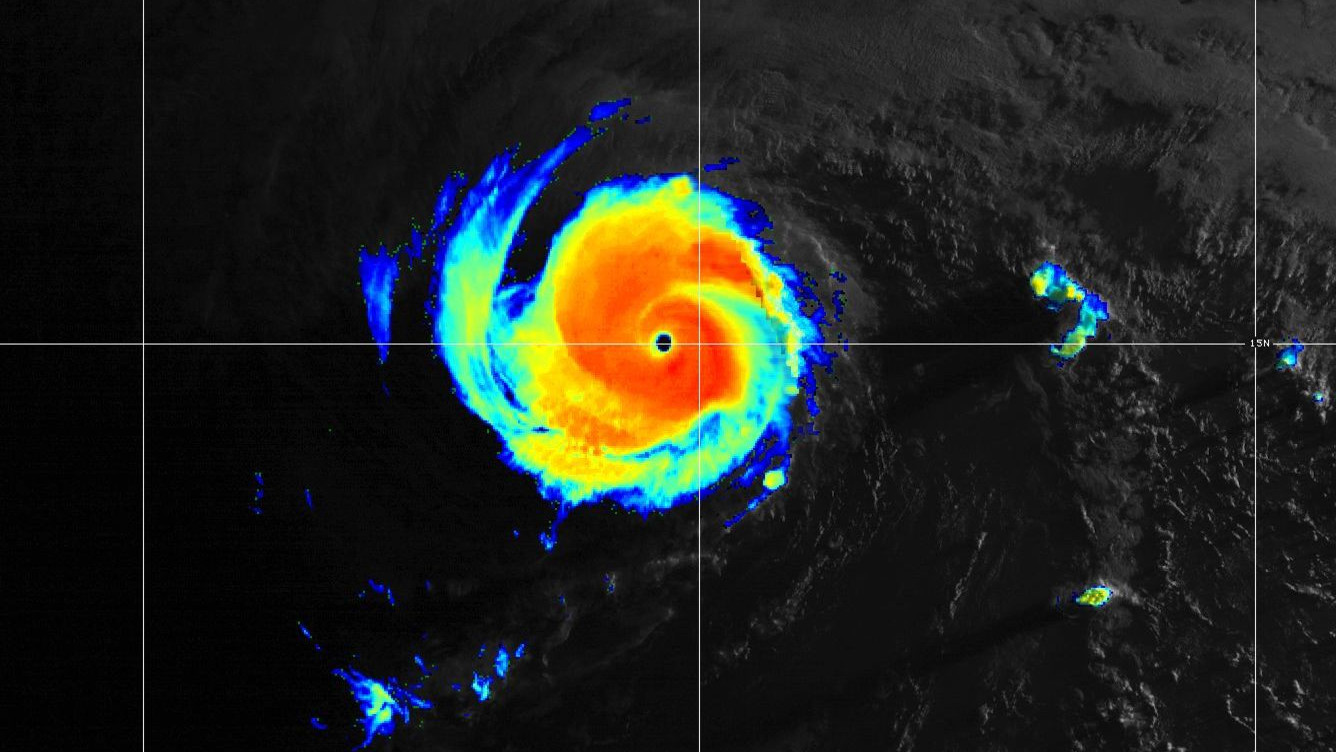
(BIVN) – Darby has weakened into a tropical storm, with sustained winds near 70 mph with higher gusts, 610 miles east-southeast of Hilo. Additional weakening is forecast during the next couple days.
“Darby is moving toward the west near 16 mph (26 km/h) and this motion is expected to continue during the next couple days with a slight increase in forward speed,” the Central Pacific Hurricane Center reported at 5 a.m. on Friday. “The forecast track will bring the center of Darby, or its remnant low, south of the Big Island on Saturday.”
Darby is still expected to weaken into a post-tropical remnant low late Saturday or Saturday night before dissipating on Sunday.
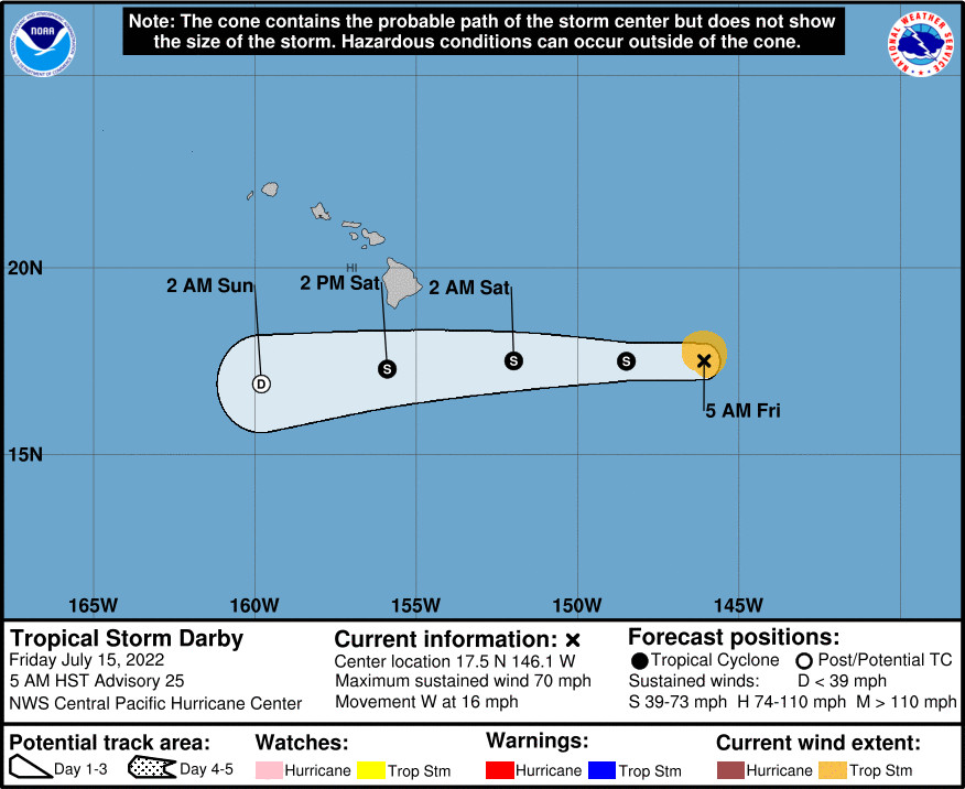
“Large swells generated by Darby are expected to affect portions of the Hawaiian Islands over the weekend,” forecasters said. While there are no coastal watches or warnings in effect for Hawaiʻi, a Tropical Storm Warning has been issued for Hawaiian offshore waters beyond 40 nautical miles out to 240 nautical miles.
From the National Weather Service in Honolulu at 3:48 a.m. HST:
Deeper tropical moisture will drift into the eastern islands of Maui and the Big Island later tonight. Precipitable Water (PW) levels will increase into the 1.5 to 2.5 inch range. Instability and tropical moisture associated with the passage of Darby will lift the trade wind inversion heights into the 10,000 to 14,000 foot range, allowing deeper convective clouds to form, enhancing shower activity across the region. This deeper moisture and unstable showers will drift westward across the state on Saturday; reaching Molokai, Lanai and Oahu by Saturday afternoon, and Kauai County by Saturday night. Expect localized heavy rainfall over windward sections of Maui and Hawaii Counties from Friday night through Saturday afternoon. Isolated thunderstorms were added to the forecast for the mountain and leeward Big Island zones from Saturday afternoon to evening. More stable conditions will spread from East to West across the state from Sunday to Monday with decreasing shower trends.
Strong winds on Saturday “may approach wind advisory levels for windier areas of each island and possibly trigger fire weather concerns,” for drier leeward areas, the forecasters said. “These weather conditions will diminish rapidly from East to West as deeper moisture associated with Darby increases humidity levels and shower activity across the island chain,” the National Weather Service added.

by Big Island Video News
on at
STORY SUMMARY
HAWAIʻI - Forecasters say we can still expect "localized heavy rainfall over windward sections of Maui and Hawaii Counties from Friday night through Saturday afternoon."