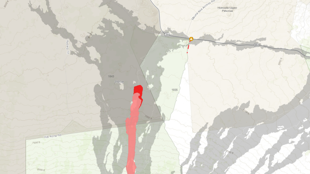
Map courtesy Hawaii County Civil Defense. New lava mapped on December 3rd in darker red.
UPDATED – (11:30 a.m. on Sunday, December 4)
- The USGS Hawaiian Volcano Observatory issued a new Volcanic Activity Notice for Mauna Loa, maintaining the WARNING alert level, but changing the Aviation Color Code from RED to ORANGE. Scientists say the threat to aviation of significant volcanic ash emission into the atmosphere has passed.
- Fissure 3 is still active on the Northeast Rift Zone. Lava flows continue to slowly move north toward Daniel K. Inouye Highway and are spreading out and inflating as they advance over the relatively flat ground. As of 7 a.m. Sunday, the flow front was about 2.3 miles (3.6 km) from the Saddle Road. Officials warn that the fronts of lava flows can break open unexpectedly, sending flows in several directions.
- Before noon on Sunday, the Hawaii Police Department temporarily closed the Mauna Loa eruption viewing area, which stretches along the Old Saddle Road between the 28.5 mile marker to the 34 mile marker, in order to conduct an investigation. The closure was expected to last three hours. (UPDATE) – The US Army Garrison says that an unexploded ordinance (UXO) was discovered off of the viewing area this morning. “It was found in the lava rocks and away from the road,” the Pōhakuloa Training Area said. “The county, in coordination with Army officials, will be detonating the UXO shortly.”
Mauna Loa Eruption, HI – USGS live stream
From the USGS Hawaiian Volcano Observatory on Sunday:
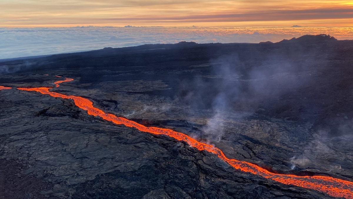
The eruption has now focused at a single vent, fissure 3, at an elevation of 11,500 ft (3510 m) along the Northeast Rift Zone of Mauna Loa. Lava fountaining at the vent has been approximately 100 feet (33 m) tall over the past day, depositing fragments of volcanic material in the area near the vent. Pele’s hair (small strands of volcanic glass) are being wafted great distances and have been reported as far as Laupāhoehoe, a community on the northeast coastline of the Island of Hawai’i about 23 miles (37 km) north of Hilo and 37 mi (59 km) northwest of fissure 3.
Sulfur dioxide (SO2) emission rates of approximately 180,000 tonnes per day (t/d) were measured on December 1, 2022 and remain elevated at this time. Volcanic gas is rising high and vertically into the atmosphere before being blown to the west at high altitude, generating vog (volcanic air pollution) in areas downwind. The International Volcanic Health Hazard Network has detailed information about vog. Forecasts for the dispersion of vog can be found on the Vog Forecasting Dashboard.
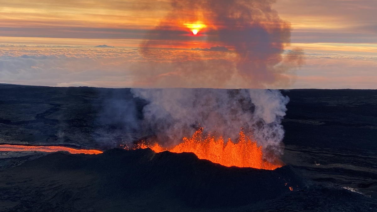
USGS: “Aerial view of fissure 3 erupting on the Northeast Rift Zone of Mauna Loa the morning of December 4, 2022.” (USGS image by L. DeSmither)
Fissure 3 is generating a lava flow traveling to the north toward the Daniel K. Inouye Highway (Saddle Road) that has reached flatter ground and slowed down significantly over the past several days, as expected. As of 7 a.m. today, December 4, the flow front was about 2.3 mi (3.6 km) from the Daniel K. Inouye Highway (Saddle Road). During the past 24 hours, the lava flow advanced at an average rate of about 40 feet per hour (12 meters per hour). Though the advance rate has slowed over the past several days, the lava flow remains active with a continuous supply from the fissure 3 vent.
Advance rates may be highly variable over the coming days and weeks. On the flat ground between Mauna Loa and Mauna Kea, lava flows advance more slowly, spread out, and inflate. Individual lobes may advance quickly, and then stall. Additional breakouts may occur if lava channels get blocked upslope. There are many variables at play and both the direction and timing of flow advances are expected to change over periods of hours to days, making it difficult to estimate when or if the flow will impact Daniel K. Inouye Highway.
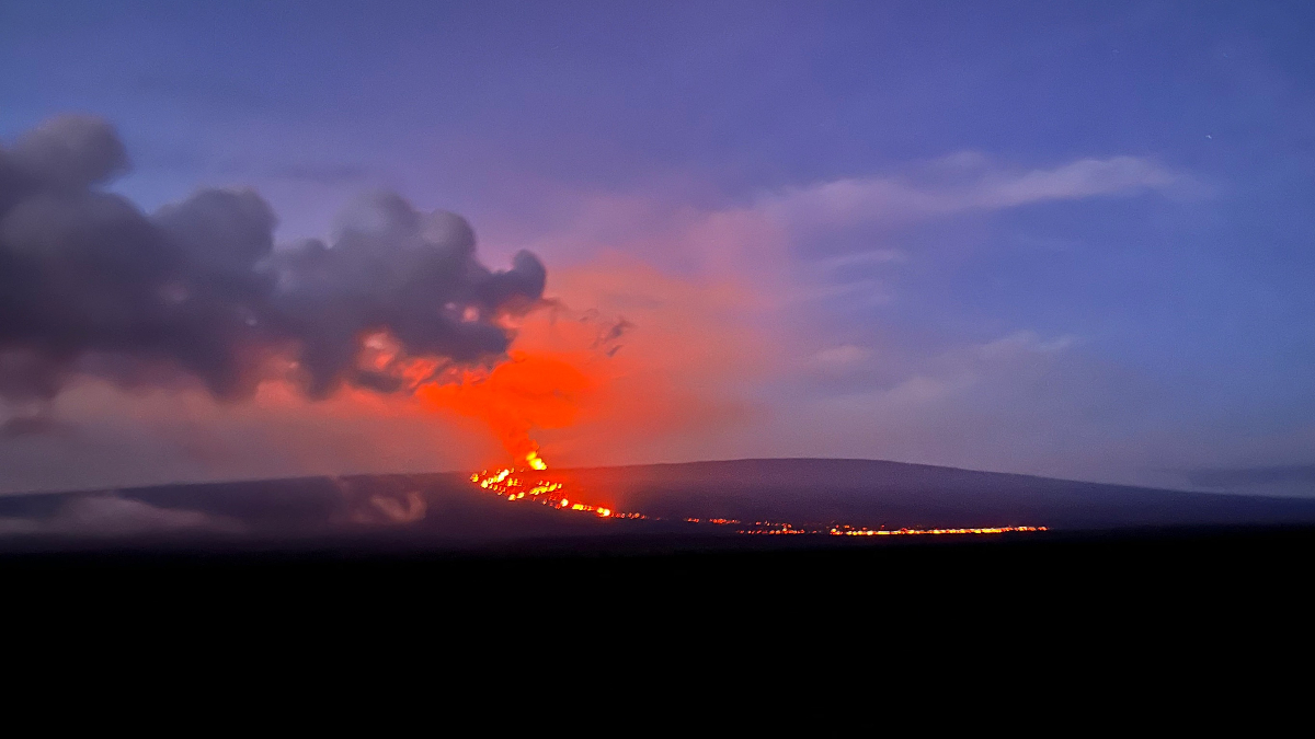
USGS: “The ongoing Northeast Rift Zone eruption of Mauna Loa, as viewed from the Daniel K. Inouye Highway (Saddle Road) shortly after 6 a.m. HST on December 4, 2022. The eruption continues, with a flow front that is slowly advancing towards the highway.” (USGS image by N. Deligne)
Tremor (a signal associated with subsurface fluid movement) continues beneath the currently active fissures. This indicates that magma is still being supplied to the fissure, and activity is likely to continue as long as we see this signal.
There is no active lava within Moku’āweoweo caldera nor the Southwest Rift Zone. We do not expect any eruptive activity outside the Northeast Rift Zone.

by Big Island Video News
on at
STORY SUMMARY
HAWAIʻI ISLAND - On Sunday, the Aviation Color Code for Mauna Loa was changed from RED to ORANGE. Lava is still over two miles from the Saddle Road.