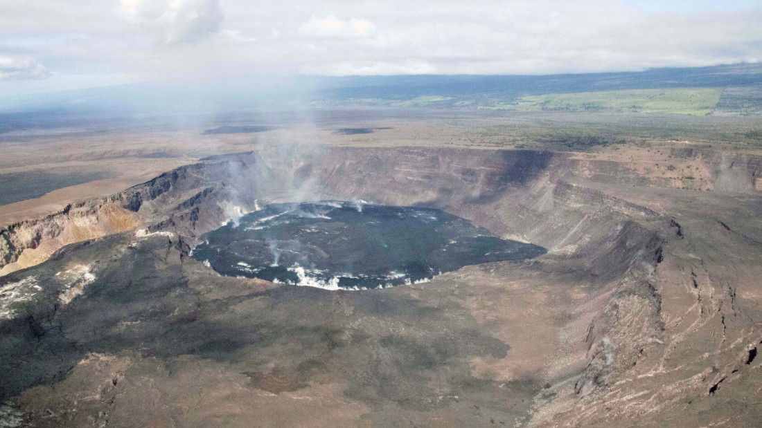
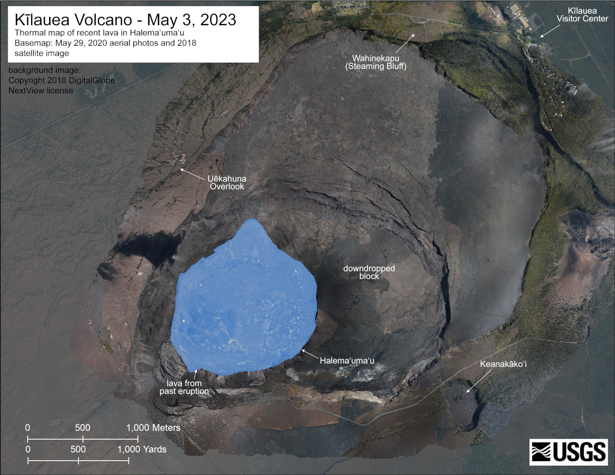
USGS: “A helicopter overflight on May 3, 2023, allowed for aerial visual and thermal imagery to be collected of Halema‘uma‘u crater at the summit of Kīlauea. No active lava was present in the crater, with only scattered warm spots on the crater floor. The scale of the thermal map ranges from blue to red, with blue colors indicative of cooler temperatures and red colors indicative of warmer temperatures.”
(BIVN) – Kīlauea volcano is not erupting. The US Geological Survey says no active lava has been observed since March 7, 2023, and the Current Volcano Alert Level for Kīlauea remains at ADVISORY.
In a Friday activity update, the Hawaiian Volcano Observatory reported that instruments in the summit region continue to track gradual inflationary tilt at this time, while summit seismicity remains slightly elevated.
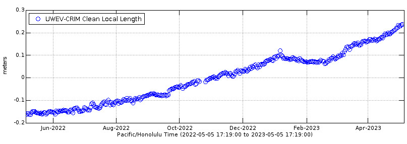
Deformation data for Kīlauea summit over the past year, showing the change in distance between two Global Positioning System (GPS) stations located on opposite sides of Kīlauea’s caldera. Note the continued inflation in the month of April 2023.
“No significant changes have been observed along either of the volcano’s rift zones over the past day,” scientists say.
On Wednesday, May 3rd, HVO geologists visited the northwestern wall of Halema‘uma‘u crater to sample older ash beds and lava flows exposed by the caldera collapse in 2018. Photos were posted to the HVO website.
From the USGS HVO’s Summit Observations posted on May 5th:
Instruments in the summit region have tracked gradual inflationary tilt over the past day, which continues at this time. Small flurries of earthquakes have occurred irregularly beneath Halemaʻumaʻu, Keanakākoʻi Crater, and the southern margin of Kaluapele (Kīlauea caldera) since April 16. Rates of summit earthquakes remain elevated, and continued earthquake flurries are possible. The most recent sulfur dioxide (SO2) emission rate of approximately 135 tonnes per day was measured on May 3.
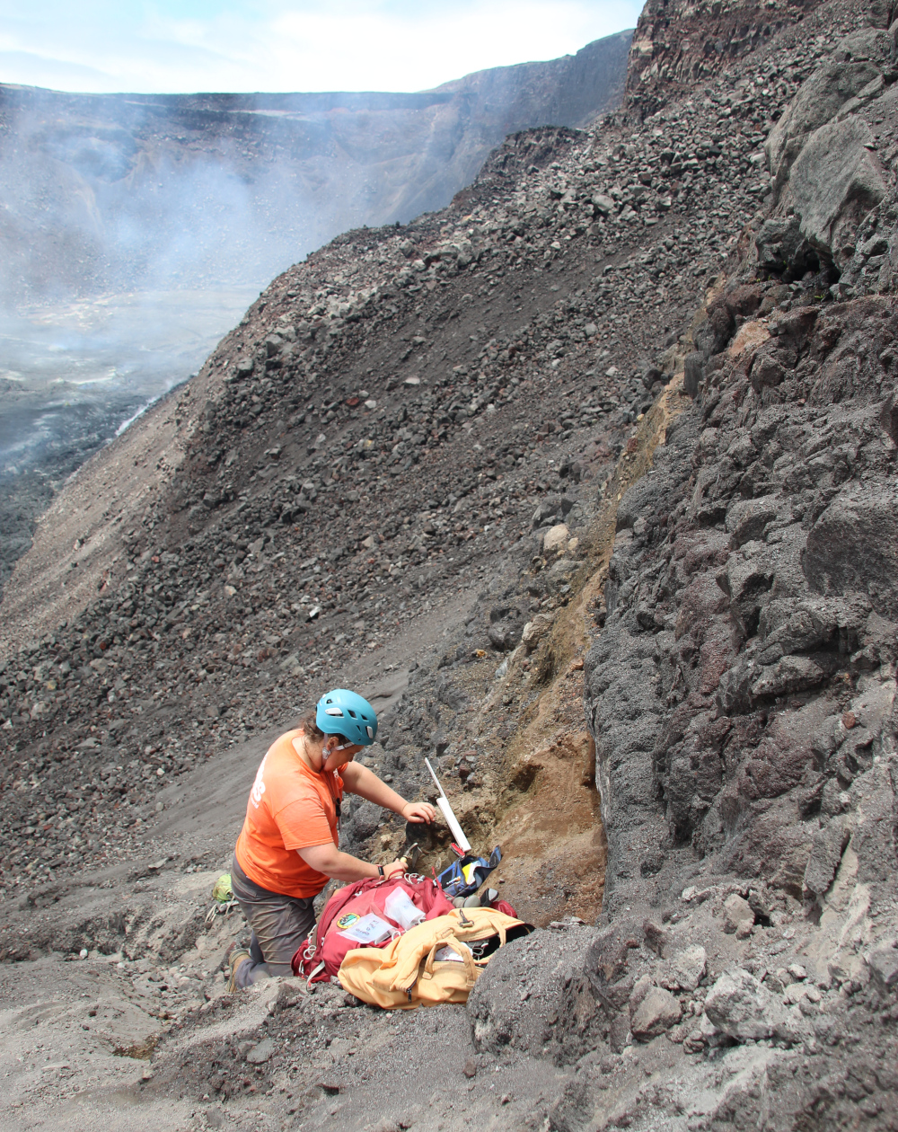
USGS: “… one of the geologists is collecting ash samples while standing on a large pile of rockfall debris that mantles the crater wall.” (USGS image by M. Zoeller)

by Big Island Video News
on at
STORY SUMMARY
HAWAIʻI VOLCANOES NATIONAL PARK - Scientists conducted Halema‘uma‘u fieldwork on May 3rd, and posted new maps and photos from the summit of Kīlauea volcano.