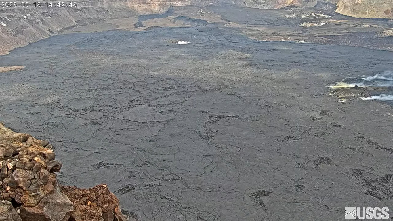
(BIVN) – Kīlauea volcano is not erupting, but scientists say signs of heightened unrest continue in the area just south of the summit.
In a Tuesday update from the USGS Hawaiian Volcano Observatory, scientists referred to the activity as “episodic” heightened unrest, and said that “an eruption in the region from Halemaʻumaʻu south to the December 1974 vents could emerge with little notice (1-2 hours) during peaks in this activity.”
The USGS Alert Level remains at ADVISORY / YELLOW, and certain areas within Hawaiʻi Volcanoes National Park remain closed due to the signs of activity.
From the USGS HVO:
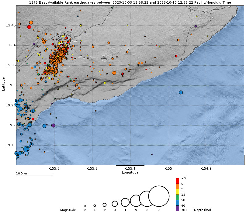
Summit Observations: Episodic heightened unrest continues in the south summit area of Kīlauea and an eruption in the region from Halemaʻumaʻu south to the December 1974 vents could emerge with little notice (1-2 hours) during peaks in this activity. Inflation at the summit of Kīlauea remains at about its highest level in over 5 years and has nearly returned to the level seen just before the last eruption on September 10th. The Uēkahuna summit tiltmeter located north of the caldera recorded very slight inflation over the past 24 hours. The Sand Hill tiltmeter located just south of the caldera went off scale during the peak activity on October 6th, but has been reset and is showing continued inflation but at a lower rate than before the event. GPS units within the south end of the caldera and further south also show continued uplift of this region. Elevated seismicity is being recorded beneath the south end of Kīlauea caldera and extends to the southwest along the trend of December 1974 vents. Seismicity increased on October 4, peaked at over 250 earthquakes per day on October 5 and 6, and continues dispersed over this area. Over the past 24 hours approximately 110 earthquakes were recorded in Kīlauea summit region compared to about 125 earthquakes occurring over the previous day. Most of the earthquakes from the seismic swarm south of the caldera are at depths of around 2.5–3.5 km (1.5–2 mi) below the surface. Sulfur dioxide (SO2) emission rates remain low and were measured at a rate of about 100 tonnes per day on October 6.
No unusual activity has been noted along Kīlauea’s East Rift Zone or Southwest Rift Zone, scientists say.