(BIVN) – Kīlauea volcano is not erupting, and scientists say the likelihood of an eminent eruption has decreased.
The alert level for Kīlauea has been lowered from WATCH to ADVISORY, and the Aviation Color Code from ORGANE to YELLOW.
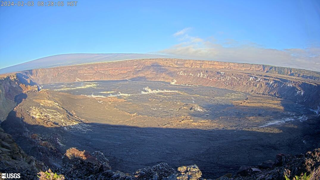
Scientists say the intrusion of magma into the area of the Koa‘e fault system appears to have slowed. Earthquake and ground deformation rates have decreased significantly over the past 24 hours.
The USGS Hawaiian Volcano Observatory on Saturday morning provided this information its Volcanic Activity Notice:
In total, more than 3,000 earthquakes were recorded over the past week during this event, which coincided with ground deformation patterns indicative of magma moving from beneath the summit to the southwest under the Koa‘e fault system. More information on this intrusive activity will be available in the Kīlauea daily update published later today.
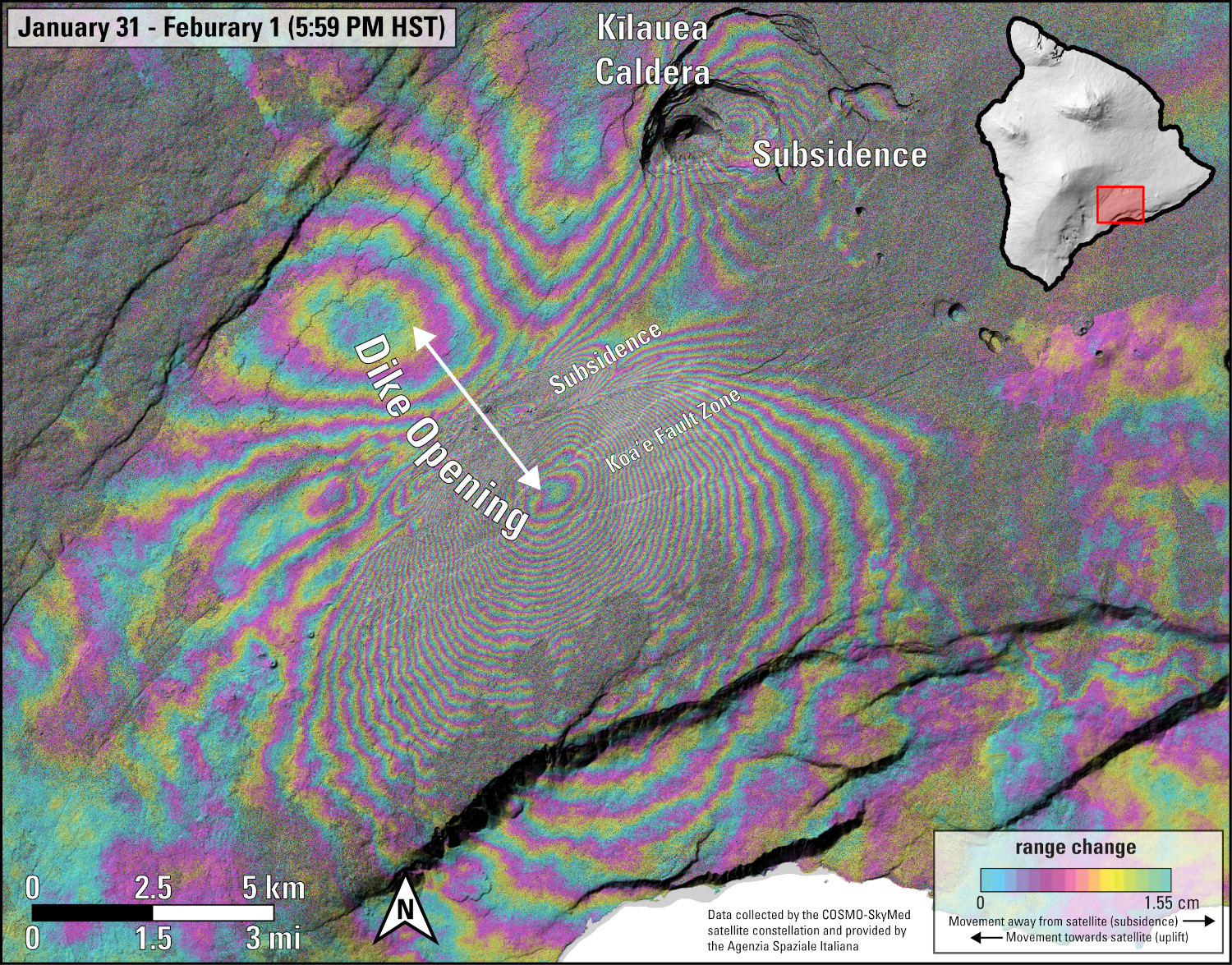
USGS: “This image shows ground deformation during the recent intrusive activity at Kīlauea volcano. Unlike previous shared interferograms, note that this one is isolated to a one-day timeframe from January 31-February 1, 2024. It therefore highlights the volcanic signals, with reduced interference from sources of data noise. Colored fringes denote areas of ground deformation, with more fringes indicating more deformation. Each color cycle represents 1.5 cm (0.6 in) of ground motion toward or away from the satellite (the direction of motion depends on the sense of color change). The complex patterns indicate overall deflation of the summit area as magma moved underground to the southwest, where the patterns show uplift and spreading (along with localized subsidence). Data are from the COSMO-SlyMed constellation of radar satellites, provided by the Italian Space Agency (Agenzia Spaziale Italiana) through the Hawaiʻi Supersite.”
The Observatory will continue to closely monitor Kīlauea for signs of renewed activity.

by Big Island Video News
on at
STORY SUMMARY
HAWAIʻI VOLCANOES NATIONAL PARK - After a few days of unrest, scientists say the likelihood of an eruption at Kīlauea has decreased.