(BIVN) – Kīlauea volcano is not erupting, and the USGS Alert Level remains at ADVISORY.
In its weekly activity update posted on Tuesday, March 26th, the USGS Hawaiian Volcano Observatory noted that low-level seismicity continues beneath the summit and Southwest Rift Zone. Rates of ground deformation remain low, scientists said.
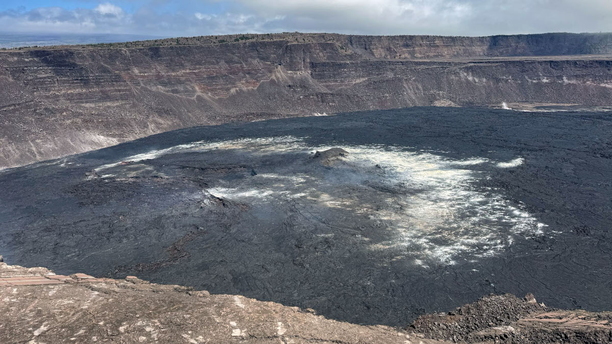
USGS: “This photo shows the eastern portion of Halema‘uma‘u, at the summit of Kīlauea. The circular area of yellow coloration, near the top of the photo, is spot where the first lava fountain emerged in the September 2023 eruption. In the lower portion of the photo, the remains of Crater Rim Drive and the Halema‘uma‘u parking lot are visible. These paved areas were destroyed during the 2018 subsidence and collapse of the caldera floor.” (USGS photo by M. Patrick)
From this week’s update:
Summit Observations: Low levels of seismicity continue beneath Kīlauea’s summit. During the past week, the rate of earthquakes here were slightly increased over last week, but daily earthquake counts remain well below those detected during the January–February intrusion or prior to recent summit eruptions. At this time, earthquake depths beneath the summit are primarily 0.3–1.6 miles (0.5–2.5 kilometers) below the surface, and magnitudes are typically below M2.0.
Ground deformation continues at low rates across Kīlauea, with tiltmeters near Uēkahuna and Sand Hill—respectively northwest and southwest of the summit caldera—showing only modest changes over the past week.
Sulfur dioxide (SO2) gas emissions have remained at low, noneruptive levels since October 2023. An SO2 emission rate of approximately 90 tonnes per day was recorded on March 19.
An Information Statement about the recent intrusion in late January and early February can be found here: (USGS Volcano Notice)
Rift Zone Observations: Low levels of seismicity continue beneath Kīlauea’s Southwest Rift Zone. During the past week, the rate of earthquakes here saw a very slight increase over previous weeks, but daily earthquake counts remain well below those detected during the January–February intrusion. No unusual activity has been noted along the East Rift Zone. We continue to closely monitor both rift zones.

by Big Island Video News
on at
STORY SUMMARY
HAWAIʻI VOLCANOES NATIONAL PARK - Scientists say low-level seismicity continues beneath the summit and Southwest Rift Zone. Rates of ground deformation remain low.