(BIVN) – The period of heightened unrest at Kīlauea ended over the weekend, but after a brief cessation, inflation in the caldera south of Halemaʻumaʻu and seismicity under the upper East Rift Zone continues.
The volcano is not erupting and the USGS Volcano Alert Level is at ADVISORY.
In this morning’s update, scientists with the USGS Hawaiian Volcano Observatory said the current activity “is similar to conditions at Kīlauea prior to last week’s period of heightened unrest.”
From the Monday update by the USGS HVO:
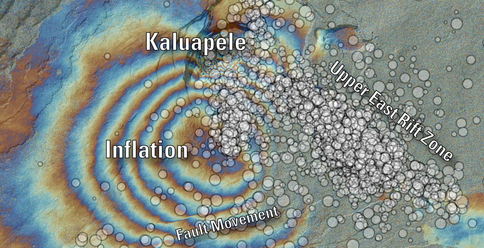
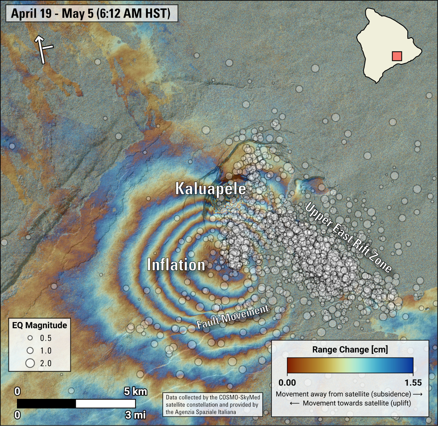
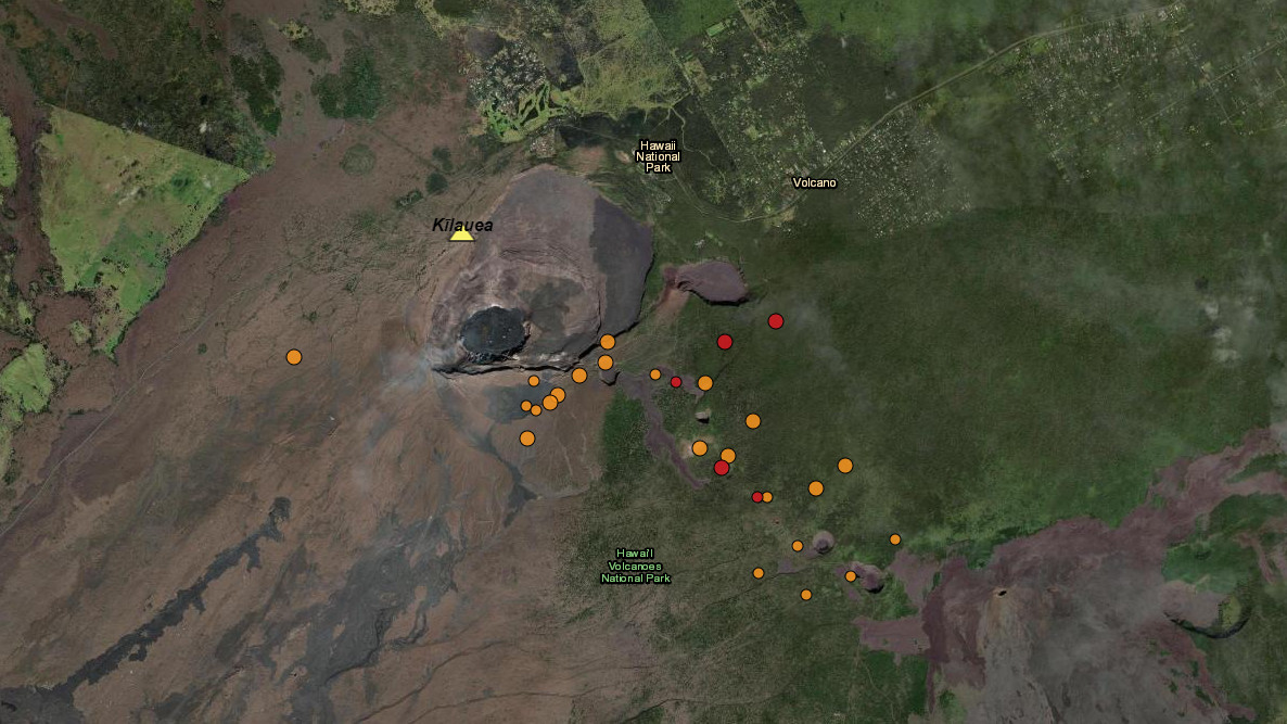
Summit and upper East Rift Zone Observations: Earthquake counts have decreased to approximately 70 earthquakes the past 24 hours compared to over 350 per day at the peak of the unrest. Earthquake locations remain focused primarily from the southeast side of Kaluapele (Kīlauea caldera) beneath Keanakākoʻi crater extending to the intersection with Hilina Pali Road. Seismicity has returned to the caldera south of Halemaʻumaʻu with approximately 10 earthquakes in that region in the past 24 hours. Earthquake depths have averaged 2-4 km (1.2-3.1 miles) beneath the surface, and magnitudes have not exceeded M2.5 in the past 24 hours, with the majority below M2.0.
Ground deformation continues beneath Halemaʻumaʻu and the south side of Kalaupele and Keanakākoʻi crater following a brief cessation related to a local deflation-inflation (DI) event beneath Halemaʻumaʻu. The Uēkahuna tiltmeter began recording inflation at approximately 4:30 AM yesterday, which has continued into this morning. The Sandhill tiltmeter is once again recording accelerated uplift at rates similar to those prior to and during last week’s seismic unrest.
Sulfur dioxide (SO2) gas emission rates remain low. An SO2 emission rate of approximately 62 tonnes per day was recorded on May 2nd.
Rift Zone Observations: All seismic activity on the East Rift Zone is confined to the upper East Rift Zone, with no significant earthquakes occurring past the Pauahi Crater. At this time, seismicity south of Kaluapele and in Kīlauea’s Southwest Rift Zone remains relatively low. Measurements from continuous gas monitoring stations downwind of Puʻuʻōʻō in the middle East Rift Zone—the site of 1983–2018 eruptive activity—continue to be below detection limits for SO2, indicating that SO2 emissions from Puʻuʻōʻō are negligible.
Analysis: The decrease in both seismicity and ground deformation indicates that the pulse of unrest that began on April 27 concluded by noon on May 3. Resumption of heightened seismic unrest could occur at any time, most likely in the upper East Rift Zone, within Kaluapele, or south of Kaluapele.
Areas within Hawaiʻi Volcanoes National Park that were closed due to last week’s period of heightened unrest have since been reopened. HVO says it continues to closely monitor Kīlauea for signs of increasing activity. “Should volcanic activity change significantly, a Volcanic Activity Notice will be issued,” scientists say.