(BIVN) – Kīlauea volcano is not erupting, and after several days with seismicity at background levels, scientists report heightened unrest has returned to the summit area.
The USGS Volcano Alert Level for Kīlauea remains at ADVISORY. The Hawaiian Volcano Observatory said on Sunday – as it has often repeated during these waxing and wanings pulses of activity – that “it is not possible to say whether this increase in activity will lead to an intrusion or an eruption in the near future, or simply continue as seismic unrest at depth.”
There are no signs of imminent eruption at this time, the USGS HVO says, although “changes in the character and location of unrest can occur quickly, as can the potential for eruption.”
From the USGS HVO update on Sunday morning:
Summit Observations and Upper East Rift Zone Observations: Over the past day, rates of seismicity in the summit, south caldera, and upper East Rift Zone regions were at background levels until approximately 7:30 A.M. HST. Less than 30 earthquakes were detected, at depths averaged 1–3 km (0.6–1.9 miles) beneath the surface, and with magnitudes below M2.0. At approximately 7:30 A.M., rates of seismicity increased beneath the summit with the onset of low frequency energy pulses. Ground deformation continues beneath Halemaʻumaʻu and the south caldera region. The Uēkahuna tiltmeter northwest of the summit recorded minor deflation over the past day. The Sand Hill tiltmeter southwest of the summit recorded minor deflation as well. Sulfur dioxide (SO2) gas emission rates remain low. An SO2 emission rate of approximately 61 tonnes per day was recorded on May 21.
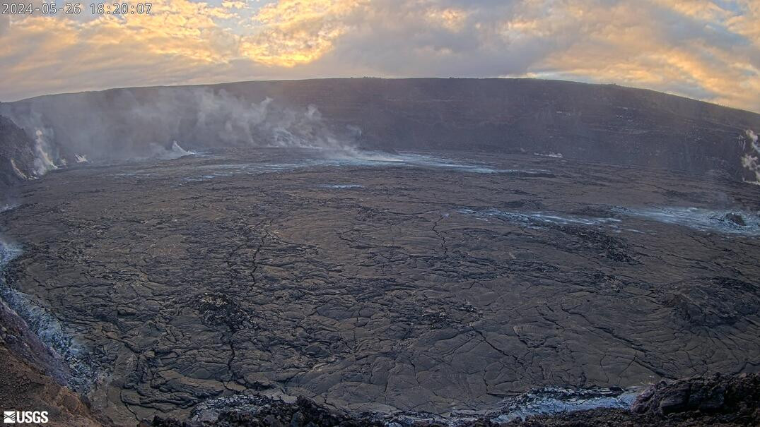
(1) USGS webcam view of Halemaʻumaʻu crater from the northwest rim of the caldera on Sunday afternoon.
Rift Zone Observations: Rates of seismicity beneath the upper and middle East Rift Zone regions decreased over the past week and are currently at background levels. Seismicity in the Southwest Rift Zone is low. Measurements from continuous gas monitoring stations downwind of Puʻuʻōʻō in the middle East Rift Zone remain below detection limits for SO2, indicating that SO2 emissions from Puʻuʻōʻō are negligible.
Analysis: Magma has been pressurizing the system beneath Halemaʻumaʻu and the south caldera region, activating seismicity in the upper East Rift Zone, and in the caldera south of Halemaʻumaʻu. At this time, it is not possible to say whether this increase in activity will lead to an intrusion or an eruption in the near future, or simply continue as seismic unrest at depth. Changes in the character and location of unrest can occur quickly, as can the potential for eruption.

by Big Island Video News
on at
STORY SUMMARY
HAWAIʻI VOLCANOES NATIONAL PARK - Scientists observed an increase in seismic activity beneath the Kīlauea summit on Sunday morning, with the onset of "low frequency energy pulses".