(BIVN) – The recent eruption of Kīlauea volcano on the upper Southwest Rift Zone remains paused, and scientists continue to say that it is unlikely to restart.
The USGS Volcano Alert Level remains at ADVISORY. “Tremor, degassing, and incandescence associated with the fissure vents are still present but have decreased significantly” since the eruption began on June 3rd, scientists say.
Overall seismicity in the summit region, including the eruption area, remains low.
Hawaiʻi Volcanoes National Park says the Kaʻū Desert area is closed due to volcanic gas hazards including Hilina Pali Road, Kulanaokuaiki Campground, Pepeiao Cabin and Maunaiki Trail. Kaʻaha is open and accessible by Puna Coast Trail.
From the USGS Hawaiian Volcano Observatory at 10:34 a.m. HST:
Activity Summary: Kīlauea volcano is not erupting. The eruption that began on Monday, June 3, southwest of Kaluapele (Kīlauea caldera) within Hawai’i Volcanoes National Park remains paused. Tremor, degassing, and incandescence associated with the fissure vents are still present but have decreased significantly since June 3, making it unlikely that this eruption will restart. Volcanic gas emissions at the eruption site remain above background levels. Overall seismicity in the summit region including the eruption area remains low. Inflationary ground deformation of the summit continues. Although the eruption has paused, additional pulses of seismicity and deformation could result in new eruptive episodes within the area or elsewhere on the Southwest Rift Zone.
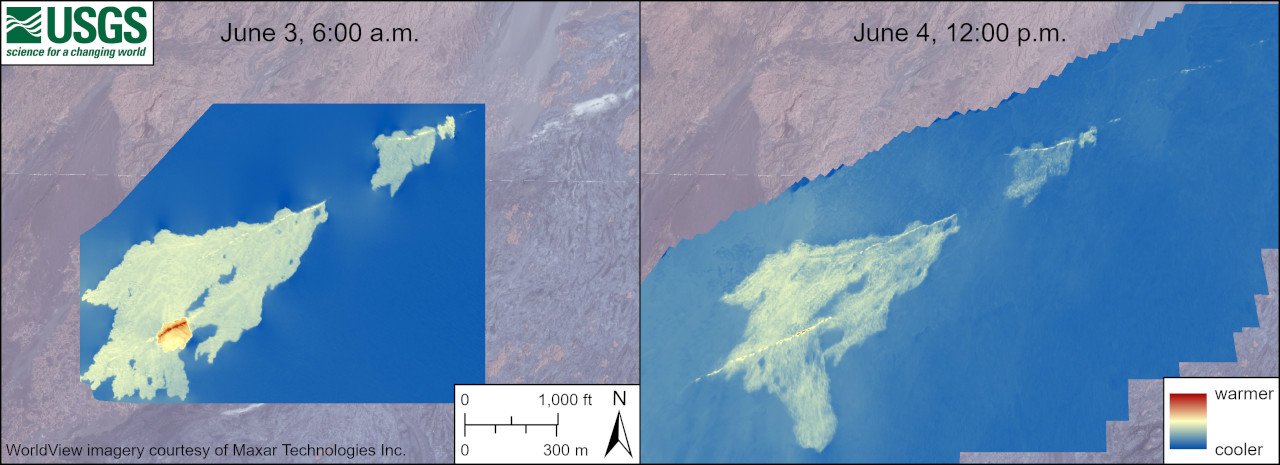
Eruption Site Observations: Lava stopped erupting from the fissure vents at approximately 9:00 a.m. HST on June 3 and lava flows stagnated by noon that day. Lava from the fissure system covered approximately 90 acres (350,000 square meters), a relatively small area. Glow continued to be observed in webcam imagery last night at the site of the fissures, although glow intensity was lower than previous nights.
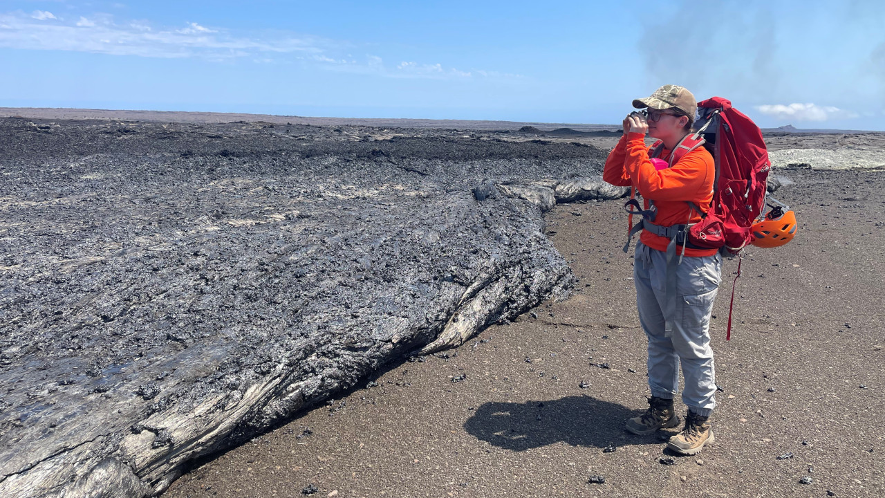
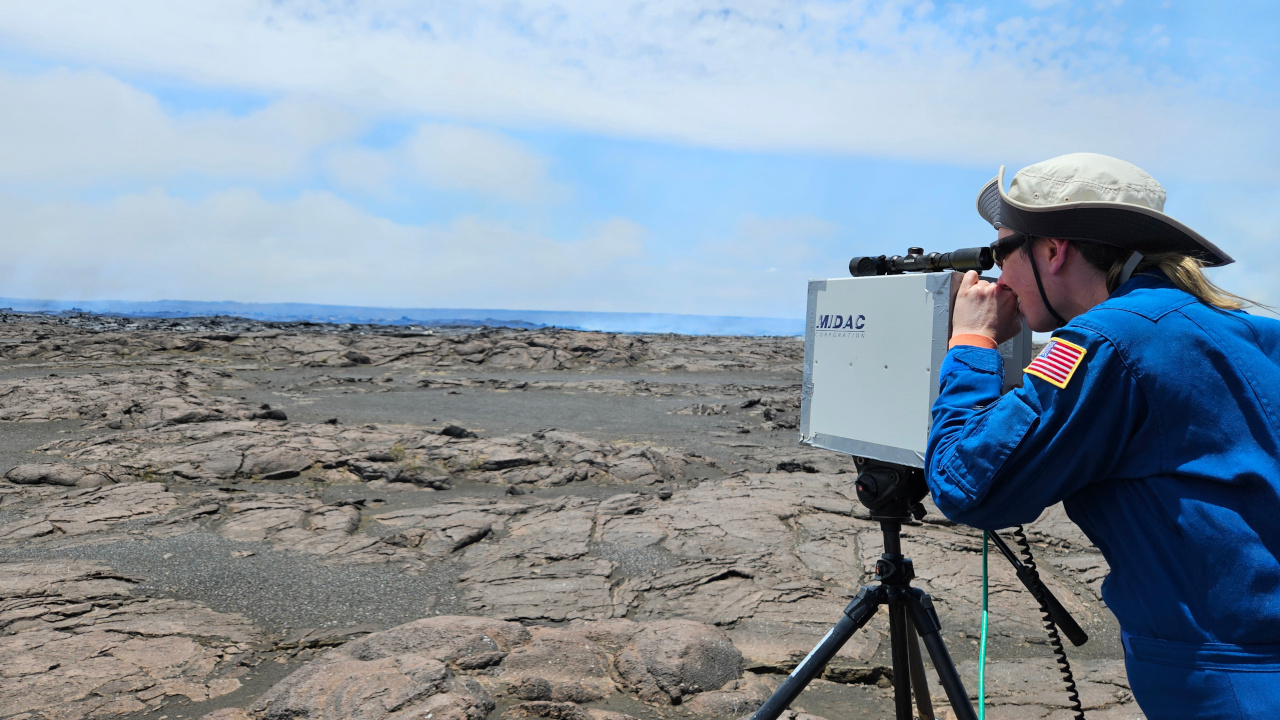
Volcanic gas emissions at the eruption site remain above background levels (100 tonnes per day or less). Sulfur dioxide (SO2) emission rates of 12,000-15,000 t/d were measured on June 3, and 5,500 t/d on June 4. Emission rates are much lower today compared to previous days; precise measurements are being made by HVO field crews at the time of this report.
Numerous large ground cracks have formed in the vicinity of the eruption extending westward to within 540 yards (500 meters) of Maunaiki. Earthquake activity remains low in the eruption site area.
Summit and Upper Rift Zone Observations: Rates of seismicity beneath the summit, upper East Rift Zone, and upper Southwest Rift Zone remained low over the past day. Tremor continues to decrease across the summit region and is approaching background levels. Less than 50 earthquakes occurred over the past 24 hours. Earthquakes were mostly located beneath the south caldera region, at depths of 1.5-3 km (1–1.8 miles), with magnitudes under M2.5. Inflationary ground deformation of the summit continued over the past day. The Uēkahuna tiltmeter northwest of the summit recorded overall inflation of approximately 2.5 microradians over the past 24 hours; the rate of inflation decreased at about 6:00 p.m. last night, then increased again at about 1:00 a.m. this morning. The Sand Hill tiltmeter southwest of the summit recorded approximately 9 microradians of inflation over the past 24 hours.
Lower Rift Zone Observations: Rates of seismicity and ground deformation beneath the middle and lower East Rift Zone and lower Southwest Rift Zone are low. Eruptive activity and unrest is restricted to the summit and upper rift zone regions. Measurements from continuous gas monitoring stations downwind of Puʻuʻōʻō in the middle East Rift Zone remain below detection limits for SO2, indicating that SO2 emissions from Puʻuʻōʻō are negligible.
Eruption Summary: Emplacement of a magmatic dike began just after 12:00 p.m. HST on June 2, 2024, beneath the area of Kaluapele south of Halemaʻumaʻu. Seismicity continued to intensify beneath this area and HVO raised the alert levels from Advisory/Yellow to Watch/Orange as the dike shallowed. Around 8:00 p.m. on June 2 a strong deflation signal on the Sand Hill tiltmeter indicated that a significant mass of lava moved to another location despite a lack of seismicity. After the deflationary event, seismicity declined significantly, and it was no longer possible to track the underground location of the magma. Data from USGS webcams and Keck Observatory webcams determined that the eruption began at 12:30 a.m. June 3, and effusion at the vents remained active until approximately 9:00 a.m., though lava flows were moving sluggishly until about noon. Tremor, degassing, and incandescence associated with the fissure vents have decreased significantly as of June 6, making it unlikely that the eruption will restart. Although the eruption has paused, additional pulses of seismicity and deformation could result in new eruptive episodes within the area or elsewhere on the Southwest Rift Zone.
Analysis: The last eruption in this area occurred in December 1974. The 1974 eruption lasted 6 hours and erupted 13 million cubic yards (10 million cubic meters) of lava that covered about 3 square miles (7 square kilometers). In contrast, the June 3, 2024, eruption lasted 8.5 hours but only erupted about 1% of the volume and covered about one third of a square mile (one half of a square kilometer). The pasty surface textures of the erupted lava and the small amount of lava erupted suggests that this lava could have been first emplaced during the January 31, 2024, intrusive event and cooled prior to being forced to the surface by the new dike
The USGS HVO says it will continue to provide daily updates for Kīlauea volcano.