(A synthesized voice was utilized in the narration for this story)
(BIVN) – Kīlauea is not erupting, however a sudden increase in earthquakes and ground deformation at the Hawaiʻi island volcano prompted a special statement from scientists just after noon on Monday.
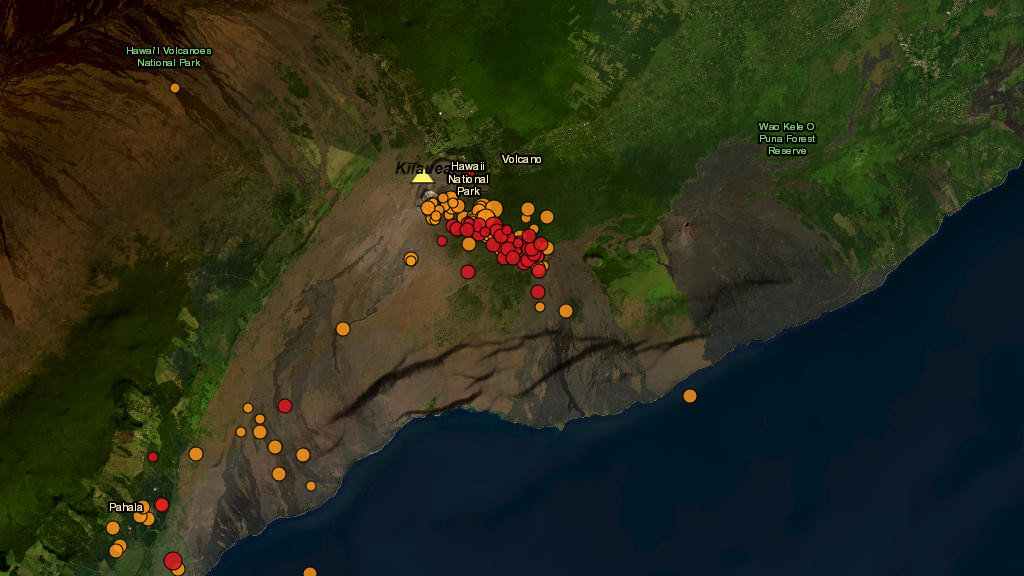
The USGS Hawaiian Volcano Observatory reported the increase in activity began at around 11 a.m. HST. About 40 earthquakes have been detected around Kīlauea’s upper East Rift Zone, the largest of which was a magnitude-3.5.
The Observatory says it is watching the situation closely and will issue additional messages as needed. For now, the Volcano Alert Level and Aviation Color Code for Kīlauea remains at ADVISORY/YELLOW, as there are no signs of an imminent eruption.
Scientists caution that conditions could change quickly. Past eruptive activity in this area of Kīlauea’s upper East Rift Zone has typically occurred between Hiʻiaka crater and Maunaulu in Hawai‘i Volcanoes National Park.
Rates of seismicity and ground deformation beneath the lower East Rift Zone and Southwest Rift Zone remain low. The current uptick in activity is restricted to the summit and upper East Rift Zone region.
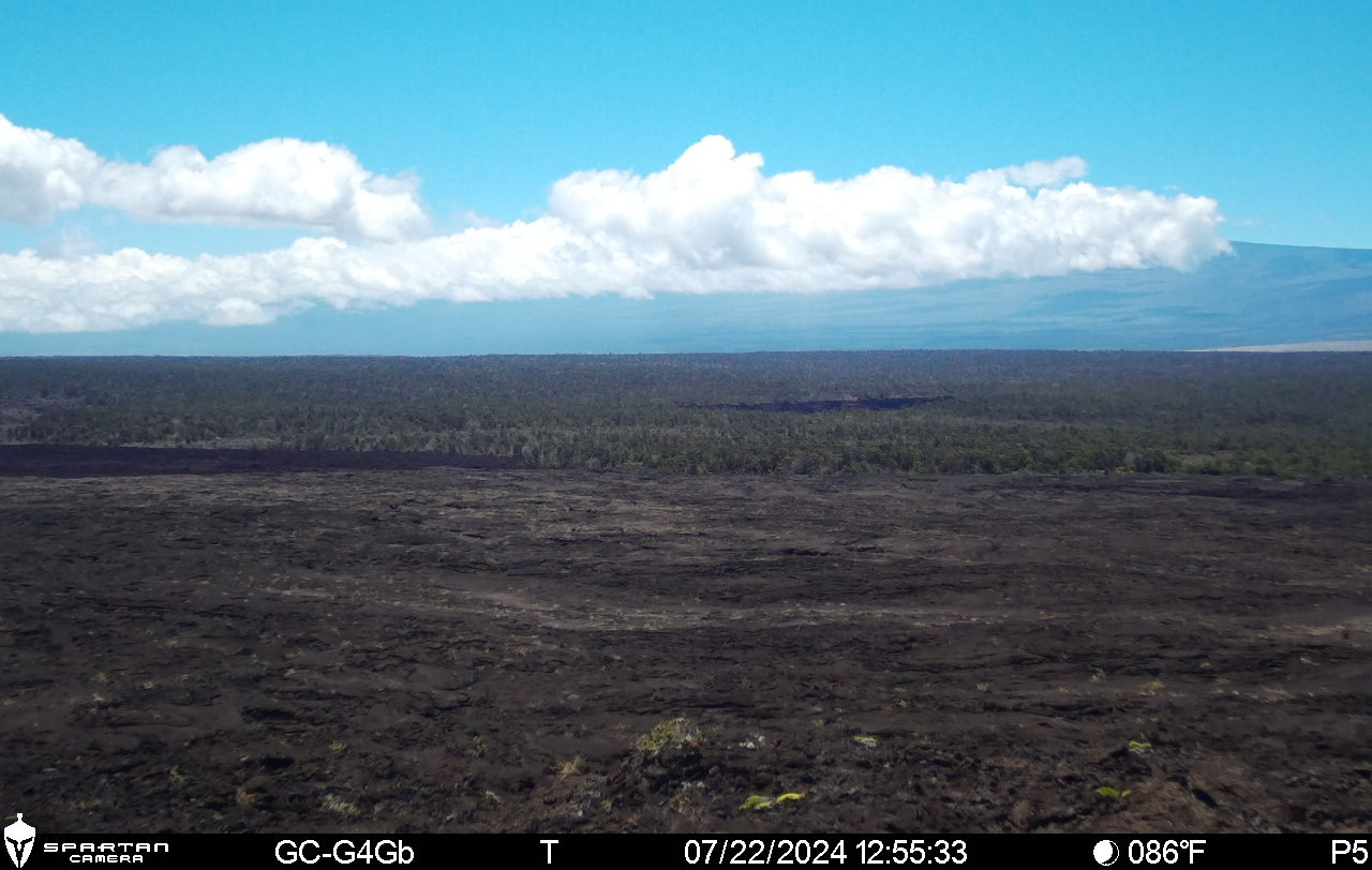
USGS image from a temporary research camera positioned near Maunaulu, looking northwest toward the upper East Rift Zone of Kīlauea.
UPDATE – (1:50 p.m.) – The National Park Service announced that due to heightened seismic activity, Chain of Craters Road is closed at the Devastation intersection to the coast, Kulanaokuaiki Campground is closed, and Escape Road (trail) and Crater Rim Trail are closed south of Nāhuku.

by Big Island Video News
on at
STORY SUMMARY
HAWAIʻI VOLCANOES NATIONAL PARK - Kīlauea is not erupting, however increased earthquake activity and rates of ground deformation at Kīlauea’s upper East Rift Zone began at approximately 11 a.m. on Monday.