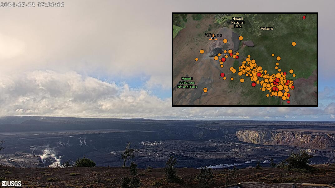
(BIVN) – Kilauea is not erupting, bit after an increase in earthquake activity and ground deformation on the upper East Rift Zone early this morning, the Volcano Alert Level has been changed.
The USGS on Tuesday (July 23) raised the Volcano Alert Level from ADVISORY to WATCH, and the Aviation Color Code from YELLOW to ORANGE.
Scientists with the USGS Hawaiian Volcano Observatory say data indicates the likely movement of magma in the subsurface.
“Earthquake activity is centered near Pauahi Crater,” the USGS HVO wrote. “The situation is rapidly evolving, and, at this time, it is not possible to say with certainty if this activity will lead to an eruption; the activity may remain below ground. An eruption in Kīlauea’s upper East Rift Zone within Hawai‘i Volcanoes National Park is one potential outcome.”
“It is not possible to say where such an outbreak may occur, but the area between Hiʻiaka crater and Maunaulu in Hawai‘i Volcanoes National Park, is potentially at risk for a new lava outbreak based on past patterns of eruptive activity in this area,” scientists wrote. “Past eruptions in this region of Kīlauea’s upper East Rift Zone, between Hiʻiaka crater and Maunaulu, occurred over hours to about a month. The location of any future outbreak will determine what areas could be in the path of new lava flows. ”
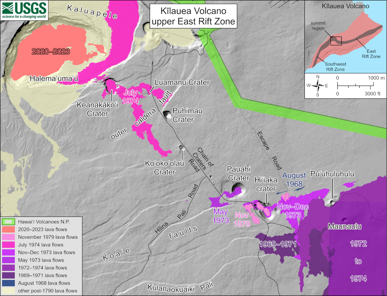
USGS: “This reference map depicts the features on Kīlauea’s upper East Rift Zone. Chain of Craters Road in Hawaiʻi Volcanoes National Park follows the path of the upper East Rift Zone. Pit craters, thermal areas, and lava flows are evidence of a long history of magma moving along this rift zone pathway. Upper East Rift Zone eruptions have typically occurred near the southeast margin of Kaluapele, or where the upper East Rift Zone meets the middle East Rift Zone near Pauahi Crater.”
The following temporary closures have been implemented within Hawaiʻi Volcano National Park as a result of the elevated activity:
- Chain of Craters Road from the intersection at Devastation parking lot to the coast.
- Kulanaokuaiki Campground is closed.
- Crater Rim Trail south of Nāhuku lava tube is closed.
- Coastal backcountry areas and Nāpau sites are closed. All new backcountry permits for those areas are canceled.
- Escape Road is closed from Nāhuku to Maunaulu.
The USGS HVO says it will continue to closely monitor Kīlauea. “Should volcanic activity change significantly, a new Volcanic Activity Notice will be issued,” scientists said.

by Big Island Video News
on at
STORY SUMMARY
HAWAIʻI VOLCANOES NATIONAL PARK - Increased earthquake activity and ground deformation Tuesday morning indicates the likely movement of magma in the subsurface.