
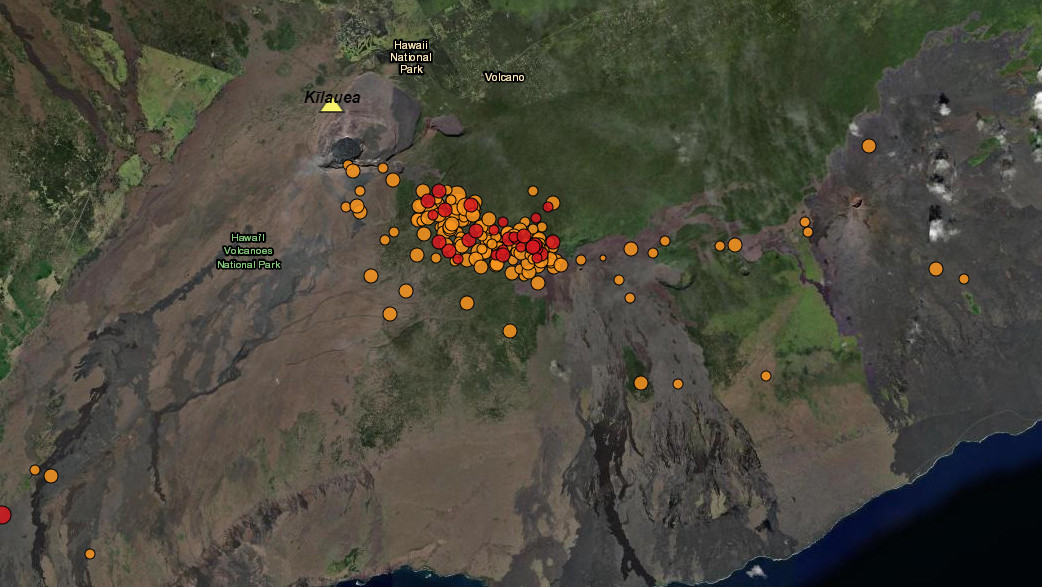

interactive map by the USGS shows the location of the recent earthquakes on the upper East Rift Zone on Kīlauea, with the most recent earthquakes in red

Earthquake Swarm Ongoing In Kīlauea Volcano’s Upper East Rift

Big Island Video News

Aug 20, 2024

STORY SUMMARY

HAWAIʻI VOLCANOES NATIONAL PARK - The number of earthquakes on Kīlauea's upper East Rift Zone increased at around midnight.

(BIVN) – Kīlauea is not erupting and the USGS Alert Level remains at ADVISORY.

The number of earthquakes on Kīlauea’s upper East Rift Zone increased at around midnight and continued into Tuesday morning. This seismic swarm is on pace to produce the highest quake count so far in August. 

Summit tiltmeters show deflationary deformation starting at around the same time the earthquake rate increased. 
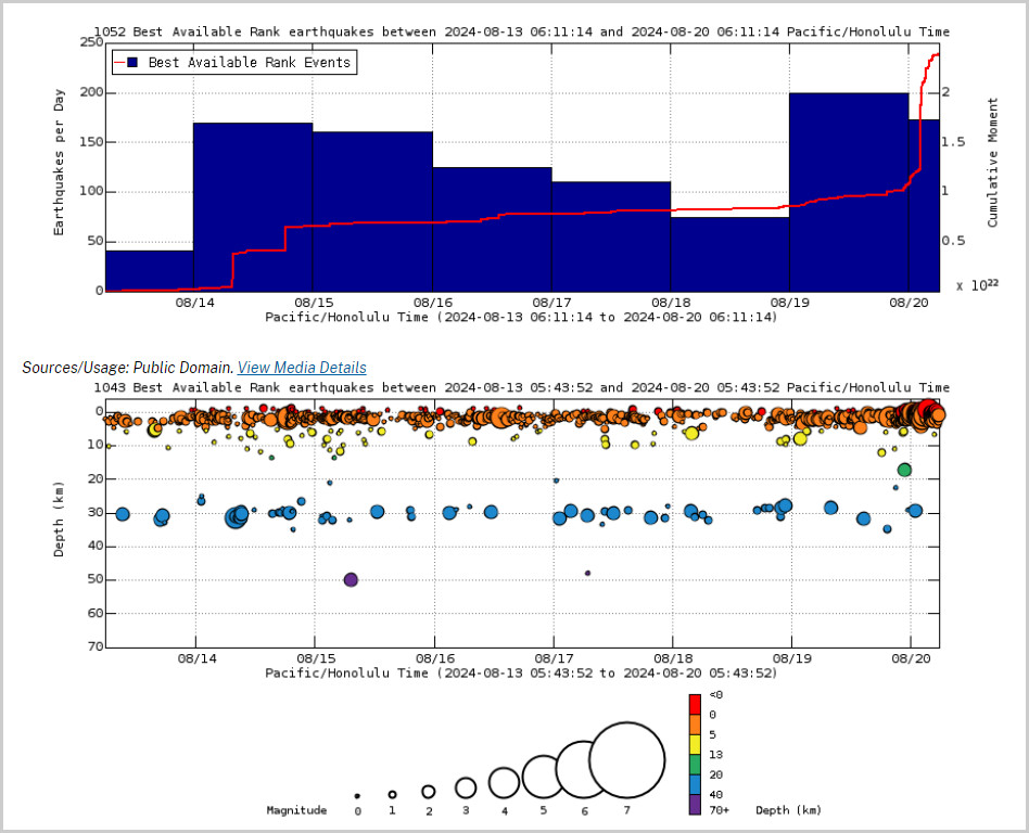


Above Top: Number of earthquakes per day during the past week (blue bars). The red line is the cumulative moment (energy) release. Bottom: Depth of earthquakes during the past week in the area shown on the map above. Depth is reported relative to sea level, which is equal to a depth of zero on the above plot. On both figures, circle-size represents magnitude, and color indicates depth. (USGS graphs)

There are no significant changes in activity in the lower East Rift Zone and Southwest Rift Zone of the volcano. All activity associated with the seismic swarm is occurring within Hawaiʻi Volcanoes National Park.

Scientists have been reporting that new seismic swarms “may occur with little or no warning and result in either intrusion of magma or eruption of lava” in the region near the summit and upper to middle East Rift Zone.

UPDATE(4:45 p.m.) – The Tuesday report from the USGS Hawaiian Volcano Observatory can be found on this updated article.

About The Featured Image

interactive map by the USGS shows the location of the recent earthquakes on the upper East Rift Zone on Kīlauea, with the most recent earthquakes in red


Image placeholder

Big Island Video News has been serving Hawaiʻi island since 2008.