(BIVN) – Earthquakes continued on the upper East Rift Zone (UERZ) of Kīlauea volcano on Wednesday, but at a lower rate than late Monday night / early Tuesday morning, when a seismic swarm began in the area.
Kīlauea is not erupting and the USGS Volcano Alert Level remains at ADVISORY.
“Changes in the character and location of unrest can occur quickly, as can the potential for eruption, but there are no signs of imminent eruption at this time,” the USGS Hawaiian Volcano Observatory reported on Tuesday. “There are no significant changes in activity in the lower East Rift Zone and Southwest Rift Zone.”
On Tuesday, hundreds of earthquakes were recorded beneath Kīlauea’s UERZ region, extending from Puhimau Crater southeast to Maunaulu. Most earthquakes were smaller than Magnitude 2, scientists said, although some were larger than Magnitude 3.
“Events have remained at depths of 1–3 km (0.6–1.8 miles) beneath the surface,” the USGS HVO said. “Most earthquakes have been too small to feel, but several were reported felt in Hawaiʻi Volcanoes National Park and surrounding communities.”
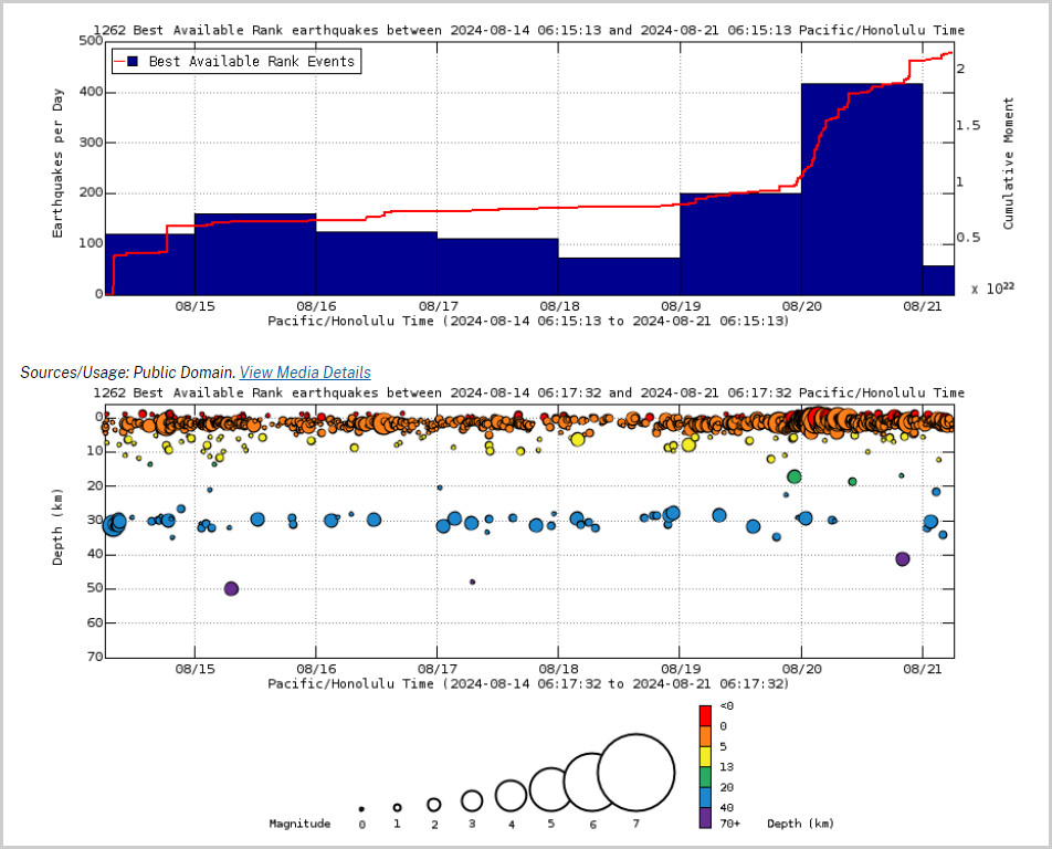
Above Top: Number of earthquakes per day during the past week (blue bars). The red line is the cumulative moment (energy) release. Bottom: Depth of earthquakes during the past week in the area shown on the map above. Depth is reported relative to sea level, which is equal to a depth of zero on the above plot. On both figures, circle-size represents magnitude, and color indicates depth. (USGS graphs)
“Earthquake activity has been accompanied by elevated rates and changing patterns of ground deformation recorded by the ESC tiltmeter in Kīlauea’s UERZ,” the USGS HVO noted.
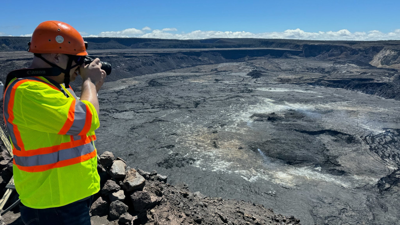
The USGS Hawaiian Volcano Observatory on its website Wednesday posted photos of a routine field visit to Kīlauea summit. “Despite ongoing earthquake activity in the upper East Rift Zone of Kīlauea, activity beneath the summit caldera was quiet” during the Tuesday visit, scientists said.
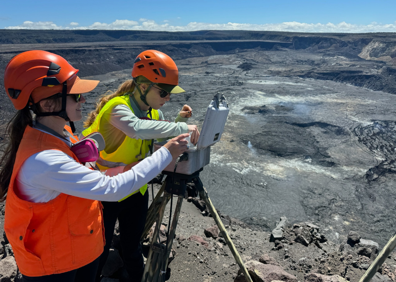
USGS scientists visited the KWcam webcam, at the summit of Kīlauea, to replace the desiccant packs that keep the webcam enclosure dry. (USGS photo by M. Patrick)
“UERZ unrest over the past night may represent another pulse of magma being supplied to the UERZ, following the intrusive event that occurred near Pauahi Crater over July 22–25, 2024,” the USGS HVO wrote on Tuesday. “Currently, the MERZ (middle East Rift Zone) has not shown signs of increased unrest; however, magma has recently re-established a path to Kīlauea’s MERZ. Unrest could potentially extend to the MERZ with continued magma supply.”

by Big Island Video News
on at
STORY SUMMARY
HAWAIʻI VOLCANOES NATIONAL PARK - Scientists conducted a routine visit to the summit of Kīlauea on Tuesday, as earthquakes rumbled beneath the upper East Rift Zone.