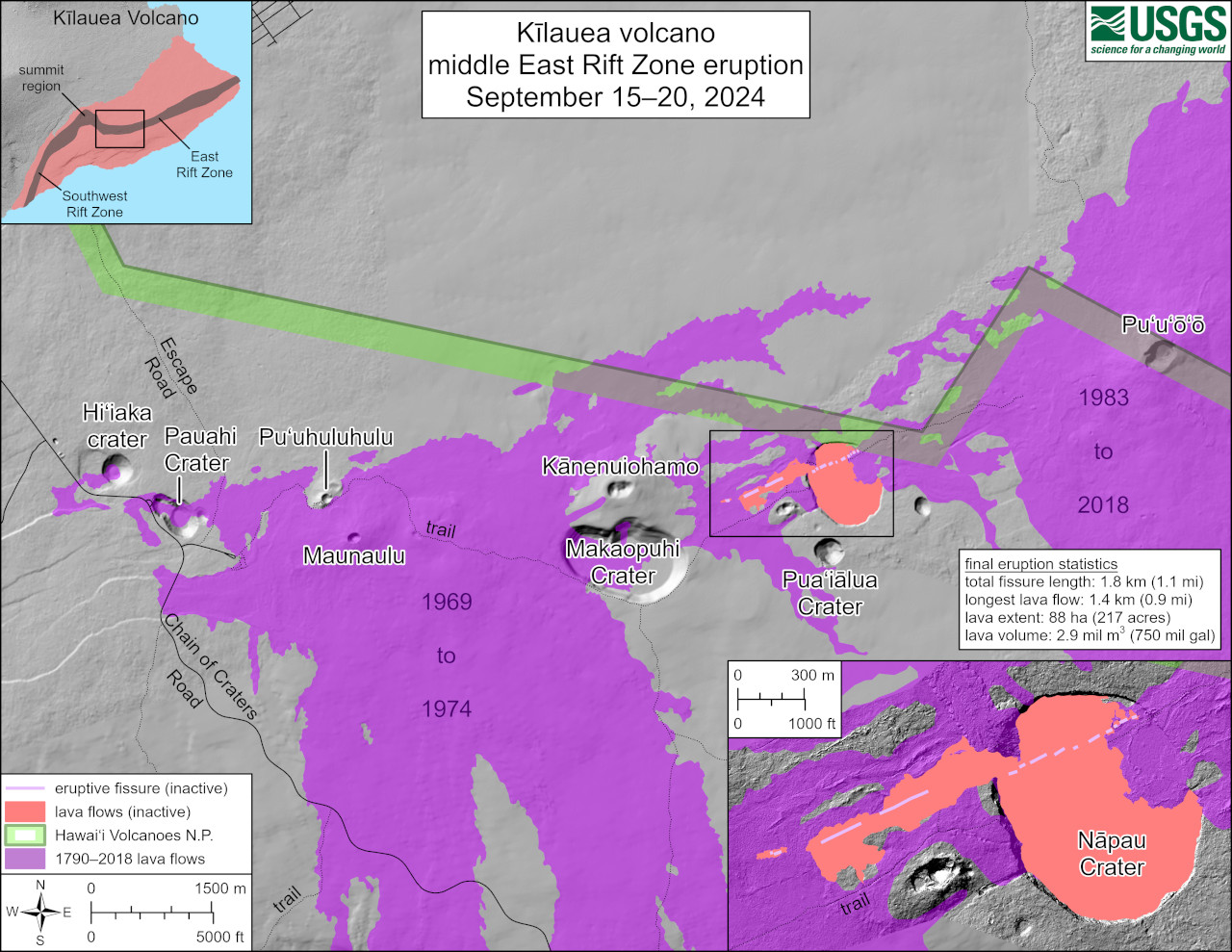
USGS: “This reference map depicts the final state of the Kīlauea middle East Rift Zone eruption that occurred between September 15 and 20, 2024. The eruptive fissures stretched along 1.8 kilometers (1.1 miles) of the East Rift Zone, with the longest lava flow extending 1.4 kilometers (0.9 miles) from the main eruptive vent, which was situated west of Nāpau Crater. In total, the eruption covered 88 hectares (217 acres) of land with approximately 2.9 million cubic meters (750 million gallons) of lava.”
(BIVN) – Kīlauea is not erupting and the USGS Volcano Alert Level remains at ADVISORY.
Although the eruption on the middle East Rift Zone (MERZ) near Nāpau Crater stopped on the morning of September 20, weak steaming continues on the inactive lava flow field. Shallow earthquake counts remain low and tremor is no longer being recorded on seismometers close to the eruption site.
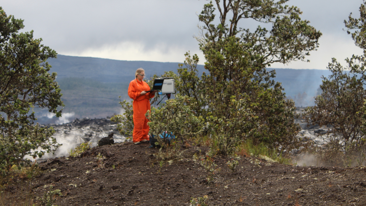
The USGS Hawaiian Volcano Observatory reported that sulfur dioxide was not detected that last time measurements were taken on Chain of Craters Road (Monday, September 23rd) which indicates that MERZ SO2 emissions are about 0 tonnes per day.
In their daily updates, the USGS HVO has been writing:
While the East Rift Zone eruption has ended, unrest continues at a low level in this region of Kīlauea. Rates of seismicity and ground deformation have greatly decreased since the eruption, but data shows that magma is continuing to move at a low rate from the summit to the middle East Rift Zone. Future intrusive episodes and eruptions could occur with continued magma supply.
No changes have been detected in the lower East Rift Zone or Southwest Rift Zone.
Hawaiʻi Volcanoes National Park says Nāpau Crater and Campground were inundated with lava from the September MERZ eruption and remain closed to all use until further notice.

by Big Island Video News
on at
STORY SUMMARY
HAWAIʻI VOLCANOES NATIONAL PARK - Kīlauea is not erupting, although magma is continuing to move at a low rate from the summit to the middle East Rift Zone.