(BIVN) – The ongoing eruption at the summit of Kīlauea volcano is currently paused, with the next episode of lava fountaining expected to occur late next week.
Minor glow from the north vent has been intermittently visible over the last few nights, suggesting that active lava remains deep within the vent.
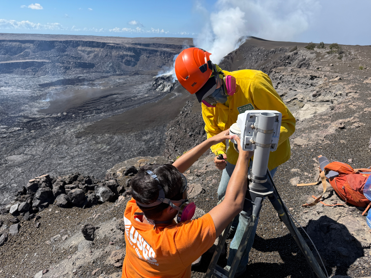
On Friday, USGS Hawaiian Volcano Observatory scientists visited the summit area to do some maintenance work on the V1cam livestream camera.

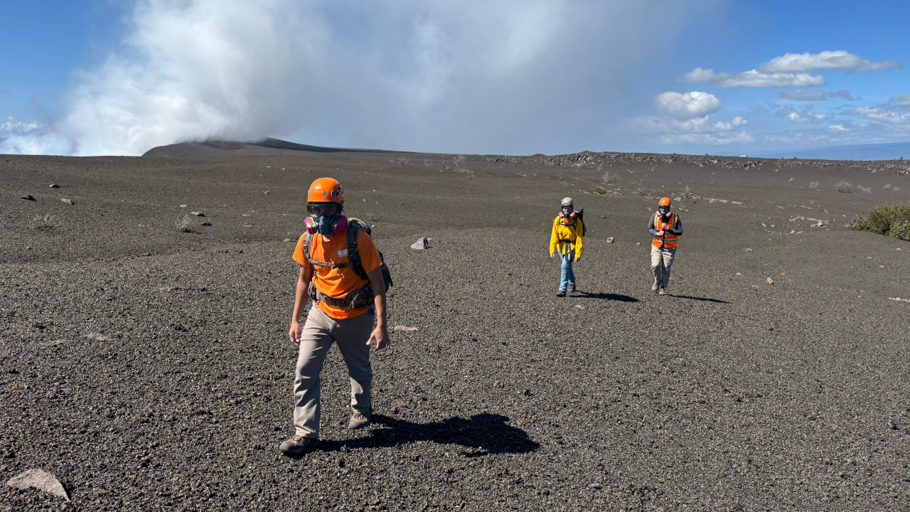
USGS: “USGS Hawaiian Volcano Observatory Scientists visited the V1cam livestream camera site on the morning of August 29 for some maintenance work. Despite their distance from the volcanic gas plume from the north and south vents, seen behind them, crews wear respiratory and eye protection to minimize their exposure to tiny wind-blown volcanic glass particles that are abundant in the air and on the ground within the closed area around Kīlauea summit. These particles can cause irritation to the eyes and lungs and should be avoided.” (USGS photo by L. DeSmither)
Photos taken during the geologists’ visit have been published to the Observatory website.
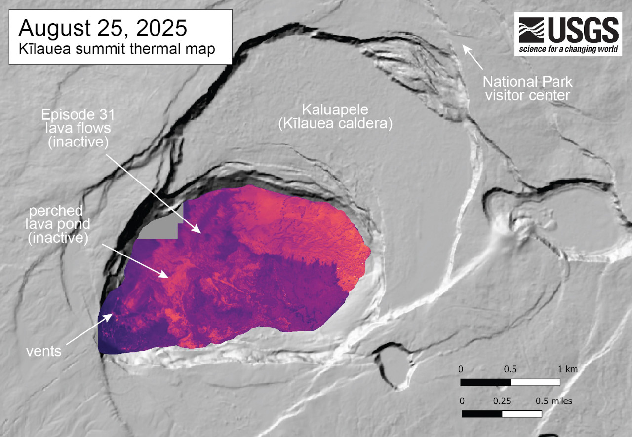
On the same webpage, the Observatory published two new maps depicting the ongoing eruption site. First, a thermal map:

USGS: “This thermal map of Kīlauea’s summit caldera was made from airborne thermal images collected on August 25, just a few days after episode 31 lava fountaining covered Halemaʻumaʻu crater floor in new lava flows. These flows remain warm in the thermal imagery, particularly in the eastern crater where flows slightly expanded the margin of new flows on the crater floor. Two tiny ooze-outs of recent lava show as white (hot) in the thermal map, and represent a small amount of residual lava squeezed out from the surface.”
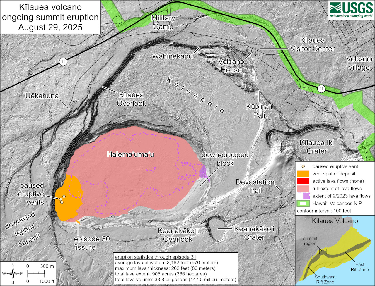
A new Kīlauea summit reference map has also been published.

USGS: “This reference map depicts the Kīlauea summit eruption within Halema‘uma‘u crater that began on December 23, 2024. As of this posting on August 29, 2025, the eruption has had thirty-one episodes, with the most recent one occurring on August 22 and 23. Most of the map data included here were collected during a Hawaiian Volcano Observatory helicopter overflight on August 25, so the provided statistics are reflective of the entire eruption to this point.”
The USGS Volcano Alert Level for Kīlauea remains at WATCH.


by Big Island Video News8:30 am
on at
STORY SUMMARY
HAWAIʻI VOLCANOES NATIONAL PARK - The USGS Hawaiian Volcano Observatory published new photos showing a recent visit to the summit area.