(BIVN) – A deepening kona low weather system north of Kauai is producing soaking rains for Hawaiʻi island, where a Flood Watch remains in effect.
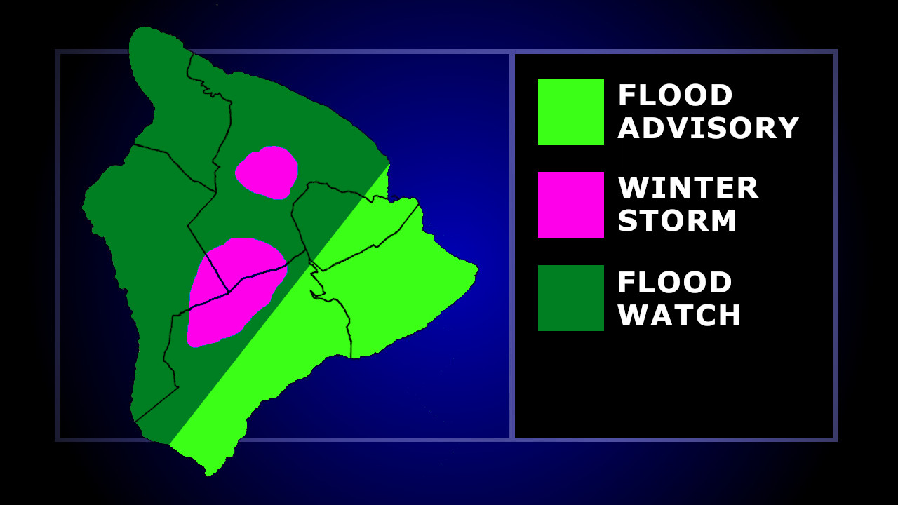
The National Weather Service in Honolulu has also issued a Winter Storm Warning for the summits of Maunakea and Mauna Loa, and posted a Flood Advisory for a large area of East Hawaiʻi on Sunday morning.
“At 7:45 a.m. HST, radar indicated heavy rain moving over portions of the Puna and Kaʻū coasts,” the Flood Advisory stated. “Rain was generally falling at a rate of 1 to 2 inches per hour, with isolated heavier rates up to 3 inches per hour between Pahala and Pahoa, including portions of Pahoa Kalapana Road and Highway 11.”
As deep moisture within an increasingly unstable environment spreads across all islands, the greatest flood risk for the Big Island remains along southeast facing mountain slopes.
“Flood prone roads and other low lying areas may be closed due to elevated runoff and overflowing streams,” the National Weather Service stated. “Urban areas may receive more significant flooding and property damage due to rapid runoff. Significant flooding may occur due to the overflow of streams and drainages. Landslides may also occur in areas with steep terrain.”
The Flood Watch will remain in effect through Monday.
Meanwhile, on Big Island summits above 11,000 feet, heavy mixed precipitation is expected, with total snow accumulations up to 5 to 10 inches.
A High Wind Watch has also been issued for the summit of Maunakea and Mauna Loa, with possible southeast winds of 50 to 65 mph, with gusts up to 80 mph.

by Big Island Video News
on at
STORY SUMMARY
HAWAIʻI ISLAND - A Flood Advisory was issued for East Hawaiʻi on Sunday morning, with heavy rain observed in Puna and Kaʻū.