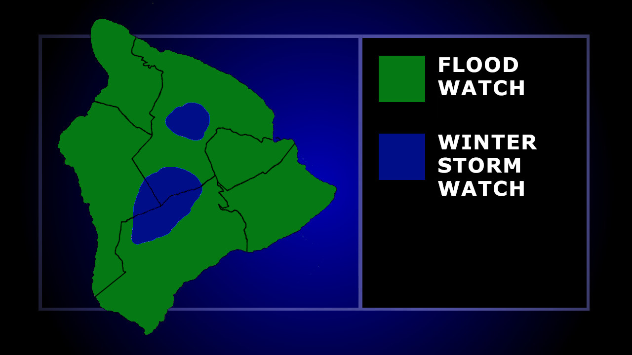
(BIVN) – A Flood Watch has been issued for the Hawaiian Islands, as an approaching front is expected to bring heavy rainfall and possible thunderstorms.
The National Weather Service has also issued a Winter Storm Watch for the summits of Maunakea and Mauna Loa on Hawaiʻi island.
Flash flooding caused by excessive rainfall will be possible from Saturday afternoon through Monday afternoon, with the greatest risk expected in windward areas, forecasters say.
From the National Weather Service discussion posted just before 4 a.m. Friday morning:
The cold front northwest of the islands will track steadily southeastward today, eventually slowing and stalling out in the vicinity of Maui County late tonight and Saturday. An increase in clouds and showers is expected to accompany the front, along with breezy north to northeast winds developing in its wake. The front will gradually weaken and dissipate by late Sunday, while a strong high builds north of the state. Abundant moisture will pool along the stalled front while a strong disturbance aloft moves overhead, bringing the potential for heavy rainfall, flash flooding and even a few thunderstorms to the area. The latest GFS/ECMWF solutions, their ensembles, as well as their AI versions support the potential for flash flooding Saturday afternoon through Monday afternoon, and as a result, a Flood Watch has been issued. Cold temperatures aloft associated with the upper disturbance moving through will support the potential for heavy snow on the Big Island summits, and as a result, a Winter Storm Watch has been issued Saturday afternoon through Monday afternoon as well.
Total snow accumulations of greater than 12 inches possible, forecasters say. Winds at the summits could gust as high as 50 mph.
The forecasters included this information in the morning discussion:
Well if that is not enough to be concerned about, very windy conditions are forecast to develop by late this weekend and continue through early next week, as a strong area of high pressure builds north of the islands. A Wind Advisory will likely be required for the entire state beginning late Sunday and continuing through at least Tuesday. Portions of the state could even see winds reach High Wind Warning levels, particularly over and downslope of terrain, through valleys, and other local acceleration areas.
Hawaiian Electric said it is closely monitoring conditions and preparing to respond to any damage to the electric system and restore any power outages. The company says additional crews will be scheduled to repair any damage, clear fallen trees or vegetation, and restore power.
“We urge our customers to complete their preparations and make safety their highest priority,” said Jim Alberts, senior vice president and chief operations officer. “And we thank our customers in advance for their patience. We understand many families may have parties and events scheduled this weekend. Please know that we’ll be out in force as soon as it’s safe to work.”

by Big Island Video News
on at
STORY SUMMARY
HAWAIʻI - Flash flooding will be possible on all Hawaiian islands, and up to a foot of snow could fall on the Big Island summits.