
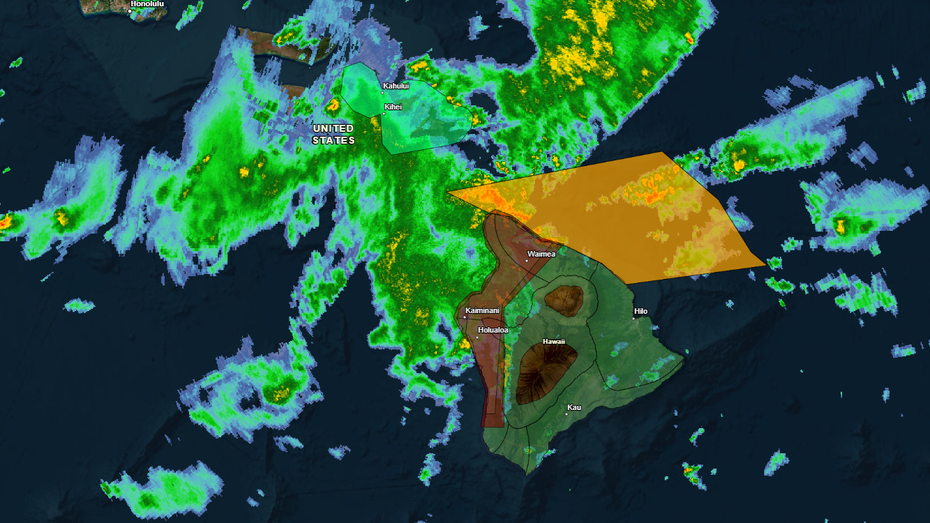

(BIVN) – The National Weather Service issued a Flash Flood Warning for North and South Kona, as well as North and South Kohala on Monday.
“At 10:22 AM HST, radar indicated heavy rain over Kona and Kohala areas,” forecasters said. “Rain was falling at a rate of 2 to 3 inches per hour. Flash flooding is ongoing or expected to begin shortly.”
Some locations that will experience flash flooding include Kailua-Kona, Captain Cook, Waikoloa Village, Kapaʻau, Puʻuanahulu, Puako, Kalaoa, Holualoa, Kawaihae, Honalo, Waimea, Kahaluʻu-Keauhou, Kohala Ranch, Kainaliu, Kealakekua, Honaunau, Waimanu Valley, Waipiʻo Valley, Pololu Valley and Kukuihaele.
Just before 10 a.m., the Ellison Onizuka Kona International Airport at Keahole (KOA) underwent a ground stop due to lightning. The ground stop for the airport has since been lifted.
In an alert a message from the Hawaiʻi County Civil Defense, residents were advised:
- Flooding is life-threatening.
- All residents in flood-prone areas are asked to remain on the alert for possible flooding conditions. Move to high ground as necessary.
- Please drive with caution. Be on the alert for run-off, ponding of water, debris, and poor visibility.
- Do not attempt to cross flowing water in a vehicle or on foot; turn around, don’t drown.
- Road closures may occur without warning.
- Remember, if lightning threatens your area, the safest place to be is indoors.
The entire island of Hawaiʻi remains under a Flood Watch through this afternoon as the second kona low in as many weeks departs the region.
