(BIVN) – The National Weather Service has issued a High Surf Advisory for East Hawaiʻi shores, as well as a Winter Weather Advisory for the summits of Maunakea and Mauna Loa.
Strong trade winds will continue to produce large breaking waves of 7 to 10 feet will be possible until Wednesday evening along east-facing shores of North Kohala, Hāmākua, Hilo, Puna and Kaʻū.
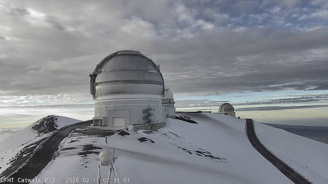
Periods of freezing rain and snow are expected on Big Island summits through Wednesday evening, where snow fell over the weekend during a Winter Storm Warning. “Total snow accumulations up to two inches and ice accretion around one to two tenths of an inch” are still possible, forecasters say.
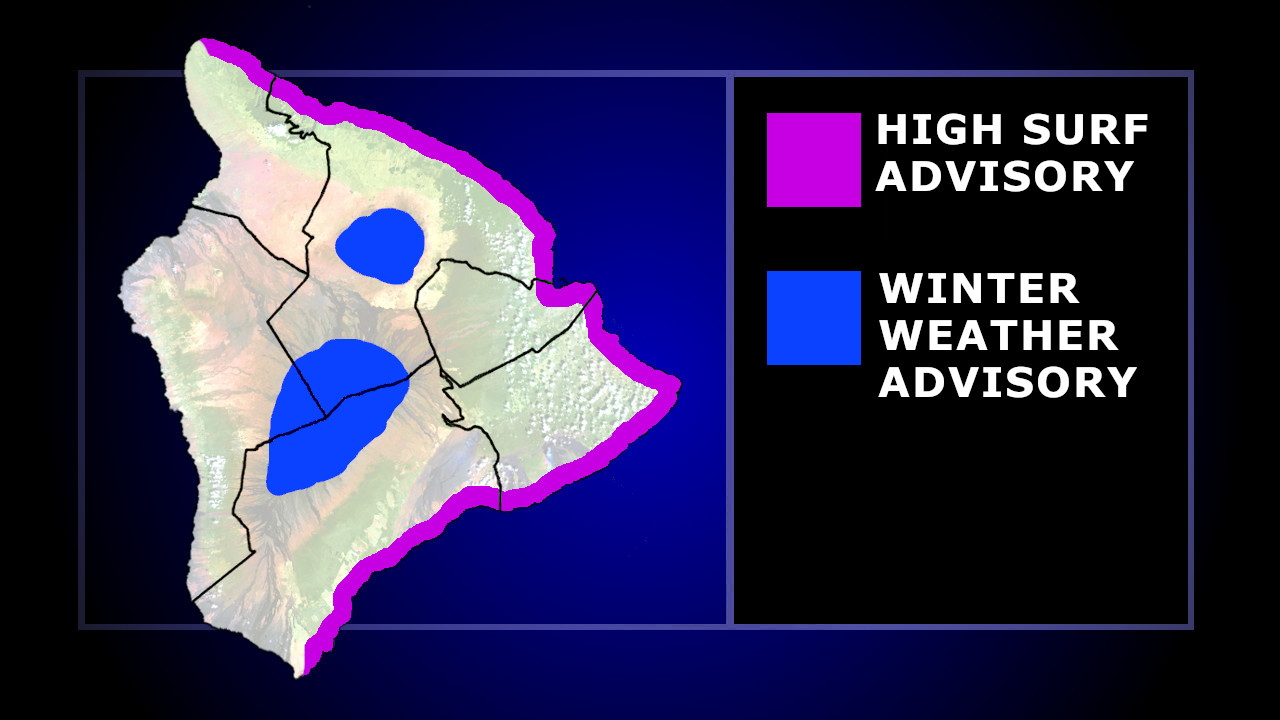
graphic by BIVN
As of this morning, the Maunakea summit access road was closed to the public due to the ice and snow. The Mauna Loa Summit was also reported closed by the National Park Service.
“Some models are hinting at unsettled weather returning to the islands by the weekend, but there’s still a fair bit of uncertainty this far out,” the National Weather Service commented in Wednesday’s morning discussion.

by Big Island Video News
on at
STORY SUMMARY
HAWAIʻI ISLAND - Waves of 7 to 10 feet will impact East Hawaiʻi shores, with a few inches of snow possible on Big Island summits.