UPDATE – (Feb 17) – The County of Hawaiʻi Department of Environmental Management announced that the shoreline advisory issued for the area between Lyman Bay (Mill Beach) and Waipahi Point has been lifted. Swimming, fishing, and other shoreline activities may now resume.
“The advisory was put in place after a malfunction of the disinfection system at the Pāpa’ikou Wastewater Treatment Plant resulted in the discharge of up to 98,300 gallons of fully treated, insufficiently disinfected, wastewater via the facility’s existing outfall, which is located at the shoreline,” a County news release stated. “Subsequent water quality sampling and laboratory analysis have confirmed that bacterial levels in the affected shoreline area are within acceptable State of Hawaiʻi Department of Health (DOH) standards. Based on these results, DOH has approved the removal of the Contaminated Water Warning Signs.”
FIRST REPORT
(BIVN) – The Pāpaʻikou shoreline in the South Hilo district has been closed due to a wastewater spill.
The Hawaiʻi County Department of Environmental Management reports that a malfunction of the disinfection system at the Pāpaʻikou Wastewater Treatment Plant on Wednesday resulted in the discharge of fully treated, insufficiently disinfected wastewater from the facility’s outfall, located at the shoreline.
“The system malfunctioned at an undetermined time between 2 p.m. Wednesday, Feb. 11 and 8:45 a.m. Thursday, Feb. 12,” the County reported, “resulting in a discharge of up to 98,300 gallons of fully treated, insufficiently disinfected wastewater.”
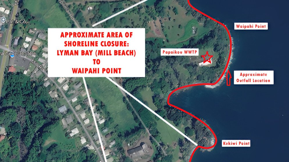
As a result, “the shoreline area in the vicinity of the outfall from Lyman Bay (Mill Beach) to Waipahi Point has been closed to shoreline activities as a precautionary measure,” the County stated. The decision was made in consultation with State Department of Health representatives.
According to the County:
The cause was due to a failure in the automated disinfection system. In response, crews took immediate remedial actions to manually disinfect the effluent and restored the automated disinfection system by 9:03 a.m. Feb. 12. In addition, emergency response procedures were initiated that included communication with relevant County and State agencies.
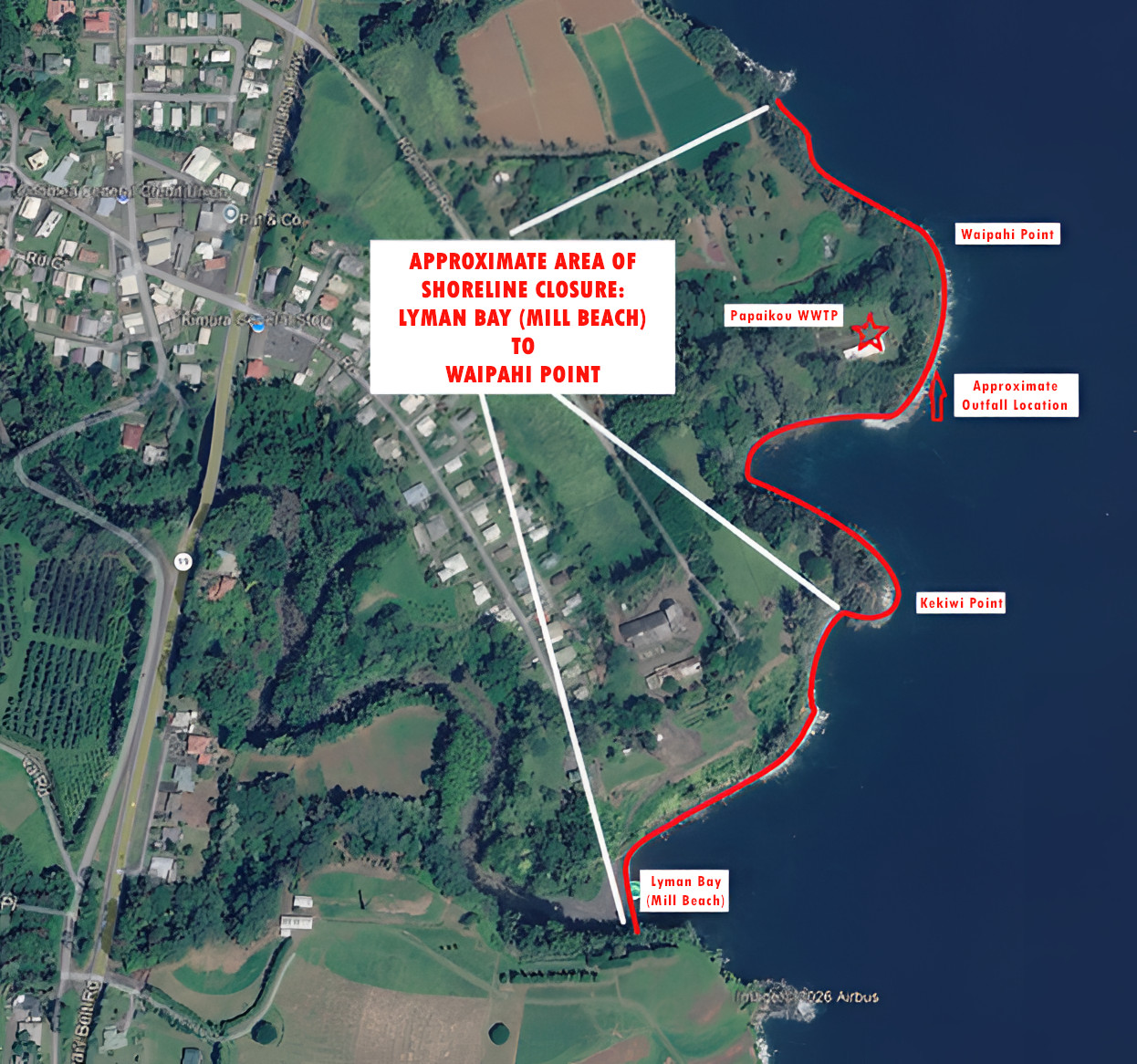
Hawaiʻi County map showing the location of the wastewater spill and the affected shoreline. Map text enhanced by BIVN for clarity.
Contaminated Water Warning Signs have been posted in the affected shoreline area to warn the public. The signs advise the public that the shoreline within the posted areas is closed to swimming, fishing, and boating activities due to the possibility of contaminated water in the area.
The Contaminated Water Warning Signs will remain in place until confirmation is obtained that bacterial levels are within acceptable levels and approval for removal of the warning signs has been received from the State Department of Health.
Again, the shoreline area in Pāpa’ikou from Lyman Bay (Mill Beach) to Waipahi Point is currently closed to swimming, fishing, and boating activities as a precautionary measure until such time that confirmation is obtained that bacterial levels in the area are acceptable.
The public will be advised when bacterial sampling has confirmed that levels are within acceptable levels for shoreline activities.

by Big Island Video News
on at
STORY SUMMARY
PĀPAʻIKOU, Hawaiʻi - A malfunction has resulted in the discharge of fully treated, but insufficiently disinfected, wastewater at the Pāpa'ikou Wastewater Treatment Plant.