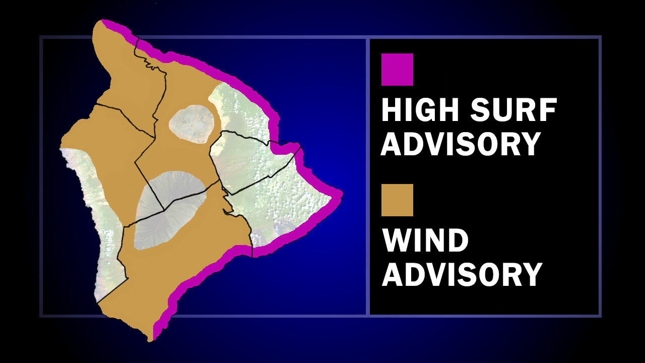
(BIVN) – The National Weather Service has issued a High Surf Advisory and a Wind Advisory for areas of Hawaiʻi island.
The High Surf Advisory is in place for east-facing shores of East Hawaiʻi, from North Kohala to Kaʻū. Large breaking waves of 8 to 12 feet are possible. The advisory will be in place until 6 a.m. Tuesday, unless it is extended.
The Wind Advisory is in effect for areas of North and South Kohala, Hāmākua, Kaʻū, and interior locations. East winds of 20 to 30 mph, with gusts over 50 mph, are possible. This advisory will be in place until 6 a.m. Monday, unless it is extended.
From the National Weather Service forecast discussion posted early Sunday morning:
We start today under an upper level ridge axis which is sandwiched between two deep troughs, one to our northwest and one to our northeast. A 1045 mb surface high is centered well north of the state. A strong pressure gradient continues to create winds of above-normal speed, with sustained winds generally 5-15 mph and gusts running 15-30 mph. The surface high will weaken as it drifts slowly south-southeast today through Monday night. After that, it will become pretty much stationary through Thursday. Aloft, the upper level ridge will be gradually pushed east by the trough to our northwest. As this trough moves closer Tuesday into Wednesday, a surface low will form several hundred miles to our northwest (Wednesday night into Thursday). This low will be too far away to bring much weather to the state, with minimal increases in PW all the way through Friday. The main impact it will have is to change our winds from easterly trades to southeast winds. This alters the areas getting the “windward” showers slightly to the south of what we typically see. Apart from advisory level winds, it should be a rather benign week of weather. No other headlines are anticipated at this time.

by Big Island Video News
on at
STORY SUMMARY
HAWAIʻI ISLAND - Both advisories are expected to be in effect all day Sunday, forecasters say.