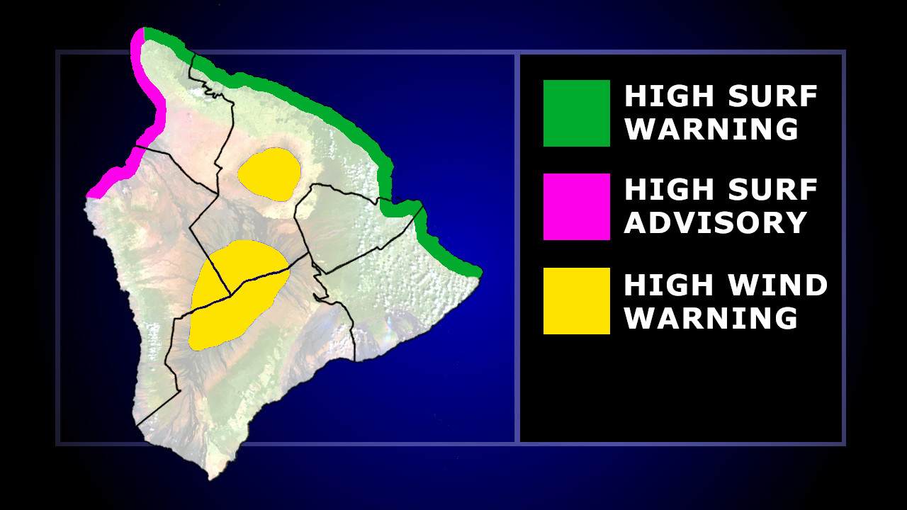
(BIVN) – The National Weather Service has issued a High Surf Warning for north and east facing shores of Hawaiʻi island, with a High Surf Advisory for the west-facing shores of North and South Kohala and North Kona.
“A long period north-northeast swell will build on Monday and peak Monday night and Tuesday,” the forecasters said. “This large swell from 010 to 030 degrees will produce much larger than normal surf across some coastlines, especially in windward areas. The swell will gradually decline Tuesday night through Friday.”
Forecasters say surf along north facing shores will build to 10 to 16 feet Monday, and will peak at 18 to 25 feet Monday night and Tuesday. Surf along east facing shores will build to 7 to 10 feet Monday and peak at 12 to 16 feet Monday night and Tuesday.
“Expect ocean water surging and sweeping across beaches, creating the potential for impacts to coastal roads and infrastructure, mainly along windward coasts,” the National Weather Service stated. “Powerful longshore and rip currents will be present at most beaches. Large breaking waves and strong currents may impact harbor entrances and channels causing challenging boat handling, mainly in Hilo and Kahului.”
Surf along west facing shores of the Big Island in the Kohala Districts will build to 6 to 10 feet Monday night and Tuesday, the forecasters said.
A High Wind Warning has also been issued for the summits of Maunakea and Mauna Loa.
The National Weather Service says west winds of 50 to 60 mph, with gusts up to 70 mph, will make driving and walking dangerous. “The winds can forcefully open doors and damage hinges or slam doors shut, possibly causing injuries,” the forecaster said.
The High Wind Warning will be in place until 6 a.m. HST Monday.

by Big Island Video News
on at
STORY SUMMARY
HAWAIʻI ISLAND - A large swell will produce much larger than normal surf across certain coastlines, especially along windward shores.