
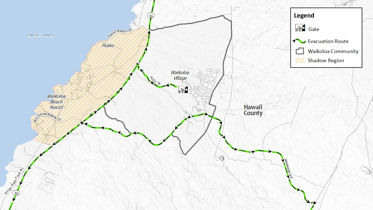

(BIVN) – The Waikoloa Evacuation Traffic Study has been released and is available online, the County of Hawaiʻi announced, as a new evacuation route for the Waikoloa Village area is moving forward.
The study was conducted by consulting firm KLD Associates under a contract managed by Hawai‘i County Civil Defense. The release comes just days after a wildland fire burned hundreds of acres in South Kohala area, prompting a Wildfire Warning for Waikoloa Village. The recent blaze stoked renewed concerns over the ability to evacuate the village in a safe and timely manner while under the threat of a wildfire.
The study, completed prior to the recent fire, was “informed by a survey completed by 501 households that assessed community demographics, evacuation responses, and the amount of time taken for certain pre-evacuation activities, such as travelling home from work,” a County news release stated.
“By understanding these patterns, we can improve our emergency planning and response efforts and ensure that everyone can get out safely during a disaster, including our more vulnerable populations,” said Mayor Kimo Alameda. “Preparedness also starts at home, and we encourage residents to make sure they have a plan in place if they need to evacuate.”
The County also gave an update on plans for an additional emergency egress.
The County says construction on a third evacuation route at the north end of Waikoloa Village, from Kamakoa Drive to Queen Kaʻahumanu Highway, is scheduled to start this week. The project is a partnership between the County and Hawaiʻi Department of Transportation.
The village currently has two routes that can be used for evacuations: Waikoloa Road and the Hulu Street evacuation route, which is used for emergencies only.
“This evacuation route will provide a third way out during a disaster and reflects our commitment to public safety,” Mayor Alameda said. “I want to thank the Department of Transportation and private landowners for working with us to get this done.”
The evacuation traffic study was funded by the U.S. Department of Housing and Urban Development through a Community Development Block Grant for hazard mitigation.
