(BIVN) – The USGS Hawaiian Volcano Observatory on Friday issued an information statement, explaining the origin of the recent cluster of earthquakes recorded in the Hāmākua district of Hawaiʻi island.
From the USGS HVO:
On Thursday, March 26 between 2:00 p.m. and 10:00 p.m. HST, the USGS Hawaiian Volcano Observatory detected a swarm of about 28 tectonic earthquakes beneath the northeast side of Mauna Kea, in the Hāmākua region. These earthquakes mainly occurred at depths between 5–10 km (3–6 miles) below the ground surface. The largest of these events were two magnitude 3 earthquakes, and each had a couple of felt reports. During the first few hours of the swarm, the earthquake rates were lower. Following the two magnitude 3 earthquakes, which occurred about one hour apart, the seismic activity stopped for about 90 minutes before resuming.
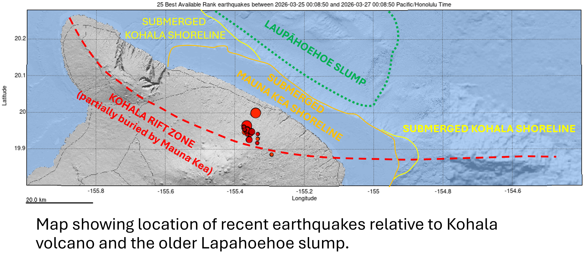
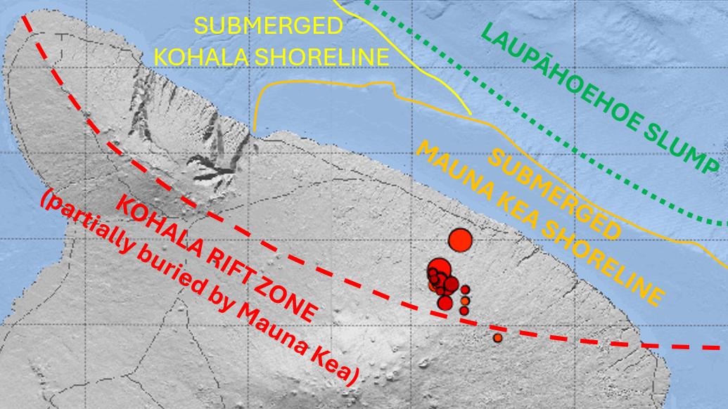
full USGS annotated map showing the location of the earthquake cluster on Hawaiʻi island
These tectonic events are not related to magma movement. Over the past 25 years, similar clusters of earthquakes in this region have occurred in 2002, 2004, 2006, 2008, and 2010 along with a scattering of isolated earthquakes overtime. Maximum magnitudes have all been in the magnitude 3 range with most earthquakes less than magnitude 2. The depth of these earthquakes put them beneath the Mauna Kea edifice and into the underlying Kohala volcano, whose rift zone extends all the way to the submarine Hilo ridge east of Mauna Kea. These earthquakes appear to be related to periodic release of stress in the elongated Kohala edifice. Stress gradually accumulates over time and is most likely due to the weight of the island. They do not appear to be directly related to the older submarine Laupāhoehoe slump or to flexural bending of the underlying oceanic lithosphere.

by Big Island Video News
on at
STORY SUMMARY
HĀMĀKUA, Hawaiʻi - Scientists confirm Thursday's tectonic events were not related to magma movement.