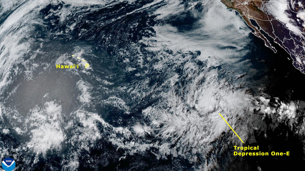
(BIVN) – The first tropical depression of the Eastern Pacific hurricane season has formed, and is expected to strengthen into a tropical storm far to the southeast of Hawaiʻi.
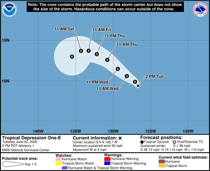
As of Tuesday afternoon, Tropical Depression One-E was located about 1,450 miles southwest of the southern tip of Baja California. Maximum sustained winds were near 30 mph (45 km/h) with higher gusts.
The developing storm is moving toward the west near 3 mph (6 km/h), and is forecast to turn toward the northwest tonight. The system is expected to strengthen into a tropical storm by Wednesday.
From the National Hurricane Center discussion on Tuesday:
Warm sea-surface temperatures of 28-29 deg C and strong upper-level divergence in a moist environment should allow for some strengthening during the next couple of days or so. However, easterly shear is forecast to increase by late week, which will likely limit the extent of strengthening that occurs. The official NHC forecast shows the system reaching tropical storm strength by Wednesday, with a peak intensity in good agreement with the HCCA consensus aid and the HAFS models. A weakening trend is forecast by this weekend as the system encounters a drier and more stable mid-level environment over cooler SSTs, and it is possible that the system could become devoid of convection by the end of the period.
Forecasters are predicting an above-normal hurricane season for the central Pacific this season, which runs June 1 to November 30. Driven by expected El Niño conditions, the National Weather Service says there could be a total of 5 to 13 tropical cyclones across the basin this year.