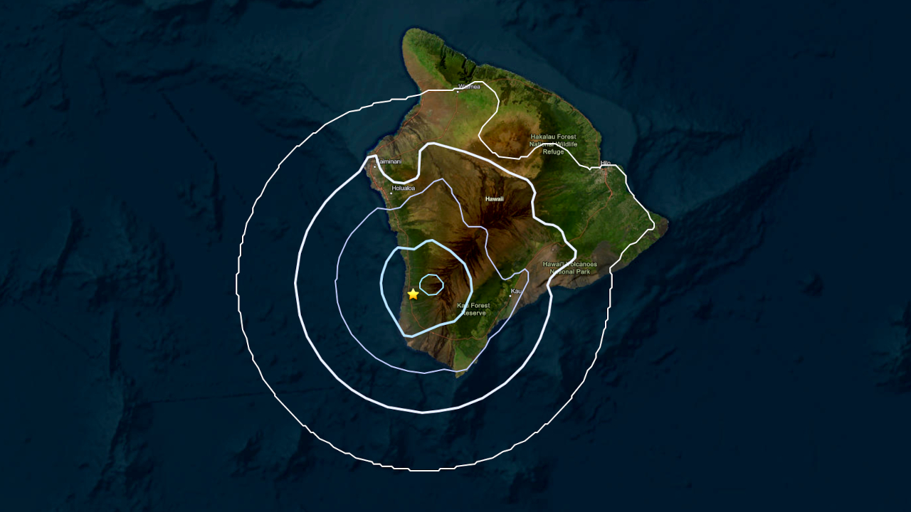
(BIVN) – UPDATED at 7:45 a.m. – A magnitude-3.8 earthquake occurred at 6:20 a.m. Monday morning in South Kona.
This event was initially reported as a magnitude-4.1 earthquake before it was revised downward. It was not strong enough to generate a tsunami threat.
According to an updated report from the U.S. Geological Survey, the earthquake was measured at a depth of 3 miles (6 km) below sea level at 6:20 a.m. HST on June 22, 2026., between the Kipahoehoe Natural Area Reserve and the South Kona Forest Reserve, or 13 miles (21 km) south of Hōnaunau-Nāpōʻopoʻo.
“The earthquake had no apparent impact on the magmatic systems of either Mauna Loa or Kīlauea volcanoes,” the USGS Hawaiian Volcano Observatory reported in an information statement. “The depth, location, and recorded seismic waves of the earthquake suggest a source due to stress within the west flank of Mauna Loa volcano.”
Scientists said the earthquake “is probably not related to the magnitude-6 earthquake that occurred on May 22, which was related to stress from the weight of the island on the underlying rigid mantle.”
Weak shaking was reported during this event. The earthquake was felt mostly in the Kona and Kaʻū districts, with a few reports coming in from Puna mauka, according to the USGS “Did You Feel It?” page. The event is not expected to have caused significant damage.